
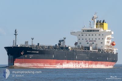
WISCO ADVENTURE
Tanker
Current Trip
| Time Travelled | 13 days |
|---|---|
| Remaining Time | 2 days |
| Distance Travelled | 2336.21 nm |
| Remaining Distance | 754.98 nm |
| AVG Speed | 11 Knots |
| MAX Speed | 14.3 Knots |
| AVG Wind | 14.8 knots |
| MAX Wind | 30.7 knots |
| MIN Temp | 16.3°C / 61.34°F |
| MAX Temp | 28.1°C / 82.58°F |
| Dybgang | 8 m |
| Position Modtaget | 4 d siden |
Current Position
| Longitude | 15.13218° |
|---|---|
| Latitude | -30.13887° |
| Status | Under way using engine |
| Fart | 13.4 Knots |
| Kurs | 345.4° |
| Område | South Atlantic Ocean |
| Station | T-AIS |
| Position Modtaget | 4 d siden |
Info
Information
The current position of WISCO ADVENTURE is in South Atlantic Ocean with coordinates -30.13887° / 15.13218° as reported on 2025-02-07 17:49 by AIS to our vessel tracker app. The vessel's current speed is 13.4 Knots and is heading at the port of WALVIS BAY. The estimated time of arrival as calculated by MyShipTracking vessel tracking app is 2025-02-15 02:22 LT
The vessel WISCO ADVENTURE (IMO: 9858852, MMSI: 355037000) is a Tanker It's sailing under the flag of [PA] Panama.
In this page you can find informations about the vessels current position, last detected port calls, and current voyage information. If the vessels is not in coverage by AIS you will find the latest position.
The current position of WISCO ADVENTURE is detected by our AIS receivers and we are not responsible for the reliability of the data. The last position was recorded while the vessel was in Coverage by the Ais receivers of our vessel tracking app.
The current draught of WISCO ADVENTURE as reported by AIS is 8 meters
Weather
| Temperature | 25.3°C / 77.54°F |
|---|---|
| Wind Speed | 5 knots |
| Direction | 179° S |
| Pressure | 1009.8 hPa |
| Humidity | 79 % |
| Cloud Coverage | 100 % |
Featured Company
Last Port Calls
| Port | Arrival | Departure | Time In Port |
|---|---|---|---|
| 2025-01-27 17:23 | 2025-01-30 10:59 | 2 d | |
| 2024-12-24 00:15 | 2024-12-25 14:21 | 1 d | |
| 2024-12-10 03:05 | 2024-12-11 16:57 | 1 d |
Last Trips
| Origin | Departure | Destination | Arrival | Distance | |
|---|---|---|---|---|---|
| 2024-12-25 19:21 | 2025-01-27 19:23 | 5177.86 nm | |||
| 2024-12-11 22:27 | 2024-12-24 05:15 | 290.77 nm | |||
| 2024-10-29 20:57 | 2024-12-10 08:35 | 6280.45 nm |
Events
| Tid | Hændelsen | Detaljer | Position / Dest | Info |
|---|---|---|---|---|
| 2025-02-09 22:00 | START Sejllads | 4.05 nm, North West of WALVIS BAY |
-22.88242 / 14.46115
NAWVB
|
Fart: 4.1 kn Kurs: 50° |
| 2025-02-09 07:00 | STOP Sejllads | 3.68 nm, North West of WALVIS BAY |
-22.88797 / 14.46422
NAWVB
|
Fart: 0.3 kn Kurs: 250° |
| 2025-02-07 17:54 | Status er ændret | Default Under way using engine |
-30.12318 / 15.12757
NAWVB
|
Fart: 13.4 kn Kurs: 345.4° |
| 2025-02-07 17:49 | Udenfor Dækning |
-30.13887 / 15.13218
South Atlantic Ocean
NAWVB
|
Fart: 13.4 kn Kurs: 345.4° |
|
| 2025-02-07 17:49 | Status er ændret | Under way using engine Default |
-30.14001 / 15.13253
NAWVB
|
Fart: 13.3 kn Kurs: 346° |
| 2025-02-07 17:39 | Status er ændret | Default Under way using engine |
-30.17737 / 15.14327
NAWVB
|
Fart: 13.2 kn Kurs: 346.4° |
| 2025-02-07 16:44 | Status er ændret | Under way using engine Default |
-30.37042 / 15.20079
NAWVB
|
Fart: 12.9 kn Kurs: 341° |
| 2025-02-07 16:34 | Indenfor Dækning |
-30.36415 / 15.19834
South Atlantic Ocean
NAWVB
|
Fart: 13 kn Kurs: 340.8° |
|
| 2025-02-06 18:04 | Status er ændret | Default Under way using engine |
-34.45737 / 17.95733
NAWVB
|
Fart: 12.6 kn Kurs: 317.9° |
| 2025-02-06 17:58 | Udenfor Dækning |
-34.47317 / 17.97447
South Atlantic Ocean
NAWVB
|
Fart: 12.6 kn Kurs: 317.9° |