

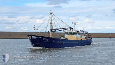
YE-87 DANIEL PIETER
Fishing

Current Trip
OOSTERSCHELDE
| Time Travelled | 1 h, 56 mins |
|---|---|
| Remaining Time | --- |
| Distance Travelled | 10.20 nm |
| Remaining Distance | --- |
| AVG Speed | 6.9 Knots |
| MAX Speed | 10.5 Knots |
| AVG Wind | 10 knots |
| MAX Wind | 10.8 knots |
| MIN Temp | 5.1°C / 41.18°F |
| MAX Temp | 6.4°C / 43.52°F |
| Dybgang | 0 m |
| Position Modtaget | 4 m siden |
Current Position
| Longitude | 5.24048° |
|---|---|
| Latitude | 53.22892° |
| Status | Under way using engine |
| Fart | 10.4 Knots |
| Kurs | 287.5° |
| Område | North Sea |
| Station | T-AIS |
| Position Modtaget | 4 m siden |
Information
The current position of YE-87 DANIEL PIETER is in North Sea with coordinates 53.22892° / 5.24048° as reported on 2025-04-07 06:57 by AIS to our vessel tracker app. The vessel's current speed is 10.4 Knots
The vessel YE-87 DANIEL PIETER (IMO: 8712142, MMSI: 246296000) is a Fishing It's sailing under the flag of [NL] Netherlands.
In this page you can find informations about the vessels current position, last detected port calls, and current voyage information. If the vessels is not in coverage by AIS you will find the latest position.
The current position of YE-87 DANIEL PIETER is detected by our AIS receivers and we are not responsible for the reliability of the data. The last position was recorded while the vessel was in Coverage by the Ais receivers of our vessel tracking app.
Weather
| Temperature | 6.1°C / 42.98°F |
|---|---|
| Wind Speed | 10 knots |
| Direction | 83° E |
| Pressure | 1027 hPa |
| Humidity | 74.9 % |
| Cloud Coverage | 16 % |


Featured Company
Last Port Calls
| Port | Arrival | Departure | Time In Port |
|---|---|---|---|
| 2025-04-03 13:38 | 2025-04-07 07:05 | 3 d | |
| 2025-03-31 18:37 | 2025-04-01 05:46 | 11 h | |
| 2025-03-31 07:22 | 2025-03-31 08:22 | 1 h | |
| 2025-03-27 13:17 | 2025-03-30 23:37 | 3 d | |
| 2025-03-17 06:56 | |||
| 2025-03-13 06:59 | |||
| 2025-03-05 06:54 |
Most Visited Ports (Last year)
| Port | Arrivals | |
|---|---|---|
| 23 | ||
| 15 | ||
| 14 | ||
| 3 | ||
| 2 | ||
| 1 |
Last Trips
| Origin | Departure | Destination | Arrival | Distance | |
|---|---|---|---|---|---|
| 2025-04-01 05:46 | 2025-04-03 13:38 | 36.83 nm | |||
| 2025-03-31 08:22 | 2025-03-31 18:37 | 77.69 nm | |||
| 2025-03-30 23:37 | 2025-03-31 07:22 | 57.59 nm | |||
| 2025-03-17 06:56 | 2025-03-27 13:17 | 131.47 nm |
Events
| Tid | Hændelsen | Detaljer | Position / Dest | Info |
|---|---|---|---|---|
| 2025-04-07 06:26 | START Sejllads | 3.73 nm, North West of HARLINGEN |
53.21466 / 5.34147
OOSTERSCHELDE
|
Fart: 4.4 kn Kurs: 73° |
| 2025-04-07 06:03 | STOP Sejllads | 3.73 nm, North West of HARLINGEN |
53.21299 / 5.33969
OOSTERSCHELDE
|
Fart: 0.1 kn Kurs: 103° |
| 2025-04-07 05:05 | Afsejlet fra sidste havn |
|
53.17731 / 5.40128
OOSTERSCHELDE
|
Fart: 8.6 kn Kurs: 289° |
| 2025-04-07 04:59 | START Sejllads |
53.17909 / 5.41948
[NL] HARLINGEN
|
Fart: 3.7 kn Kurs: 254° |
|
| 2025-04-07 04:38 | STOP Sejllads |
53.17990 / 5.42336
[NL] HARLINGEN
|
Fart: 0.3 kn Kurs: 251° |
|
| 2025-04-07 04:28 | START Sejllads |
53.17881 / 5.44088
[NL] HARLINGEN
|
Fart: 5.1 kn Kurs: 306° |
|
| 2025-04-03 12:12 | STOP Sejllads |
53.17696 / 5.44186
[NL] HARLINGEN
|
Fart: 0.3 kn Kurs: 211° |
|
| 2025-04-03 12:06 | START Sejllads |
53.18095 / 5.43403
[NL] HARLINGEN
|
Fart: 4.9 kn Kurs: 109° |
|
| 2025-04-03 11:57 | STOP Sejllads |
53.18084 / 5.42981
[NL] HARLINGEN
|
Fart: 0.2 kn Kurs: 84° |
|
| 2025-04-03 11:52 | START Sejllads |
53.17943 / 5.42146
[NL] HARLINGEN
|
Fart: 4 kn Kurs: 72° |