

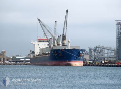
YIN NING
Bulk Carrier

Current Trip
GWANGYANG
| Time Travelled | 16 days |
|---|---|
| Remaining Time | --- |
| Distance Travelled | 2552.92 nm |
| Remaining Distance | --- |
| AVG Speed | 10.7 Knots |
| MAX Speed | 13.6 Knots |
| AVG Wind | 8.6 knots |
| MAX Wind | 24.8 knots |
| MIN Temp | 22.5°C / 72.5°F |
| MAX Temp | 30.1°C / 86.18°F |
| Dybgang | 11.6 m |
| Position Modtaget | 2 d siden |
Current Position
| Longitude | 107.18069° |
|---|---|
| Latitude | -0.65644° |
| Status | Under way using engine |
| Fart | 10.9 Knots |
| Kurs | 141.4° |
| Område | South China Sea |
| Station | T-AIS |
| Position Modtaget | 2 d siden |
Information
The current position of YIN NING is in South China Sea with coordinates -0.65644° / 107.18069° as reported on 2025-06-07 01:34 by AIS to our vessel tracker app. The vessel's current speed is 10.9 Knots
The vessel YIN NING (IMO: 9396892, MMSI: 413336000) is a Bulk Carrier that was built in 2008 ( 17 år gamle ). It's sailing under the flag of [CN] China.
In this page you can find informations about the vessels current position, last detected port calls, and current voyage information. If the vessels is not in coverage by AIS you will find the latest position.
The current position of YIN NING is detected by our AIS receivers and we are not responsible for the reliability of the data. The last position was recorded while the vessel was in Coverage by the Ais receivers of our vessel tracking app.
The current draught of YIN NING as reported by AIS is 11.6 meters
Weather
| Temperature | 28.9°C / 84.02°F |
|---|---|
| Wind Speed | 15 knots |
| Direction | 116° ESE |
| Pressure | 1009.6 hPa |
| Humidity | 73.4 % |
| Cloud Coverage | 46 % |


Featured Company
Events
| Tid | Hændelsen | Detaljer | Position / Dest | Info |
|---|---|---|---|---|
| 2025-06-07 01:40 | Status er ændret | Default Under way using engine |
-.67142 / 107.19276
GWANGYANG
|
Fart: 10.9 kn Kurs: 141.4° |
| 2025-06-07 01:34 | Udenfor Dækning |
-.65644 / 107.18069
South China Sea
|
Fart: 10.9 kn Kurs: 141.4° |
|
| 2025-06-06 22:57 | Fundet i havområde | Indonesian part of the South China Sea |
-.28450 / 106.89739
South China Sea
|
Fart: 10.7 kn Kurs: 141.1° |
| 2025-06-06 22:57 | Status er ændret | Under way using engine Default |
-.28450 / 106.89739
GWANGYANG
|
Fart: 10.7 kn Kurs: 141° |
| 2025-06-06 22:45 | Indenfor Dækning |
-.28450 / 106.89739
South China Sea
|
Fart: 10.7 kn Kurs: 141.1° |
|
| 2025-06-05 15:47 | Status er ændret | Default Under way using engine |
4.56651 / 104.30442
GWANGYANG
|
Fart: 10.9 kn Kurs: 160.4° |
| 2025-06-05 15:47 | Status er ændret | Under way using engine Default |
4.56651 / 104.30442
GWANGYANG
|
Fart: 10.8 kn Kurs: 160° |
| 2025-06-05 15:47 | Indenfor Dækning |
4.56651 / 104.30442
South China Sea
|
Fart: 10.9 kn Kurs: 160.4° |
|
| 2025-06-05 15:47 | Udenfor Dækning |
4.56651 / 104.30442
South China Sea
|
Fart: 10.9 kn Kurs: 160.4° |
|
| 2025-06-01 02:22 | STOP Sejllads | 5.31 nm, North of KRONG PREAH SIHANOUK |
10.74055 / 103.50320
GWANGYANG
|
Fart: 0.2 kn Kurs: 36° |