
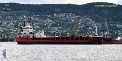
DANITA
General Cargo
Current Trip
| Time Travelled | 2 days |
|---|---|
| Remaining Time | --- |
| Distance Travelled | 279.27 nm |
| Remaining Distance | --- |
| AVG Speed | 12.4 Knoten |
| MAX Speed | 13.3 Knoten |
| AVG Wind | 10.8 knots |
| MAX Wind | 18.3 knots |
| MIN Temp | -1.7°C / 28.94°F |
| MAX Temp | 0.6°C / 33.08°F |
| Tiefgang | 4.2 m |
| Position erhalten | 1 d alt |
Current Position
| Länge | 19.99463° |
|---|---|
| Breite | 59.49259° |
| Zustand | Under way using engine |
| Geschwindigkeit | 12.6 Knoten |
| Kurs | 154.6° |
| Gebiet | Baltic Sea |
| Station | T-AIS |
| Position erhalten | 1 d alt |
Info
Information
Die aktuelle Position von DANITA befindet sich in Baltic Sea mit den Koordinaten 59.49259° / 19.99463°, wie von AIS am 2025-03-13 09:44 an unsere Schiffsverfolgungs-App. Die aktuelle Geschwindigkeit des Schiffes betragt 12.6 Knoten
Das Schiff DANITA (IMO: 9341108, MMSI: 255806139) ist General Cargo das wurde im Jahr 2005 ( 20 Jahre alt ) gebaut. Es segelt unter der Flagge [PT] Portugal.
Auf dieser Seite finden Sie Informationen zur aktuellen Position des Schiffes, zu den zuletzt erkannten Hafenanlaufen und zu aktuellen Reiseinformationen. Wenn die Schiffe nicht von AIS abgedeckt werden, finden Sie die neueste Position.
Die aktuelle Position von DANITA wird von unseren AIS-Empfangern erkannt und wir sind nicht fur die Zuverlassigkeit der Daten verantwortlich. Die letzte Position wurde von den Ais-Empfangern unserer Schiffsverfolgungs-App aufgezeichnet, wahrend sich das Schiff in Deckung befand.
Der aktuelle Entwurf von DANITA, wie von AIS gemeldet, betragt 4.2 meter
Weather
| Temperature | 0.3°C / 32.54°F |
|---|---|
| Wind Speed | 18 knots |
| Direction | 12° NNE |
| Pressure | 995 hPa |
| Humidity | 84.3 % |
| Cloud Coverage | 100 % |
Featured Company
Last Port Calls
| Port | Arrival | Departure | Time In Port |
|---|---|---|---|
| 2025-03-11 18:47 | 2025-03-12 23:15 | 1 d | |
| 2025-03-03 13:30 | 2025-03-04 20:06 | 1 d | |
| 2025-02-28 12:49 | 2025-03-01 08:03 | 19 h | |
| 2025-02-27 08:33 | 2025-02-28 07:17 | 22 h | |
| 2025-02-21 21:54 | 2025-02-24 10:35 | 2 d | |
| 2025-02-19 14:43 | 2025-02-20 22:16 | 1 d | |
| 2025-02-11 00:11 | 2025-02-12 03:15 | 1 d | |
| 2025-02-05 18:24 | 2025-02-07 20:35 | 2 d | |
| 2025-02-03 19:59 | 2025-02-04 20:04 | 1 d | |
| 2025-01-28 09:22 | 2025-01-29 14:15 | 1 d |
Most Visited Ports (Last year)
| Port | Arrivals | |
|---|---|---|
| 15 | ||
| 12 | ||
| 4 | ||
| 4 | ||
| 3 | ||
| 3 |
Last Trips
| Origin | Departure | Destination | Arrival | Distance | |
|---|---|---|---|---|---|
| 2025-03-04 20:06 | 2025-03-11 18:47 | 1135.32 nm | |||
| 2025-03-01 08:03 | 2025-03-03 13:30 | 548.69 nm | |||
| 2025-02-28 07:17 | 2025-02-28 12:49 | 62.25 nm | |||
| 2025-02-24 10:35 | 2025-02-27 08:33 | 666.85 nm | |||
| 2025-02-20 22:16 | 2025-02-21 21:54 | 274.02 nm | |||
| 2025-02-12 03:15 | 2025-02-19 14:43 | 858.87 nm | |||
| 2025-02-07 20:35 | 2025-02-11 00:11 | 831.70 nm | |||
| 2025-02-04 20:04 | 2025-02-05 18:24 | 278.04 nm | |||
| 2025-01-29 14:15 | 2025-02-03 19:59 | 1179.63 nm | |||
| 2025-01-26 03:26 | 2025-01-28 09:22 | 618.41 nm |
Events
| Zeit | Ereignis | Details | Position / Ziel | Information |
|---|---|---|---|---|
| 2025-03-13 09:50 | geänderter Status | Default Under way using engine |
59.47648 / 20.01050
ROOMASSAARE
|
Geschwindigkeit: 12.6 kn Kurs: 154.6° |
| 2025-03-13 09:44 | außerhalb Abdeckung |
59.49259 / 19.99463
Baltic Sea
ROOMASSAARE
|
Geschwindigkeit: 12.6 kn Kurs: 154.6° |
|
| 2025-03-13 09:22 | Ändere Seegebiet | Swedish part of the Baltic Sea Finnish part of the Baltic Sea |
59.56852 / 19.97156
Baltic Sea
ROOMASSAARE
|
Geschwindigkeit: 12.5 kn Kurs: 177.3° |
| 2025-03-13 08:01 | Ändere Seegebiet | Finnish part of the Baltic Sea Finnish part of the Gulf of Bothnia |
59.79887 / 19.65033
Baltic Sea
ROOMASSAARE
|
Geschwindigkeit: 12.7 kn Kurs: 141.8° |
| 2025-03-13 07:56 | Ändere Seegebiet | Finnish part of the Gulf of Bothnia Swedish part of the Gulf of Bothnia |
59.81261 / 19.62877
Gulf of Bothnia
ROOMASSAARE
|
Geschwindigkeit: 12.5 kn Kurs: 140° |
| 2025-03-13 04:08 | geänderter Status | Under way using engine Default |
60.49583 / 19.00547
ROOMASSAARE
|
Geschwindigkeit: 12.2 kn Kurs: 234° |
| 2025-03-13 04:06 | geänderter Status | Default Under way using engine |
60.50212 / 19.01978
ROOMASSAARE
|
Geschwindigkeit: 12.3 kn Kurs: 236.3° |
| 2025-03-13 03:41 | Auf See entdeckt | Swedish part of the Gulf of Bothnia |
60.54872 / 19.16477
Gulf of Bothnia
ROOMASSAARE
|
Geschwindigkeit: 12 kn Kurs: 237.7° |
| 2025-03-13 03:40 | geänderter Status | Under way using engine Default |
60.54992 / 19.16870
ROOMASSAARE
|
Geschwindigkeit: 12.2 kn Kurs: 237° |
| 2025-03-13 03:22 | geänderter Status | Default Under way using engine |
60.58499 / 19.27405
ROOMASSAARE
|
Geschwindigkeit: 12.2 kn Kurs: 235.5° |