
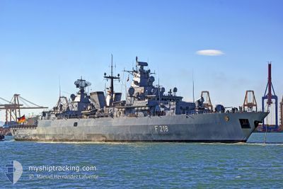
GERMAN WARSHIP F218
Military ops
Current Trip
| Trip Time | 23 h, 15 mins |
|---|---|
| Trip Distance | 116.35 nm |
| AVG Speed | 5.7 Knoten |
| MAX Speed | 8.8 Knoten |
| Tiefgang | 6.8 m |
| AVG Wind | 9.9 knots |
| MAX Wind | 17 knots |
| MIN Temp | 1.9°C / 35.42°F |
| MAX Temp | 6.8°C / 44.24°F |
| Position erhalten | 5 d alt |
Current Position
| Länge | 7.20862° |
|---|---|
| Breite | 53.35228° |
| Zustand | Default |
| Geschwindigkeit | 0.8 Knoten |
| Kurs | 28° |
| Gebiet | North Sea |
| Station | T-AIS |
| Position erhalten | 5 d alt |
Info
Information
Die aktuelle Position von GERMAN WARSHIP F218 befindet sich in North Sea mit den Koordinaten 53.35228° / 7.20862°, wie von AIS am 2025-02-04 15:01 an unsere Schiffsverfolgungs-App. Die aktuelle Geschwindigkeit des Schiffes betragt 0.8 Knoten und befindet sich derzeit im Port von EMDEN .
Das Schiff GERMAN WARSHIP F218 (MMSI: 211210190) ist Military ops Es segelt unter der Flagge [DE] Germany.
Auf dieser Seite finden Sie Informationen zur aktuellen Position des Schiffes, zu den zuletzt erkannten Hafenanlaufen und zu aktuellen Reiseinformationen. Wenn die Schiffe nicht von AIS abgedeckt werden, finden Sie die neueste Position.
Die aktuelle Position von GERMAN WARSHIP F218 wird von unseren AIS-Empfangern erkannt und wir sind nicht fur die Zuverlassigkeit der Daten verantwortlich. Die letzte Position wurde von den Ais-Empfangern unserer Schiffsverfolgungs-App aufgezeichnet, wahrend sich das Schiff in Deckung befand.
Der aktuelle Entwurf von GERMAN WARSHIP F218, wie von AIS gemeldet, betragt 6.8 meter
Weather
| Temperature | 6.3°C / 43.34°F |
|---|---|
| Wind Speed | 11 knots |
| Direction | 200° SSW |
| Pressure | 1025 hPa |
| Humidity | 75.5 % |
| Cloud Coverage | 12 % |
Featured Company
Last Port Calls
| Port | Arrival | Departure | Time In Port |
|---|---|---|---|
| 2025-02-04 14:51 | |||
| 2025-02-03 15:36 |
Most Visited Ports (Last year)
| Port | Arrivals | |
|---|---|---|
| 5 | ||
| 1 | ||
| 1 | ||
| 1 |
Last Trips
| Origin | Departure | Destination | Arrival | Distance | |
|---|---|---|---|---|---|
| 2025-02-03 15:36 | 2025-02-04 14:51 | 116.35 nm |
Events
| Zeit | Ereignis | Details | Position / Ziel | Information |
|---|---|---|---|---|
| 2025-02-04 15:01 | außerhalb Abdeckung |
53.35228 / 7.20862
North Sea
[DE] EMDEN
|
Geschwindigkeit: 0.8 kn Kurs: 23.8° |
|
| 2025-02-04 13:51 | ZIELHAFEN |
|
53.33491 / 7.18070
[DE] EMDEN
|
Geschwindigkeit: 2.2 kn Kurs: 61° |
| 2025-02-04 12:47 | Ändere Seegebiet | German part of the North Sea Dutch part of the North Sea |
53.32337 / 7.02338
North Sea
|
Geschwindigkeit: 5.5 kn Kurs: 90.6° |
| 2025-02-04 10:29 | Ändere Seegebiet | Dutch part of the North Sea German part of the North Sea |
53.51034 / 6.78130
North Sea
|
Geschwindigkeit: 7.5 kn Kurs: 129° |
| 2025-02-04 10:01 | Ändere Seegebiet | German part of the North Sea Dutch part of the North Sea |
53.54408 / 6.70560
North Sea
|
Geschwindigkeit: 7 kn Kurs: 127.8° |
| 2025-02-04 10:01 | in Abdeckung |
53.54408 / 6.70560
North Sea
|
Geschwindigkeit: 7 kn Kurs: 127.8° |
|
| 2025-02-04 08:30 | außerhalb Abdeckung |
53.61279 / 6.51722
North Sea
|
Geschwindigkeit: 4.7 kn Kurs: 89.6° |
|
| 2025-02-04 06:44 | Ändere Seegebiet | Dutch part of the North Sea German part of the North Sea |
53.63689 / 6.35863
North Sea
|
Geschwindigkeit: 2.9 kn Kurs: 215.3° |
| 2025-02-03 14:36 | ABFAHRTSHAFEN |
|
53.54899 / 8.17851
|
Geschwindigkeit: 4 kn Kurs: 26° |
| 2025-02-03 14:19 | START Bewegung |
53.53440 / 8.16298
[DE] WILHELMSHAVEN
|
Geschwindigkeit: 3.1 kn Kurs: 28° |