
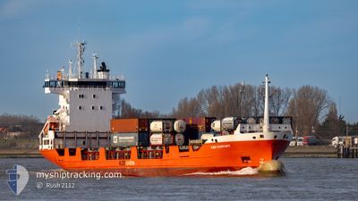
A2B COMFORT
Container Ship
Current Trip
| Time Travelled | 11 h, 57 mins |
|---|---|
| Remaining Time | 2 h, 19 mins |
| Distance Travelled | 180.44 nm |
| Remaining Distance | 37.81 nm |
| AVG Speed | 14.7 Noeuds |
| MAX Speed | 17.1 Noeuds |
| AVG Wind | 10.3 knots |
| MAX Wind | 15 knots |
| MIN Temp | 2.9°C / 37.22°F |
| MAX Temp | 6.9°C / 44.42°F |
| Tirant d eau | 5.4 m |
| Position reçue | Maintenant |
Current Position
| Longitude | 3.97728° |
|---|---|
| Latitude | 52.00566° |
| Etat | Under way using engine |
| Vitesse | 15.2 Noeuds |
| Parcours | 110.4° |
| Zone | North Sea |
| Station | T-AIS |
| Position reçue | Maintenant |
Info
Information
The current position of A2B COMFORT is in North Sea with coordinates 52.00566° / 3.97728° as reported on 2025-02-26 12:44 by AIS to our vessel tracker app. The vessel's current speed is 15.2 Noeuds and is heading at the port of MOERDIJK. The estimated time of arrival as calculated by MyShipTracking vessel tracking app is 2025-02-26 15:04 LT
The vessel A2B COMFORT (IMO: 9183415, MMSI: 246891000) is a Container Ship that was built in 1998 ( 27 Age ). It's sailing under the flag of [NL] Netherlands.
In this page you can find informations about the vessels current position, last detected port calls, and current voyage information. If the vessels is not in coverage by AIS you will find the latest position.
The current position of A2B COMFORT is detected by our AIS receivers and we are not responsible for the reliability of the data. The last position was recorded while the vessel was in Coverage by the Ais receivers of our vessel tracking app.
The current draught of A2B COMFORT as reported by AIS is 5.4 meters
Weather
| Temperature | 5.8°C / 42.44°F |
|---|---|
| Wind Speed | 13 knots |
| Direction | 206° SSW |
| Pressure | 1015.4 hPa |
| Humidity | 88.3 % |
| Cloud Coverage | 12 % |
Featured Company
Last Port Calls
| Port | Arrival | Departure | Time In Port |
|---|---|---|---|
| 2025-02-25 10:20 | 2025-02-26 00:48 | 14 h | |
| 2025-02-23 14:57 | 2025-02-24 17:32 | 1 d | |
| 2025-02-21 17:53 | 2025-02-22 23:05 | 1 d | |
| 2025-02-20 18:13 | 2025-02-20 23:39 | 5 h | |
| 2025-02-19 17:52 | 2025-02-20 01:21 | 7 h | |
| 2025-02-18 06:25 | 2025-02-18 23:00 | 16 h | |
| 2025-02-17 08:46 | 2025-02-17 16:05 | 7 h | |
| 2025-02-16 04:52 | 2025-02-16 18:23 | 13 h | |
| 2025-02-14 19:36 | 2025-02-15 13:09 | 17 h | |
| 2025-02-13 01:05 | 2025-02-13 22:15 | 21 h |
Most Visited Ports (Last year)
| Port | Arrivals | |
|---|---|---|
| 124 | ||
| 118 | ||
| 8 | ||
| 2 | ||
| 2 | ||
| 2 |
Last Trips
| Origin | Departure | Destination | Arrival | Distance | |
|---|---|---|---|---|---|
| 2025-02-24 18:32 | 2025-02-25 10:20 | 217.45 nm | |||
| 2025-02-22 23:05 | 2025-02-23 15:57 | 217.46 nm | |||
| 2025-02-21 00:39 | 2025-02-21 17:53 | 220.46 nm | |||
| 2025-02-20 01:21 | 2025-02-20 19:13 | 218.60 nm | |||
| 2025-02-19 00:00 | 2025-02-19 17:52 | 221.67 nm | |||
| 2025-02-17 16:05 | 2025-02-18 07:25 | 171.44 nm | |||
| 2025-02-16 19:23 | 2025-02-17 08:46 | 172.89 nm | |||
| 2025-02-15 13:09 | 2025-02-16 05:52 | 218.47 nm | |||
| 2025-02-13 23:15 | 2025-02-14 19:36 | 239.07 nm | |||
| 2025-02-12 08:41 | 2025-02-13 02:05 | 217.42 nm |
Events
| Heure | Evenement | Détails | Position/ Destination | Info |
|---|---|---|---|---|
| 2025-02-26 11:17 | Changement de zone | Dutch part of the North Sea United Kingdom part of the North Sea |
52.15136 / 3.44361
North Sea
NLMOE
|
Vitesse: 14.5 kn Parcours: 122.8° |
| 2025-02-26 11:16 | Etat Changé | Under way using engine Default |
52.15306 / 3.43927
NLMOE
|
Vitesse: 14.6 kn Parcours: 118° |
| 2025-02-26 11:16 | Dans la zone couverte |
52.15136 / 3.44361
North Sea
NLMOE
|
Vitesse: 14.5 kn Parcours: 122.8° |
|
| 2025-02-26 08:50 | Etat Changé | Default Under way using engine |
52.49279 / 2.62676
NLMOE
|
Vitesse: 15.3 kn Parcours: 123.8° |
| 2025-02-26 08:42 | Etat Changé | Under way using engine Default |
52.51200 / 2.58096
NLMOE
|
Vitesse: 15.2 kn Parcours: 125° |
| 2025-02-26 08:42 | Hors de la zone couverte |
52.51200 / 2.58096
North Sea
NLMOE
|
Vitesse: 15.3 kn Parcours: 123.8° |
|
| 2025-02-26 08:29 | Dans la zone couverte |
52.51200 / 2.58096
North Sea
NLMOE
|
Vitesse: 15.3 kn Parcours: 123.8° |
|
| 2025-02-26 07:38 | Etat Changé | Default Under way using engine |
52.66389 / 2.18998
NLMOE
|
Vitesse: 16.1 kn Parcours: 125° |
| 2025-02-26 07:30 | Hors de la zone couverte |
52.68466 / 2.14285
North Sea
NLMOE
|
Vitesse: 16.1 kn Parcours: 125° |
|
| 2025-02-26 04:38 | Etat Changé | Under way using engine Default |
53.08420 / 1.00065
NLMOE
|
Vitesse: 16.1 kn Parcours: 134° |