

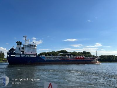
AGATH
Tanker

Current Trip
| Time Travelled | 1 day |
|---|---|
| Remaining Time | 1 day |
| Distance Travelled | 295.58 nm |
| Remaining Distance | 322.37 nm |
| AVG Speed | 6.7 Noeuds |
| MAX Speed | 12.4 Noeuds |
| AVG Wind | 21 knots |
| MAX Wind | 28 knots |
| MIN Temp | 9.5°C / 49.1°F |
| MAX Temp | 15.6°C / 60.08°F |
| Tirant d eau | 5.1 m |
| Position reçue | 1 m depuis |
Current Position
| Longitude | 6.95699° |
|---|---|
| Latitude | 56.28640° |
| Etat | Under way using engine |
| Vitesse | 9.3 Noeuds |
| Parcours | 215.2° |
| Zone | North Sea |
| Station | T-AIS |
| Position reçue | 1 m depuis |
Information
The current position of AGATH is in North Sea with coordinates 56.28640° / 6.95699° as reported on 2025-05-27 19:26 by AIS to our vessel tracker app. The vessel's current speed is 9.3 Noeuds and is heading at the port of ROTTERDAM. The estimated time of arrival as calculated by MyShipTracking vessel tracking app is 2025-05-29 15:10 LT
The vessel AGATH (IMO: 9537642, MMSI: 209168000) is a Tanker It's sailing under the flag of [CY] Cyprus.
In this page you can find informations about the vessels current position, last detected port calls, and current voyage information. If the vessels is not in coverage by AIS you will find the latest position.
The current position of AGATH is detected by our AIS receivers and we are not responsible for the reliability of the data. The last position was recorded while the vessel was in Coverage by the Ais receivers of our vessel tracking app.
The current draught of AGATH as reported by AIS is 5.1 meters
Weather
| Temperature | 10.9°C / 51.62°F |
|---|---|
| Wind Speed | 13 knots |
| Direction | 222° SW |
| Pressure | 1008.1 hPa |
| Humidity | 86.7 % |
| Cloud Coverage | 100 % |


Featured Company
Last Port Calls
| Port | Arrival | Departure | Time In Port |
|---|---|---|---|
| 2025-05-25 19:58 | 2025-05-26 11:29 | 15 h | |
| 2025-05-21 15:55 | 2025-05-22 21:10 | 1 d | |
| 2025-05-19 03:05 | 2025-05-20 03:23 | 1 d | |
| 2025-05-14 08:16 | 2025-05-14 23:02 | 14 h | |
| 2025-05-11 22:59 | 2025-05-12 23:40 | 1 d | |
| 2025-05-07 12:14 | 2025-05-08 14:41 | 1 d | |
| 2025-05-03 11:44 | 2025-05-04 00:17 | 12 h | |
| 2025-04-27 22:13 | 2025-04-27 22:48 | 34 m | |
| 2025-04-25 08:29 | 2025-04-26 11:20 | 1 d | |
| 2025-04-24 09:04 | 2025-04-24 22:40 | 13 h |
Most Visited Ports (Last year)
| Port | Arrivals | |
|---|---|---|
| 16 | ||
| 14 | ||
| 8 | ||
| 5 | ||
| 4 | ||
| 3 |
Last Trips
| Origin | Departure | Destination | Arrival | Distance | |
|---|---|---|---|---|---|
| 2025-05-22 21:10 | 2025-05-25 19:58 | 652.61 nm | |||
| 2025-05-20 03:23 | 2025-05-21 15:55 | 249.72 nm | |||
| 2025-05-14 23:02 | 2025-05-19 03:05 | 957.24 nm | |||
| 2025-05-12 23:40 | 2025-05-14 08:16 | 200.22 nm | |||
| 2025-05-08 14:41 | 2025-05-11 22:59 | 682.91 nm | |||
| 2025-05-04 00:17 | 2025-05-07 12:14 | 777.65 nm | |||
| 2025-04-27 22:48 | 2025-05-03 11:44 | 1086.46 nm | |||
| 2025-04-26 11:20 | 2025-04-27 22:13 | 356.56 nm | |||
| 2025-04-24 22:40 | 2025-04-25 08:29 | 84.73 nm | |||
| 2025-04-21 02:52 | 2025-04-24 09:04 | 687.13 nm |
Events
| Heure | Evenement | Détails | Position/ Destination | Info |
|---|---|---|---|---|
| 2025-05-27 07:40 | Changement de zone | Danish part of the North Sea Danish part of the Skaggerak |
57.29759 / 8.29083
North Sea
NLRTM
|
Vitesse: 7.9 kn Parcours: 217.1° |
| 2025-05-26 20:50 | Changement de zone | Danish part of the Skaggerak Danish part of the Kattegat |
57.80483 / 10.96292
Skaggerak
NLRTM
|
Vitesse: 9.4 kn Parcours: 314.5° |
| 2025-05-26 19:37 | Changement de zone | Danish part of the Kattegat Swedish part of the Kattegat |
57.64803 / 11.20769
Kattegat
NLRTM
|
Vitesse: 10.4 kn Parcours: 315.6° |
| 2025-05-26 09:29 | PORT DE DEPART |
|
56.01523 / 12.69485
NLRTM
|
Vitesse: 6.7 kn Parcours: 256° |
| 2025-05-26 09:26 | Changement d'ETA | 2025/05/28 17:30 2025/05/28 17:00 |
56.02125 / 12.69809
[SE] HELSINGBORG
|
Vitesse: 6.5 kn Parcours: 179° |
| 2025-05-26 09:25 | Etat Changé | Under way using engine Moored |
56.02273 / 12.69803
[SE] HELSINGBORG
|
Vitesse: 4.9 kn Parcours: 179° |
| 2025-05-26 09:24 | Démarrage |
56.02393 / 12.69794
[SE] HELSINGBORG
|
Vitesse: 3.1 kn Parcours: 180° |
|
| 2025-05-26 08:47 | Tirant d'eau modifié | 5.1 6.1 |
56.02589 / 12.69768
[SE] HELSINGBORG
|
Vitesse: Parcours: 172° |
| 2025-05-26 08:47 | Changement de destination | NLRTM SEHEL |
56.02589 / 12.69768
[SE] HELSINGBORG
|
Vitesse: Parcours: 172° |
| 2025-05-26 08:47 | Changement d'ETA | 2025/05/28 17:00 2025/05/25 16:00 |
56.02589 / 12.69768
[SE] HELSINGBORG
|
Vitesse: Parcours: 172° |