
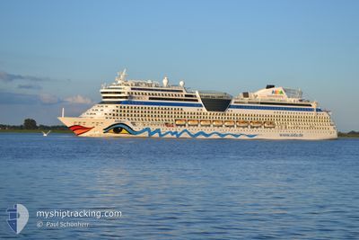
AIDASOL
Passengers Ship
Current Trip
| Time Travelled | 1 day |
|---|---|
| Remaining Time | 39 mins |
| Distance Travelled | 428.40 nm |
| Remaining Distance | 13.42 nm |
| AVG Speed | 13 Noeuds |
| MAX Speed | 16.1 Noeuds |
| AVG Wind | 11.6 knots |
| MAX Wind | 20.3 knots |
| MIN Temp | -4.8°C / 23.36°F |
| MAX Temp | 3.4°C / 38.12°F |
| Tirant d eau | 7.3 m |
| Position reçue | Maintenant |
Current Position
| Longitude | 5.10428° |
|---|---|
| Latitude | 59.35110° |
| Etat | Under way using engine |
| Vitesse | 15.2 Noeuds |
| Parcours | 359.4° |
| Zone | North Sea |
| Station | T-AIS |
| Position reçue | Maintenant |
Info
Information
The current position of AIDASOL is in North Sea with coordinates 59.35110° / 5.10428° as reported on 2025-02-19 04:36 by AIS to our vessel tracker app. The vessel's current speed is 15.2 Noeuds and is heading at the port of HAUGESUND. The estimated time of arrival as calculated by MyShipTracking vessel tracking app is 2025-02-19 05:16 LT
The vessel AIDASOL (IMO: 9490040, MMSI: 247302900) is a Passengers Ship that was built in 2011 ( 14 Age ). It's sailing under the flag of [IT] Italy.
In this page you can find informations about the vessels current position, last detected port calls, and current voyage information. If the vessels is not in coverage by AIS you will find the latest position.
The current position of AIDASOL is detected by our AIS receivers and we are not responsible for the reliability of the data. The last position was recorded while the vessel was in Coverage by the Ais receivers of our vessel tracking app.
The current draught of AIDASOL as reported by AIS is 7.3 meters
Weather
| Temperature | 2.4°C / 36.32°F |
|---|---|
| Wind Speed | 20 knots |
| Direction | 150° SSE |
| Pressure | 1027.2 hPa |
| Humidity | 65.8 % |
| Cloud Coverage | 58 % |
Featured Company
Last Port Calls
| Port | Arrival | Departure | Time In Port |
|---|---|---|---|
| 2025-02-17 03:28 | 2025-02-17 21:49 | 18 h | |
| 2025-02-15 09:13 | 2025-02-15 18:17 | 9 h | |
| 2025-02-13 06:03 | 2025-02-13 15:21 | 9 h | |
| 2025-02-12 06:49 | 2025-02-12 16:16 | 9 h | |
| 2025-02-10 11:17 | 2025-02-10 20:20 | 9 h | |
| 2025-02-09 07:12 | 2025-02-09 18:34 | 11 h | |
| 2025-01-30 04:24 | 2025-01-30 20:52 | 16 h | |
| 2025-01-26 03:46 | 2025-01-27 23:38 | 1 d | |
| 2025-01-23 06:00 | 2025-01-24 17:08 | 1 d | |
| 2025-01-21 05:11 | 2025-01-21 18:33 | 13 h |
Most Visited Ports (Last year)
| Port | Arrivals | |
|---|---|---|
| 24 | ||
| 12 | ||
| 11 | ||
| 10 | ||
| 8 | ||
| 7 |
Last Trips
| Origin | Departure | Destination | Arrival | Distance | |
|---|---|---|---|---|---|
| 2025-02-15 18:17 | 2025-02-17 04:28 | 562.85 nm | |||
| 2025-02-13 15:21 | 2025-02-15 09:13 | 687.12 nm | |||
| 2025-02-12 16:16 | 2025-02-13 06:03 | 193.86 nm | |||
| 2025-02-10 20:20 | 2025-02-12 06:49 | 510.16 nm | |||
| 2025-02-09 18:34 | 2025-02-10 11:17 | 259.24 nm | |||
| 2025-01-30 22:52 | 2025-02-09 07:12 | 3860.94 nm | |||
| 2025-01-28 01:38 | 2025-01-30 06:24 | 715.50 nm | |||
| 2025-01-24 19:08 | 2025-01-26 05:46 | 441.69 nm | |||
| 2025-01-21 20:33 | 2025-01-23 08:00 | 396.08 nm | |||
| 2025-01-17 20:23 | 2025-01-21 07:11 | 1429.45 nm |
Events
| Heure | Evenement | Détails | Position/ Destination | Info |
|---|---|---|---|---|
| 2025-02-18 17:33 | Changement de zone | Norwegian part of the North Sea Danish part of the North Sea |
57.01059 / 5.76848
North Sea
NOHAU
|
Vitesse: 13.9 kn Parcours: 353.5° |
| 2025-02-18 17:33 | Etat Changé | Under way using engine Default |
57.01059 / 5.76848
NOHAU
|
Vitesse: 13.9 kn Parcours: 354° |
| 2025-02-18 17:17 | Dans la zone couverte |
57.01059 / 5.76848
North Sea
NOHAU
|
Vitesse: 13.9 kn Parcours: 353.5° |
|
| 2025-02-18 16:17 | Etat Changé | Default Under way using engine |
56.71275 / 5.82925
NOHAU
|
Vitesse: 14.6 kn Parcours: 354.1° |
| 2025-02-18 16:01 | Hors de la zone couverte |
56.65059 / 5.84187
North Sea
NOHAU
|
Vitesse: 14.6 kn Parcours: 354.1° |
|
| 2025-02-18 16:00 | Dans la zone couverte |
56.65059 / 5.84187
North Sea
NOHAU
|
Vitesse: 14.6 kn Parcours: 354.1° |
|
| 2025-02-18 14:14 | Hors de la zone couverte |
56.24217 / 6.09089
North Sea
NOHAU
|
Vitesse: 14.5 kn Parcours: 339.7° |
|
| 2025-02-18 12:18 | Etat Changé | Under way using engine Default |
55.79837 / 6.34912
NOHAU
|
Vitesse: 14.3 kn Parcours: 342° |
| 2025-02-18 11:59 | Etat Changé | Default Under way using engine |
55.72888 / 6.38922
NOHAU
|
Vitesse: 14.3 kn Parcours: 342° |
| 2025-02-18 11:59 | Changement de zone | Danish part of the North Sea German part of the North Sea |
55.72700 / 6.39030
North Sea
NOHAU
|
Vitesse: 14.3 kn Parcours: 342° |