
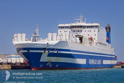
ALCUDIA EXPRESS
Ro-Ro/Passenger Ship
Current Trip
| Trip Time | 7 h, 20 mins |
|---|---|
| Trip Distance | 102.08 nm |
| AVG Speed | 14.5 Noeuds |
| MAX Speed | 15.6 Noeuds |
| Tirant d eau | 7.3 m |
| AVG Wind | 6.2 knots |
| MAX Wind | 10 knots |
| MIN Temp | 21°C / 69.8°F |
| MAX Temp | 22.1°C / 71.78°F |
| Position reçue | 5 d depuis |
Current Position
| Longitude | 33.94874° |
|---|---|
| Latitude | 26.74599° |
| Etat | Moored |
| Vitesse | |
| Parcours | 141° |
| Zone | Red Sea |
| Station | T-AIS |
| Position reçue | 5 d depuis |
Info
Information
The current position of ALCUDIA EXPRESS is in Red Sea with coordinates 26.74599° / 33.94874° as reported on 2025-02-04 19:09 by AIS to our vessel tracker app. The vessel's current speed is 0 Noeuds and is currently inside the port of SAFAGA.
The vessel ALCUDIA EXPRESS (IMO: 9010151, MMSI: 210099000) is a Ro-Ro/Passenger Ship that was built in 1994 ( 31 Age ). It's sailing under the flag of [CY] Cyprus.
In this page you can find informations about the vessels current position, last detected port calls, and current voyage information. If the vessels is not in coverage by AIS you will find the latest position.
The current position of ALCUDIA EXPRESS is detected by our AIS receivers and we are not responsible for the reliability of the data. The last position was recorded while the vessel was in Coverage by the Ais receivers of our vessel tracking app.
The current draught of ALCUDIA EXPRESS as reported by AIS is 7.3 meters
Weather
| Temperature | 21.3°C / 70.34°F |
|---|---|
| Wind Speed | 9 knots |
| Direction | 327° NNW |
| Pressure | 1013.7 hPa |
| Humidity | 44.5 % |
| Cloud Coverage | 100 % |
Featured Company
Last Port Calls
| Port | Arrival | Departure | Time In Port |
|---|---|---|---|
| 2025-02-04 09:55 | |||
| 2025-02-03 15:49 | 2025-02-04 03:35 | 11 h | |
| 2025-02-03 07:38 | |||
| 2025-01-21 07:46 | |||
| 2025-01-14 14:05 | 2025-01-15 00:56 | 10 h | |
| 2025-01-14 06:10 | |||
| 2025-01-11 09:42 | |||
| 2025-01-04 11:20 | 2025-01-05 06:47 | 19 h | |
| 2024-12-19 06:28 | |||
| 2024-12-11 16:30 | 2024-12-13 04:01 | 1 d |
Last Trips
| Origin | Departure | Destination | Arrival | Distance | |
|---|---|---|---|---|---|
| 2025-02-04 03:35 | 2025-02-04 09:55 | 102.08 nm | |||
| 2025-02-03 07:38 | 2025-02-03 15:49 | 96.33 nm | |||
| 2025-01-14 06:10 | 2025-01-14 14:05 | 94.59 nm | |||
| 2024-12-19 06:28 | 2025-01-04 11:20 | 70.75 nm | |||
| 2024-12-11 10:27 | 2024-12-11 16:30 | 101.71 nm | |||
| 2024-11-29 03:46 | 2024-12-11 04:30 | 183.73 nm |
Events
| Heure | Evenement | Détails | Position/ Destination | Info |
|---|---|---|---|---|
| 2025-02-04 19:09 | Hors de la zone couverte |
26.74599 / 33.94874
Red Sea
[EG] SAFAGA
|
Vitesse: Parcours: 155.6° |
|
| 2025-02-04 19:09 | Dans la zone couverte |
26.74599 / 33.94874
Red Sea
[EG] SAFAGA
|
Vitesse: Parcours: 155.6° |
|
| 2025-02-04 14:12 | Hors de la zone couverte |
26.74592 / 33.94870
Red Sea
[EG] SAFAGA
|
Vitesse: Parcours: 318.3° |
|
| 2025-02-04 08:22 | Etat Changé | Moored Under way using engine |
26.74586 / 33.94870
[EG] SAFAGA
|
Vitesse: 0.1 kn Parcours: 139° |
| 2025-02-04 07:55 | Arret |
26.74547 / 33.94905
[EG] SAFAGA
|
Vitesse: 0.2 kn Parcours: 141° |
|
| 2025-02-04 07:55 | Port d'arrivée |
|
26.74547 / 33.94905
[EG] SAFAGA
|
Vitesse: 0.6 kn Parcours: 136° |
| 2025-02-04 06:00 | Dans la zone couverte |
26.84414 / 34.30615
Red Sea
<<< |
Vitesse: 14.9 kn Parcours: 246.3° |
|
| 2025-02-04 04:03 | Hors de la zone couverte |
27.07741 / 34.79063
Red Sea
<<< |
Vitesse: 15.6 kn Parcours: 230.1° |
|
| 2025-02-04 04:03 | Changement de zone | Egyptian part of the Red Sea Saudi Arabian part of the Red Sea |
27.07741 / 34.79063
Red Sea
<<< |
Vitesse: 15.6 kn Parcours: 230.1° |
| 2025-02-04 02:54 | Changement d'ETA | 2025/02/04 07:00 2025/02/03 12:15 |
27.25742 / 35.04031
<<< |
Vitesse: 14.5 kn Parcours: 235.9° |