

AMAZON VIRTUE
Tanker

Current Trip
| Time Travelled | 48 days |
|---|---|
| Remaining Time | --- |
| Distance Travelled | 7346.43 nm |
| Remaining Distance | 3.91 nm |
| AVG Speed | 12.1 Noeuds |
| MAX Speed | 15.5 Noeuds |
| AVG Wind | 10.4 knots |
| MAX Wind | 27.9 knots |
| MIN Temp | 16.6°C / 61.88°F |
| MAX Temp | 30°C / 86°F |
| Tirant d eau | 12.2 m |
| Position reçue | 23 d depuis |
Current Position
| Longitude | 17.42847° |
|---|---|
| Latitude | -33.36592° |
| Etat | Under way using engine |
| Vitesse | 13.1 Noeuds |
| Parcours | 336.7° |
| Zone | South Atlantic Ocean |
| Station | T-AIS |
| Position reçue | 23 d depuis |
Information
The current position of AMAZON VIRTUE is in South Atlantic Ocean with coordinates -33.36592° / 17.42847° as reported on 2025-05-17 13:30 by AIS to our vessel tracker app. The vessel's current speed is 13.1 Noeuds and is heading at the port of LOME. The estimated time of arrival as calculated by MyShipTracking vessel tracking app is 2025-05-26 04:30 LT
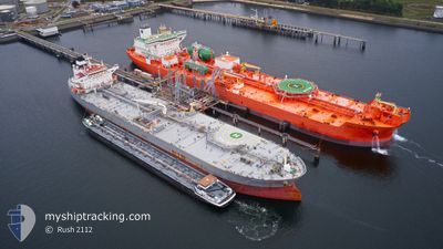
The vessel AMAZON VIRTUE (IMO: 9660360, MMSI: 241293000) is a Tanker It's sailing under the flag of [GR] Greece.
In this page you can find informations about the vessels current position, last detected port calls, and current voyage information. If the vessels is not in coverage by AIS you will find the latest position.
The current position of AMAZON VIRTUE is detected by our AIS receivers and we are not responsible for the reliability of the data. The last position was recorded while the vessel was in Coverage by the Ais receivers of our vessel tracking app.
The current draught of AMAZON VIRTUE as reported by AIS is 12.2 meters
Weather
| Temperature | 27.4°C / 81.32°F |
|---|---|
| Wind Speed | 4 knots |
| Direction | 211° SSW |
| Pressure | 1013.9 hPa |
| Humidity | 78.9 % |
| Cloud Coverage | 57 % |


Featured Company
Last Port Calls
| Port | Arrival | Departure | Time In Port |
|---|---|---|---|
| 2025-04-20 18:49 | 2025-04-22 21:59 | 2 d | |
| 2025-04-16 20:18 | 2025-04-19 11:02 | 2 d | |
| 2025-04-04 05:34 |
Last Trips
| Origin | Departure | Destination | Arrival | Distance | |
|---|---|---|---|---|---|
| 2025-04-19 11:02 | 2025-04-20 18:49 | 276.90 nm | |||
| 2025-04-04 05:34 | 2025-04-16 20:18 | 1209.21 nm |
Events
| Heure | Evenement | Détails | Position/ Destination | Info |
|---|---|---|---|---|
| 2025-06-04 18:45 | Arret | 7.9 nm, South of LOME |
6.00593 / 1.27282
TGLFW
|
Vitesse: 0.1 kn Parcours: 233° |
| 2025-06-03 10:30 | Arret | 12.24 nm, South of LOME |
5.94058 / 1.23015
TGLFW
|
Vitesse: 0.2 kn Parcours: 209° |
| 2025-06-03 08:15 | Démarrage | 8.67 nm, South of LOME |
6.00018 / 1.23994
TGLFW
|
Vitesse: 3.2 kn Parcours: 213° |
| 2025-06-01 15:34 | Arret | 7.3 nm, South of LOME |
6.02022 / 1.25265
TGLFW
|
Vitesse: 0.1 kn Parcours: 218° |
| 2025-06-01 14:59 | Démarrage | 5.72 nm, South of LOME |
6.04817 / 1.25258
TGLFW
|
Vitesse: 3.4 kn Parcours: 213° |