
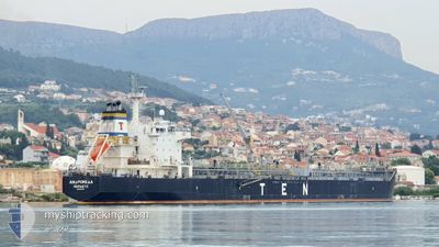
ANDROMEDA
Oil/Chemical Tanker
Current Trip
| Time Travelled | 8 days |
|---|---|
| Remaining Time | 5 days |
| Distance Travelled | 1931.13 nm |
| Remaining Distance | 1479.82 nm |
| AVG Speed | 11.2 Noeuds |
| MAX Speed | 14.3 Noeuds |
| AVG Wind | 12.7 knots |
| MAX Wind | 35 knots |
| MIN Temp | 6.3°C / 43.34°F |
| MAX Temp | 18.2°C / 64.76°F |
| Tirant d eau | 10.1 m |
| Position reçue | 6 h, 39 m depuis |
Current Position
| Longitude | -6.10027° |
|---|---|
| Latitude | 35.96053° |
| Etat | Under way using engine |
| Vitesse | 10.2 Noeuds |
| Parcours | 270° |
| Zone | North Atlantic Ocean |
| Station | T-AIS |
| Position reçue | 6 h, 39 m depuis |
Info
Information
The current position of ANDROMEDA is in North Atlantic Ocean with coordinates 35.96053° / -6.10027° as reported on 2025-03-14 15:26 by AIS to our vessel tracker app. The vessel's current speed is 10.2 Noeuds and is heading at the port of DAKAR. The estimated time of arrival as calculated by MyShipTracking vessel tracking app is 2025-03-20 12:31 LT
The vessel ANDROMEDA (IMO: 9315795, MMSI: 240597000) is a Oil/Chemical Tanker that was built in 2007 ( 18 Age ). It's sailing under the flag of [GR] Greece.
In this page you can find informations about the vessels current position, last detected port calls, and current voyage information. If the vessels is not in coverage by AIS you will find the latest position.
The current position of ANDROMEDA is detected by our AIS receivers and we are not responsible for the reliability of the data. The last position was recorded while the vessel was in Coverage by the Ais receivers of our vessel tracking app.
The current draught of ANDROMEDA as reported by AIS is 10.1 meters
Weather
| Temperature | 15.1°C / 59.18°F |
|---|---|
| Wind Speed | 18 knots |
| Direction | 302° WNW |
| Pressure | 1010.6 hPa |
| Humidity | 64.2 % |
| Cloud Coverage | 2 % |
Featured Company
Last Port Calls
| Port | Arrival | Departure | Time In Port |
|---|---|---|---|
| 2025-03-06 23:48 | 2025-03-07 00:53 | 1 h | |
| 2025-03-03 20:45 | 2025-03-04 14:49 | 18 h | |
| 2025-03-01 20:53 | 2025-03-03 19:56 | 1 d | |
| 2025-03-01 18:34 | 2025-03-01 18:44 | 9 m | |
| 2025-03-01 04:46 | 2025-03-01 14:36 | 9 h | |
| 2025-02-14 01:46 | 2025-02-14 14:13 | 12 h | |
| 2025-02-13 19:53 | |||
| 2025-02-01 07:31 | 2025-02-01 19:13 | 11 h | |
| 2025-01-26 13:44 | 2025-01-28 02:29 | 1 d | |
| 2025-01-01 06:59 |
Last Trips
| Origin | Departure | Destination | Arrival | Distance | |
|---|---|---|---|---|---|
| 2025-03-04 14:49 | 2025-03-06 23:48 | 519.88 nm | |||
| 2025-03-03 19:56 | 2025-03-03 20:45 | 11.99 nm | |||
| 2025-03-01 18:44 | 2025-03-01 20:53 | 7.26 nm | |||
| 2025-03-01 14:36 | 2025-03-01 18:34 | 20.25 nm | |||
| 2025-02-14 14:13 | 2025-03-01 04:46 | 667.40 nm | |||
| 2025-02-13 19:53 | 2025-02-14 01:46 | 7.26 nm | |||
| 2025-01-28 02:29 | 2025-02-01 07:31 | 735.96 nm | |||
| 2025-01-01 06:59 | 2025-01-26 13:44 | 2629.01 nm |
Events
| Heure | Evenement | Détails | Position/ Destination | Info |
|---|---|---|---|---|
| 2025-03-14 15:29 | Etat Changé | Default Under way using engine |
35.96038 / -6.10953
SNDKR
|
Vitesse: 10.2 kn Parcours: 270° |
| 2025-03-14 15:26 | Hors de la zone couverte |
35.96053 / -6.10027
North Atlantic Ocean
SNDKR
|
Vitesse: 10.2 kn Parcours: 270° |
|
| 2025-03-14 15:24 | Etat Changé | Under way using engine Default |
35.96070 / -6.09322
SNDKR
|
Vitesse: 10.6 kn Parcours: 268° |
| 2025-03-14 15:07 | Etat Changé | Default Under way using engine |
35.96140 / -6.03500
SNDKR
|
Vitesse: 9.9 kn Parcours: 274° |
| 2025-03-14 15:02 | Etat Changé | Under way using engine Default |
35.96108 / -6.01757
SNDKR
|
Vitesse: 9.8 kn Parcours: 271° |
| 2025-03-14 14:57 | Etat Changé | Default Under way using engine |
35.96062 / -5.99912
SNDKR
|
Vitesse: 10.2 kn Parcours: 269° |
| 2025-03-14 14:53 | Detecté en mer | Spanish part of the North Atlantic Ocean |
35.96043 / -5.98540
North Atlantic Ocean
SNDKR
|
Vitesse: 10.4 kn Parcours: 269° |
| 2025-03-14 14:26 | Etat Changé | Under way using engine Default |
35.96097 / -5.88982
SNDKR
|
Vitesse: 10.2 kn Parcours: 269° |
| 2025-03-14 14:24 | Etat Changé | Default Under way using engine |
35.96105 / -5.88297
SNDKR
|
Vitesse: 9.8 kn Parcours: 270° |
| 2025-03-14 13:52 | Etat Changé | Under way using engine Default |
35.96562 / -5.77385
SNDKR
|
Vitesse: 10.8 kn Parcours: 265° |