
ANNA
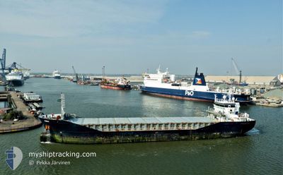
General Cargo
Current Trip
| Trip Time | 14 days |
|---|---|
| Trip Distance | 3089.81 nm |
| AVG Speed | 9.6 Noeuds |
| MAX Speed | 14.1 Noeuds |
| Tirant d eau | 5.8 m |
| AVG Wind | 10.4 knots |
| MAX Wind | 34 knots |
| MIN Temp | -3.1°C / 26.42°F |
| MAX Temp | 17°C / 62.6°F |
| Position reçue | 2 m depuis |
Current Position
| Longitude | 9.84633° |
|---|---|
| Latitude | 63.31800° |
| Etat | Under way using engine |
| Vitesse | |
| Parcours | 206° |
| Zone | Norwegian Sea |
| Station | T-AIS |
| Position reçue | 2 m depuis |
Info
Information
The current position of ANNA is in Norwegian Sea with coordinates 63.31800° / 9.84633° as reported on 2025-02-12 15:55 by AIS to our vessel tracker app. The vessel's current speed is 0 Noeuds and is currently inside the port of ORKANGER.
The vessel ANNA (IMO: 9361110, MMSI: 245615000) is a General Cargo that was built in 2008 ( 17 Age ). It's sailing under the flag of [NL] Netherlands.
In this page you can find informations about the vessels current position, last detected port calls, and current voyage information. If the vessels is not in coverage by AIS you will find the latest position.
The current position of ANNA is detected by our AIS receivers and we are not responsible for the reliability of the data. The last position was recorded while the vessel was in Coverage by the Ais receivers of our vessel tracking app.
The current draught of ANNA as reported by AIS is 5.8 meters
Weather
| Temperature | -2.5°C / 27.5°F |
|---|---|
| Wind Speed | 2 knots |
| Direction | 54° NE |
| Pressure | 1032.6 hPa |
| Humidity | 96.5 % |
| Cloud Coverage | 90 % |
Featured Company
Last Port Calls
| Port | Arrival | Departure | Time In Port |
|---|---|---|---|
| 2025-02-12 16:36 | |||
| 2025-01-24 07:44 | 2025-01-29 16:22 | 5 d | |
| 2025-01-11 17:45 | 2025-01-15 09:52 | 3 d | |
| 2025-01-04 07:37 | 2025-01-08 17:33 | 4 d | |
| 2024-12-18 12:47 | 2024-12-30 15:10 | 12 d | |
| 2024-12-05 15:49 | 2024-12-05 21:12 | 5 h |
Last Trips
| Origin | Departure | Destination | Arrival | Distance | |
|---|---|---|---|---|---|
| 2025-01-29 16:22 | 2025-02-12 16:36 | 3089.81 nm | |||
| 2025-01-15 09:52 | 2025-01-24 07:44 | 545.17 nm | |||
| 2025-01-08 17:33 | 2025-01-11 17:45 | 443.17 nm | |||
| 2024-12-30 15:10 | 2025-01-04 07:37 | 1047.11 nm | |||
| 2024-12-05 21:12 | 2024-12-18 12:47 | 1825.32 nm | |||
| 2024-11-24 15:09 | 2024-12-05 15:49 | 2375.61 nm |
Events
| Heure | Evenement | Détails | Position/ Destination | Info |
|---|---|---|---|---|
| 2025-02-12 15:49 | Arret |
63.31800 / 9.84633
[NO] ORKANGER
|
Vitesse: 0.2 kn Parcours: 201° |
|
| 2025-02-12 15:36 | Port d'arrivée |
|
63.32933 / 9.86633
[NO] ORKANGER
|
Vitesse: 10.9 kn Parcours: 231° |
| 2025-02-12 09:59 | Etat Changé | Under way using engine Default |
63.40550 / 8.57917
NOORK
|
Vitesse: 10.7 kn Parcours: 65° |
| 2025-02-12 09:57 | Etat Changé | Default Under way using engine |
63.40283 / 8.56717
NOORK
|
Vitesse: 10.7 kn Parcours: 65° |
| 2025-02-12 00:16 | Tirant d'eau modifié | 5.8 6 |
62.59917 / 5.70917
NOORK
|
Vitesse: 9.3 kn Parcours: 41° |
| 2025-02-12 00:16 | Changement d'ETA | 2025/02/12 17:00 2025/02/12 20:00 |
62.59917 / 5.70917
NOORK
|
Vitesse: 9.3 kn Parcours: 41° |
| 2025-02-11 13:12 | Changement de zone | Norwegian part of the Norwegian Sea Norwegian part of the North Sea |
61.00617 / 4.30000
Norwegian Sea
NOORK
|
Vitesse: 10.4 kn Parcours: 8° |
| 2025-02-10 22:50 | Etat Changé | Under way using engine Default |
58.69483 / 3.75417
NOORK
|
Vitesse: 10.1 kn Parcours: 1° |
| 2025-02-10 22:36 | Etat Changé | Default Under way using engine |
58.65317 / 3.75117
NOORK
|
Vitesse: 9.3 kn Parcours: 6° |
| 2025-02-10 19:44 | Etat Changé | Under way using engine Default |
58.20283 / 3.81467
NOORK
|
Vitesse: 9.9 kn Parcours: 341° |