
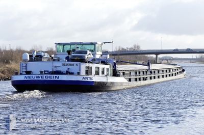
ANTIO
Cargo
Current Trip
| Time Travelled | 3 days |
|---|---|
| Remaining Time | --- |
| Distance Travelled | 128.83 nm |
| Remaining Distance | --- |
| AVG Speed | 6.9 Noeuds |
| MAX Speed | 8.1 Noeuds |
| AVG Wind | 8.5 knots |
| MAX Wind | 12 knots |
| MIN Temp | 3.5°C / 38.3°F |
| MAX Temp | 7.6°C / 45.68°F |
| Tirant d eau | 2.1 m |
| Position reçue | 9 m depuis |
Current Position
| Longitude | 7.72663° |
|---|---|
| Latitude | 52.35674° |
| Etat | Moored |
| Vitesse | |
| Parcours | --- |
| Zone | North Sea |
| Station | T-AIS |
| Position reçue | 9 m depuis |
Info
Information
The current position of ANTIO is in North Sea with coordinates 52.35674° / 7.72663° as reported on 2025-03-01 17:25 by AIS to our vessel tracker app. The vessel's current speed is 0 Noeuds
The vessel ANTIO (MMSI: 244670353) is a Cargo It's sailing under the flag of [NL] Netherlands.
In this page you can find informations about the vessels current position, last detected port calls, and current voyage information. If the vessels is not in coverage by AIS you will find the latest position.
The current position of ANTIO is detected by our AIS receivers and we are not responsible for the reliability of the data. The last position was recorded while the vessel was in Coverage by the Ais receivers of our vessel tracking app.
The current draught of ANTIO as reported by AIS is 2.1 meters
Weather
| Temperature | 6°C / 42.8°F |
|---|---|
| Wind Speed | 4 knots |
| Direction | 21° NNE |
| Pressure | 1033.6 hPa |
| Humidity | 66.9 % |
| Cloud Coverage | 92 % |
Featured Company
Last Port Calls
| Port | Arrival | Departure | Time In Port |
|---|---|---|---|
| 2025-02-26 16:41 | 2025-02-26 17:21 | 39 m | |
| 2025-02-26 15:16 | 2025-02-26 15:17 | 1 m | |
| 2025-02-24 20:59 | 2025-02-26 12:41 | 1 d | |
| 2025-02-20 14:38 | 2025-02-24 20:22 | 4 d | |
| 2025-02-18 14:36 | 2025-02-19 18:27 | 1 d | |
| 2025-02-07 08:48 | 2025-02-07 08:59 | 11 m | |
| 2025-02-04 15:29 | 2025-02-04 16:01 | 31 m | |
| 2025-02-03 11:26 | 2025-02-04 11:28 | 1 d | |
| 2025-02-02 19:25 | 2025-02-03 11:04 | 15 h | |
| 2025-01-31 15:13 | 2025-02-02 15:46 | 2 d |
Most Visited Ports (Last year)
| Port | Arrivals | |
|---|---|---|
| 20 | ||
| 16 | ||
| 13 | ||
| 9 | ||
| 5 | ||
| 5 |
Last Trips
| Origin | Departure | Destination | Arrival | Distance | |
|---|---|---|---|---|---|
| 2025-02-26 16:17 | 2025-02-26 17:41 | 9.79 nm | |||
| 2025-02-26 13:41 | 2025-02-26 16:16 | 20.74 nm | |||
| 2025-02-24 21:22 | 2025-02-24 21:59 | 4.18 nm | |||
| 2025-02-19 19:27 | 2025-02-20 15:38 | 46.56 nm | |||
| 2025-02-07 09:59 | 2025-02-18 15:36 | 409.29 nm | |||
| 2025-02-04 17:01 | 2025-02-07 09:48 | 302.29 nm | |||
| 2025-02-04 12:28 | 2025-02-04 16:29 | 31.13 nm | |||
| 2025-02-03 12:04 | 2025-02-03 12:26 | 2.01 nm | |||
| 2025-02-02 16:46 | 2025-02-02 20:25 | 29.93 nm | |||
| 2025-01-31 15:08 | 2025-01-31 16:13 | 6.95 nm |
Events
| Heure | Evenement | Détails | Position/ Destination | Info |
|---|---|---|---|---|
| 2025-03-01 17:04 | Etat Changé | Moored Under way using engine |
52.35680 / 7.72663
BULSTRINGEN
|
Vitesse: Parcours: 511° |
| 2025-03-01 16:35 | Changement de destination | BULSTRINGEN AMSTERDAM |
52.35678 / 7.72671
BULSTRINGEN
|
Vitesse: Parcours: 511° |
| 2025-03-01 16:35 | Changement d'ETA | 2025/03/04 17:49 2025/02/20 17:49 |
52.35678 / 7.72671
BULSTRINGEN
|
Vitesse: Parcours: 511° |
| 2025-03-01 16:32 | Dans la zone couverte |
52.35678 / 7.72671
North Sea
|
Vitesse: Parcours: 511° |
|
| 2025-03-01 09:06 | Hors de la zone couverte |
51.89318 / 7.66017
North Sea
|
Vitesse: 5.6 kn Parcours: 30.6° |
|
| 2025-03-01 06:36 | Démarrage | 2.53 nm, North of OLFEN |
51.76883 / 7.41852
AMSTERDAM
|
Vitesse: 4 kn Parcours: 332.9° |
| 2025-03-01 06:34 | Etat Changé | Under way using engine Moored |
51.76734 / 7.41986
AMSTERDAM
|
Vitesse: 0.3 kn Parcours: 511° |
| 2025-03-01 06:34 | Dans la zone couverte |
51.76734 / 7.41986
North Sea
|
Vitesse: 1.3 kn Parcours: 325.2° |
|
| 2025-02-28 21:37 | Hors de la zone couverte |
51.76723 / 7.42010
North Sea
|
Vitesse: Parcours: 511° |
|
| 2025-02-28 21:16 | Dans la zone couverte |
51.76723 / 7.42008
North Sea
|
Vitesse: Parcours: 511° |