
APHRODITE I
General Cargo
Current Trip
| Time Travelled | 19 days |
|---|---|
| Remaining Time | 3 h, 36 mins |
| Distance Travelled | 2018.28 nm |
| Remaining Distance | 59.78 nm |
| AVG Speed | 6.6 Noeuds |
| MAX Speed | 11.7 Noeuds |
| AVG Wind | 13.1 knots |
| MAX Wind | 31 knots |
| MIN Temp | -2.3°C / 27.86°F |
| MAX Temp | 14°C / 57.2°F |
| Tirant d eau | 7.4 m |
| Position reçue | 32 m depuis |
Current Position
| Longitude | 26.23569° |
|---|---|
| Latitude | 38.90837° |
| Etat | Under way using engine |
| Vitesse | 8.9 Noeuds |
| Parcours | 120.8° |
| Zone | Aegean Sea |
| Station | T-AIS |
| Position reçue | 32 m depuis |
Info
Information
The current position of APHRODITE I is in Aegean Sea with coordinates 38.90837° / 26.23569° as reported on 2025-02-25 06:45 by AIS to our vessel tracker app. The vessel's current speed is 8.9 Noeuds and is heading at the port of ALIAGA. The estimated time of arrival as calculated by MyShipTracking vessel tracking app is 2025-02-25 13:53 LT
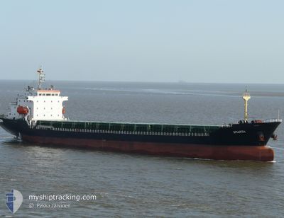
The vessel APHRODITE I (IMO: 9372468, MMSI: 636012774) is a General Cargo that was built in 2005 ( 20 Age ). It's sailing under the flag of [LR] Liberia.
In this page you can find informations about the vessels current position, last detected port calls, and current voyage information. If the vessels is not in coverage by AIS you will find the latest position.
The current position of APHRODITE I is detected by our AIS receivers and we are not responsible for the reliability of the data. The last position was recorded while the vessel was in Coverage by the Ais receivers of our vessel tracking app.
The current draught of APHRODITE I as reported by AIS is 7.4 meters
Weather
| Temperature | 5.9°C / 42.62°F |
|---|---|
| Wind Speed | 5 knots |
| Direction | 139° SE |
| Pressure | 1026.6 hPa |
| Humidity | 76.1 % |
| Cloud Coverage | 100 % |
Featured Company
Last Trips
| Origin | Departure | Destination | Arrival | Distance | |
|---|---|---|---|---|---|
| 2025-01-20 04:58 | 2025-01-27 07:02 | 1189.51 nm | |||
| 2025-01-06 07:57 | 2025-01-20 03:24 | 465.78 nm | |||
| 2024-12-15 13:54 | 2024-12-22 10:43 | 991.39 nm | |||
| 2024-12-08 20:18 | 2024-12-09 18:12 | 133.38 nm | |||
| 2024-11-30 16:00 | 2024-12-06 21:49 | 9.36 nm |
Events
| Heure | Evenement | Détails | Position/ Destination | Info |
|---|---|---|---|---|
| 2025-02-25 06:49 | Etat Changé | Default Under way using engine |
38.90245 / 26.24703
TRALI
|
Vitesse: 8.9 kn Parcours: 120.8° |
| 2025-02-25 06:28 | Etat Changé | Under way using engine Default |
38.93198 / 26.18990
TRALI
|
Vitesse: 8.9 kn Parcours: 127° |
| 2025-02-25 06:28 | Dans la zone couverte |
38.93172 / 26.19038
Aegean Sea
|
Vitesse: 9 kn Parcours: 125.8° |
|
| 2025-02-25 04:07 | Etat Changé | Default Under way using engine |
39.12746 / 25.82329
TRALI
|
Vitesse: 8.8 kn Parcours: 124.8° |
| 2025-02-25 04:06 | Hors de la zone couverte |
39.12910 / 25.82028
Aegean Sea
|
Vitesse: 8.8 kn Parcours: 124.8° |
|
| 2025-02-25 03:51 | Etat Changé | Under way using engine Default |
39.14932 / 25.78342
TRALI
|
Vitesse: 8.2 kn Parcours: 121° |
| 2025-02-25 03:26 | Etat Changé | Default Under way using engine |
39.19764 / 25.75664
TRALI
|
Vitesse: 8.9 kn Parcours: 181.9° |
| 2025-02-24 23:28 | Changement de zone | Greek part of the Aegean Sea Turkish part of the Sea of Marmara |
39.77945 / 25.81070
Aegean Sea
|
Vitesse: 8.7 kn Parcours: 185.3° |
| 2025-02-24 23:28 | Etat Changé | Under way using engine Default |
39.77945 / 25.81070
TRALI
|
Vitesse: 8.7 kn Parcours: 180° |
| 2025-02-24 23:28 | Dans la zone couverte |
39.77945 / 25.81070
Aegean Sea
|
Vitesse: 8.7 kn Parcours: 185.3° |