
APL GWANGYANG
Container Ship
Current Trip
| Time Travelled | 24 days |
|---|---|
| Remaining Time | 8 h, 48 mins |
| Distance Travelled | 9775.44 nm |
| Remaining Distance | 205.76 nm |
| AVG Speed | 16.5 Noeuds |
| MAX Speed | 19.1 Noeuds |
| AVG Wind | 13.2 knots |
| MAX Wind | 29 knots |
| MIN Temp | 11°C / 51.8°F |
| MAX Temp | 28.7°C / 83.66°F |
| Tirant d eau | 15.9 m |
| Position reçue | 3 h, 20 m depuis |
Current Position
| Longitude | 56.97759° |
|---|---|
| Latitude | 25.86957° |
| Etat | Under way using engine |
| Vitesse | 16.5 Noeuds |
| Parcours | 333° |
| Zone | Gulf of Oman |
| Station | T-AIS |
| Position reçue | 3 h, 20 m depuis |
Info
Information
The current position of APL GWANGYANG is in Gulf of Oman with coordinates 25.86957° / 56.97759° as reported on 2025-02-07 12:14 by AIS to our vessel tracker app. The vessel's current speed is 16.5 Noeuds and is heading at the port of KHALIFA. The estimated time of arrival as calculated by MyShipTracking vessel tracking app is 2025-02-08 00:22 LT
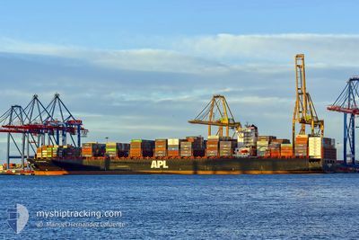
The vessel APL GWANGYANG (IMO: 9461879, MMSI: 566319000) is a Container Ship that was built in 2011 ( 14 Age ). It's sailing under the flag of [SG] Singapore.
In this page you can find informations about the vessels current position, last detected port calls, and current voyage information. If the vessels is not in coverage by AIS you will find the latest position.
The current position of APL GWANGYANG is detected by our AIS receivers and we are not responsible for the reliability of the data. The last position was recorded while the vessel was in Coverage by the Ais receivers of our vessel tracking app.
The current draught of APL GWANGYANG as reported by AIS is 15.9 meters
Weather
| Temperature | 22.1°C / 71.78°F |
|---|---|
| Wind Speed | 17 knots |
| Direction | 165° SSE |
| Pressure | 1014.4 hPa |
| Humidity | 74 % |
| Cloud Coverage | 100 % |
Featured Company
Last Port Calls
| Port | Arrival | Departure | Time In Port |
|---|---|---|---|
| 2025-01-13 02:53 | 2025-01-14 05:00 | 1 d | |
| 2025-01-05 11:14 | 2025-01-07 05:26 | 1 d | |
| 2024-12-29 21:58 | 2025-01-03 01:17 | 4 d | |
| 2024-12-28 11:54 | 2024-12-29 12:51 | 1 d | |
| 2024-12-22 00:20 | 2024-12-27 06:12 | 5 d | |
| 2024-12-17 03:40 | 2024-12-18 06:35 | 1 d | |
| 2024-12-15 08:41 | 2024-12-16 10:39 | 1 d | |
| 2024-12-11 04:17 | 2024-12-12 03:01 | 22 h |
Most Visited Ports (Last year)
| Port | Arrivals | |
|---|---|---|
| 4 | ||
| 4 | ||
| 4 | ||
| 4 | ||
| 4 | ||
| 4 |
Last Trips
| Origin | Departure | Destination | Arrival | Distance | |
|---|---|---|---|---|---|
| 2025-01-07 06:26 | 2025-01-13 03:53 | 1283.91 nm | |||
| 2025-01-03 02:17 | 2025-01-05 12:14 | 268.22 nm | |||
| 2024-12-29 13:51 | 2024-12-29 22:58 | 129.33 nm | |||
| 2024-12-27 07:12 | 2024-12-28 12:54 | 355.43 nm | |||
| 2024-12-18 07:35 | 2024-12-22 01:20 | 531.91 nm | |||
| 2024-12-16 10:39 | 2024-12-17 04:40 | 260.99 nm | |||
| 2024-12-12 04:01 | 2024-12-15 08:41 | 1210.14 nm | |||
| 2024-11-18 17:18 | 2024-12-11 05:17 | 9746.43 nm |
Events
| Heure | Evenement | Détails | Position/ Destination | Info |
|---|---|---|---|---|
| 2025-02-07 12:17 | Etat Changé | Default Under way using engine |
25.87931 / 56.97175
AEKHL
|
Vitesse: 16.5 kn Parcours: 333° |
| 2025-02-07 12:14 | Hors de la zone couverte |
25.86957 / 56.97759
Gulf of Oman
AEKHL
|
Vitesse: 16.5 kn Parcours: 333° |
|
| 2025-02-07 10:26 | Changement de zone | Iranian part of the Gulf of Oman South African part of the Indian Ocean |
25.41413 / 57.20752
Gulf of Oman
AEKHL
|
Vitesse: 16.8 kn Parcours: 308.5° |
| 2025-02-07 10:26 | Etat Changé | Under way using engine Default |
25.41330 / 57.20866
AEKHL
|
Vitesse: 16.9 kn Parcours: 311° |
| 2025-02-07 10:26 | Dans la zone couverte |
25.41413 / 57.20752
Gulf of Oman
AEKHL
|
Vitesse: 16.8 kn Parcours: 308.5° |
|
| 2025-01-28 21:12 | Etat Changé | Default Under way using engine |
-29.52757 / 31.63207
AEKHL
|
Vitesse: 17.5 kn Parcours: 38.1° |
| 2025-01-28 21:06 | Hors de la zone couverte |
-29.55036 / 31.61140
Indian Ocean
AEKHL
|
Vitesse: 17.5 kn Parcours: 38.1° |
|
| 2025-01-28 17:34 | Tirant d'eau modifié | 15.9 15 |
-30.37150 / 30.89243
AEKHL
|
Vitesse: 16.8 kn Parcours: 35.7° |
| 2025-01-28 17:34 | Changement d'ETA | 2025/02/08 06:00 |
-30.37150 / 30.89243
AEKHL
|
Vitesse: 16.8 kn Parcours: 35.7° |
| 2025-01-28 17:22 | Etat Changé | Under way using engine Default |
-30.41678 / 30.85509
AEKHL
|
Vitesse: 16.5 kn Parcours: 35° |