

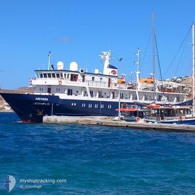
ARETHUSA
Passengers Ship

Current Trip
| Time Travelled | 2 h, 6 mins |
|---|---|
| Remaining Time | --- |
| Distance Travelled | 1.93 nm |
| Remaining Distance | --- |
| AVG Speed | 3.7 Noeuds |
| MAX Speed | 4.3 Noeuds |
| AVG Wind | 13 knots |
| MAX Wind | 13 knots |
| MIN Temp | 20.9°C / 69.62°F |
| MAX Temp | 21.2°C / 70.16°F |
| Tirant d eau | 3 m |
| Position reçue | 2 m depuis |
Current Position
| Longitude | 25.41131° |
|---|---|
| Latitude | 36.37340° |
| Etat | Under way using engine |
| Vitesse | 0.6 Noeuds |
| Parcours | 57° |
| Zone | Aegean Sea |
| Station | T-AIS |
| Position reçue | 2 m depuis |
Information
The current position of ARETHUSA is in Aegean Sea with coordinates 36.37340° / 25.41131° as reported on 2025-06-02 12:32 by AIS to our vessel tracker app. The vessel's current speed is 0.6 Noeuds
The vessel ARETHUSA (IMO: 9398022, MMSI: 249069000) is a Passengers Ship that was built in 2008 ( 17 Age ). It's sailing under the flag of [MT] Malta.
In this page you can find informations about the vessels current position, last detected port calls, and current voyage information. If the vessels is not in coverage by AIS you will find the latest position.
The current position of ARETHUSA is detected by our AIS receivers and we are not responsible for the reliability of the data. The last position was recorded while the vessel was in Coverage by the Ais receivers of our vessel tracking app.
The current draught of ARETHUSA as reported by AIS is 3 meters
Weather
| Temperature | 21.2°C / 70.16°F |
|---|---|
| Wind Speed | 13 knots |
| Direction | 300° WNW |
| Pressure | 1020.3 hPa |
| Humidity | 73.1 % |
| Cloud Coverage | --- |


Featured Company
Last Port Calls
| Port | Arrival | Departure | Time In Port |
|---|---|---|---|
| 2025-06-02 13:26 | 2025-06-02 13:28 | 2 m | |
| 2025-06-02 06:00 | 2025-06-02 08:20 | 2 h | |
| 2025-05-31 19:34 | 2025-06-01 23:46 | 1 d | |
| 2025-05-31 06:55 | 2025-05-31 12:27 | 5 h | |
| 2025-05-28 20:19 | 2025-05-30 21:42 | 2 d | |
| 2025-05-28 07:25 | 2025-05-28 13:14 | 5 h | |
| 2025-05-26 18:11 | 2025-05-27 15:40 | 21 h | |
| 2025-05-25 07:36 | 2025-05-26 15:56 | 1 d | |
| 2025-05-24 09:23 | 2025-05-24 14:59 | 5 h | |
| 2025-05-22 19:30 | 2025-05-24 05:10 | 1 d |
Last Trips
| Origin | Departure | Destination | Arrival | Distance | |
|---|---|---|---|---|---|
| 2025-06-02 08:20 | 2025-06-02 13:26 | 6.60 nm | |||
| 2025-06-01 23:46 | 2025-06-02 06:00 | 55.35 nm | |||
| 2025-05-31 12:27 | 2025-05-31 19:34 | 46.03 nm | |||
| 2025-05-30 21:42 | 2025-05-31 06:55 | 85.01 nm | |||
| 2025-05-28 13:14 | 2025-05-28 20:19 | 74.87 nm | |||
| 2025-05-27 15:40 | 2025-05-28 07:25 | 174.66 nm | |||
| 2025-05-26 15:56 | 2025-05-26 18:11 | 14.96 nm | |||
| 2025-05-24 14:59 | 2025-05-25 07:36 | 184.61 nm | |||
| 2025-05-24 05:10 | 2025-05-24 09:23 | 41.37 nm | |||
| 2025-05-21 23:05 | 2025-05-22 19:30 | 107.85 nm |
Events
| Heure | Evenement | Détails | Position/ Destination | Info |
|---|---|---|---|---|
| 2025-06-02 12:29 | Arret | 1.52 nm, South of SANTORINI |
36.37392 / 25.41117
GRKMI
|
Vitesse: Parcours: 64° |
| 2025-06-02 12:04 | Changement de destination | GRKMI GRJTR |
36.37897 / 25.40917
GRKMI
|
Vitesse: 0.8 kn Parcours: 60° |
| 2025-06-02 12:04 | Changement d'ETA | 2025/06/03 04:00 2025/06/02 04:00 |
36.37897 / 25.40917
GRKMI
|
Vitesse: 0.8 kn Parcours: 60° |
| 2025-06-02 11:37 | Démarrage | 1.37 nm, South West of SANTORINI |
36.37726 / 25.40927
GRJTR
|
Vitesse: 3.1 kn Parcours: 319° |
| 2025-06-02 10:50 | Arret | 1.28 nm, South West of SANTORINI |
36.38403 / 25.40152
GRJTR
|
Vitesse: Parcours: 236° |
| 2025-06-02 10:28 | PORT DE DEPART |
|
36.38851 / 25.40379
GRJTR
|
Vitesse: 2.2 kn Parcours: 263° |
| 2025-06-02 10:26 | Port d'arrivée |
|
36.38811 / 25.40623
[GR] SANTORINI
|
Vitesse: 4.1 kn Parcours: 334° |
| 2025-06-02 10:10 | Démarrage | 1.69 nm, South of SANTORINI |
36.37100 / 25.41095
GRJTR
|
Vitesse: 3.1 kn Parcours: 346° |
| 2025-06-02 09:22 | Arret | 1.36 nm, South West of SANTORINI |
36.37910 / 25.40591
GRJTR
|
Vitesse: Parcours: 232° |
| 2025-06-02 05:20 | PORT DE DEPART |
|
36.38797 / 25.40417
GRJTR
|
Vitesse: 6.8 kn Parcours: 252° |