
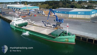
ARKLOW CLIPPER
Cargo
Current Trip
IELMK
| Time Travelled | 27 mins |
|---|---|
| Remaining Time | --- |
| Distance Travelled | --- |
| Remaining Distance | --- |
| AVG Speed | --- |
| MAX Speed | --- |
| AVG Wind | --- |
| MAX Wind | --- |
| MIN Temp | --- |
| MAX Temp | --- |
| Tirant d eau | 4 m |
| Position reçue | 2 d depuis |
Current Position
| Longitude | -9.73480° |
|---|---|
| Latitude | 52.54951° |
| Etat | Under way using engine |
| Vitesse | 8.6 Noeuds |
| Parcours | 52.6° |
| Zone | North Atlantic Ocean |
| Station | T-AIS |
| Position reçue | 2 d depuis |
Info
Information
The current position of ARKLOW CLIPPER is in North Atlantic Ocean with coordinates 52.54951° / -9.73480° as reported on 2025-02-10 12:13 by AIS to our vessel tracker app. The vessel's current speed is 8.6 Noeuds
The vessel ARKLOW CLIPPER (IMO: 9757137, MMSI: 250006456) is a Cargo It's sailing under the flag of [IE] Ireland.
In this page you can find informations about the vessels current position, last detected port calls, and current voyage information. If the vessels is not in coverage by AIS you will find the latest position.
The current position of ARKLOW CLIPPER is detected by our AIS receivers and we are not responsible for the reliability of the data. The last position was recorded while the vessel was in Coverage by the Ais receivers of our vessel tracking app.
The current draught of ARKLOW CLIPPER as reported by AIS is 4 meters
Weather
| Temperature | 4.5°C / 40.1°F |
|---|---|
| Wind Speed | 11 knots |
| Direction | 114° ESE |
| Pressure | 1019.1 hPa |
| Humidity | 91.6 % |
| Cloud Coverage | 100 % |
Featured Company
Last Port Calls
| Port | Arrival | Departure | Time In Port |
|---|---|---|---|
| 2025-02-10 16:06 | 2025-02-13 06:14 | 2 d | |
| 2025-02-08 02:59 | 2025-02-09 02:15 | 23 h | |
| 2025-02-04 09:35 | 2025-02-06 17:55 | 2 d | |
| 2025-01-22 14:48 | 2025-02-01 12:13 | 9 d | |
| 2025-01-20 18:33 | 2025-01-22 14:16 | 1 d | |
| 2025-01-11 10:23 | 2025-01-13 18:19 | 2 d | |
| 2025-01-06 12:21 | 2025-01-08 17:23 | 2 d | |
| 2025-01-03 21:51 | 2025-01-04 04:55 | 7 h | |
| 2024-12-24 01:39 | 2024-12-28 19:25 | 4 d | |
| 2024-12-19 18:07 | 2024-12-24 01:33 | 4 d |
Last Trips
| Origin | Departure | Destination | Arrival | Distance | |
|---|---|---|---|---|---|
| 2025-02-09 02:15 | 2025-02-10 16:06 | 415.86 nm | |||
| 2025-02-06 17:55 | 2025-02-08 02:59 | 304.62 nm | |||
| 2025-02-01 13:13 | 2025-02-04 09:35 | 706.28 nm | |||
| 2025-01-22 15:16 | 2025-01-22 15:48 | 2.22 nm | |||
| 2025-01-13 19:19 | 2025-01-20 19:33 | 1775.32 nm | |||
| 2025-01-08 18:23 | 2025-01-11 11:23 | 50.80 nm | |||
| 2025-01-04 05:55 | 2025-01-06 13:21 | 428.26 nm | |||
| 2024-12-28 20:25 | 2025-01-03 22:51 | 1412.79 nm | |||
| 2024-12-24 02:33 | 2024-12-24 02:39 | 0.55 nm | |||
| 2024-12-19 02:54 | 2024-12-19 19:07 | 123.67 nm |
Events
| Heure | Evenement | Détails | Position/ Destination | Info |
|---|---|---|---|---|
| 2025-02-13 06:27 | Démarrage | 1.96 nm, West of LIMERICK |
52.65548 / -8.68538
IELMK
|
Vitesse: 7.8 kn Parcours: 234° |
| 2025-02-13 06:14 | PORT DE DEPART |
|
52.65548 / -8.68538
IELMK
|
Vitesse: 0.7 kn Parcours: 245° |
| 2025-02-10 16:50 | Arret |
52.65801 / -8.64313
[IE] LIMERICK
|
Vitesse: 0.1 kn Parcours: 242° |
|
| 2025-02-10 16:06 | Port d'arrivée |
|
52.65674 / -8.66118
[IE] LIMERICK
|
Vitesse: 8.9 kn Parcours: 103° |
| 2025-02-10 12:16 | Etat Changé | Default Under way using engine |
52.55379 / -9.72543
IELMK
|
Vitesse: 8.6 kn Parcours: 52.6° |
| 2025-02-10 12:13 | Hors de la zone couverte |
52.54951 / -9.73480
North Atlantic Ocean
IELMK
|
Vitesse: 8.6 kn Parcours: 52.6° |
|
| 2025-02-10 12:12 | Etat Changé | Under way using engine Default |
52.54832 / -9.73741
IELMK
|
Vitesse: 8.4 kn Parcours: 54° |
| 2025-02-10 12:12 | Dans la zone couverte |
52.54951 / -9.73480
North Atlantic Ocean
IELMK
|
Vitesse: 8.6 kn Parcours: 52.6° |
|
| 2025-02-10 03:37 | Etat Changé | Default Under way using engine |
51.59428 / -10.39769
IELMK
|
Vitesse: 9.5 kn Parcours: 317.6° |
| 2025-02-10 03:34 | Hors de la zone couverte |
51.58920 / -10.39016
North Atlantic Ocean
IELMK
|
Vitesse: 9.5 kn Parcours: 317.6° |