
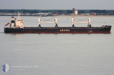
ARUNA ISMAIL
Bulk Carrier
Current Trip
| Time Travelled | 8 days |
|---|---|
| Remaining Time | 3 days |
| Distance Travelled | 2243.70 nm |
| Remaining Distance | 979.07 nm |
| AVG Speed | 10.7 Noeuds |
| MAX Speed | 13.4 Noeuds |
| AVG Wind | 9.8 knots |
| MAX Wind | 22.2 knots |
| MIN Temp | 9.8°C / 49.64°F |
| MAX Temp | 26.9°C / 80.42°F |
| Tirant d eau | 10 m |
| Position reçue | 4 d depuis |
Current Position
| Longitude | -13.68148° |
|---|---|
| Latitude | 28.07529° |
| Etat | Under way using engine |
| Vitesse | 12.1 Noeuds |
| Parcours | 215.4° |
| Zone | North Atlantic Ocean |
| Station | T-AIS |
| Position reçue | 4 d depuis |
Info
Information
The current position of ARUNA ISMAIL is in North Atlantic Ocean with coordinates 28.07529° / -13.68148° as reported on 2025-02-03 05:45 by AIS to our vessel tracker app. The vessel's current speed is 12.1 Noeuds and is heading at the port of TEMA. The estimated time of arrival as calculated by MyShipTracking vessel tracking app is 2025-02-11 03:08 LT
The vessel ARUNA ISMAIL (IMO: 9637296, MMSI: 538004999) is a Bulk Carrier that was built in 2013 ( 12 Age ). It's sailing under the flag of [MH] Marshall Is.
In this page you can find informations about the vessels current position, last detected port calls, and current voyage information. If the vessels is not in coverage by AIS you will find the latest position.
The current position of ARUNA ISMAIL is detected by our AIS receivers and we are not responsible for the reliability of the data. The last position was recorded while the vessel was in Coverage by the Ais receivers of our vessel tracking app.
The current draught of ARUNA ISMAIL as reported by AIS is 10 meters
Weather
| Temperature | 26.5°C / 79.7°F |
|---|---|
| Wind Speed | 9 knots |
| Direction | 239° WSW |
| Pressure | 1009.7 hPa |
| Humidity | 74.2 % |
| Cloud Coverage | 58 % |
Featured Company
Last Port Calls
| Port | Arrival | Departure | Time In Port |
|---|---|---|---|
| 2025-01-16 11:06 | 2025-01-30 17:24 | 14 d | |
| 2025-01-01 16:06 | 2025-01-05 15:36 | 3 d |
Last Trips
| Origin | Departure | Destination | Arrival | Distance | |
|---|---|---|---|---|---|
| 2025-01-05 15:36 | 2025-01-16 11:06 | 535.39 nm | |||
| 2024-11-28 03:32 | 2025-01-01 16:06 | 2377.95 nm |
Events
| Heure | Evenement | Détails | Position/ Destination | Info |
|---|---|---|---|---|
| 2025-02-03 05:57 | Etat Changé | Default Under way using engine |
28.04492 / -13.70599
GHTEM
|
Vitesse: 12.1 kn Parcours: 215.4° |
| 2025-02-03 05:45 | Hors de la zone couverte |
28.07529 / -13.68148
North Atlantic Ocean
GHTEM
|
Vitesse: 12.1 kn Parcours: 215.4° |
|
| 2025-02-03 05:22 | Etat Changé | Under way using engine Default |
28.13916 / -13.62738
GHTEM
|
Vitesse: 12 kn Parcours: 217° |
| 2025-02-03 05:13 | Dans la zone couverte |
28.13916 / -13.62738
North Atlantic Ocean
GHTEM
|
Vitesse: 12 kn Parcours: 217.4° |
|
| 2025-02-03 04:17 | Etat Changé | Default Under way using engine |
28.31209 / -13.48028
GHTEM
|
Vitesse: 11.9 kn Parcours: 216.2° |
| 2025-02-03 04:09 | Hors de la zone couverte |
28.33215 / -13.46378
North Atlantic Ocean
GHTEM
|
Vitesse: 11.9 kn Parcours: 216.2° |
|
| 2025-02-03 04:04 | Changement de zone | Spanish (Canary Islands) part of the North Atlantic Ocean Moroccan part of the Strait of Gibraltar |
28.34609 / -13.45264
North Atlantic Ocean
GHTEM
|
Vitesse: 11.8 kn Parcours: 211.5° |
| 2025-02-03 04:02 | Etat Changé | Under way using engine Default |
28.35075 / -13.44929
GHTEM
|
Vitesse: 11.7 kn Parcours: 214° |
| 2025-02-03 04:02 | Dans la zone couverte |
28.34609 / -13.45264
North Atlantic Ocean
GHTEM
|
Vitesse: 11.8 kn Parcours: 211.5° |
|
| 2025-02-01 03:03 | Hors de la zone couverte |
35.93764 / -5.80015
Strait of Gibraltar
GHTEM
|
Vitesse: 12.3 kn Parcours: 255.8° |