
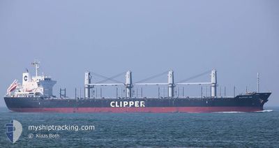
ATROMITOS L
Bulk Carrier
Current Trip
| Time Travelled | 4 days |
|---|---|
| Remaining Time | --- |
| Distance Travelled | 1183.71 nm |
| Remaining Distance | --- |
| AVG Speed | 10.6 Noeuds |
| MAX Speed | 13.4 Noeuds |
| AVG Wind | 18.8 knots |
| MAX Wind | 27.1 knots |
| MIN Temp | 0.3°C / 32.54°F |
| MAX Temp | 5.7°C / 42.26°F |
| Tirant d eau | 9.7 m |
| Position reçue | 2 m depuis |
Current Position
| Longitude | 1.29426° |
|---|---|
| Latitude | 50.97041° |
| Etat | Under way using engine |
| Vitesse | 13.4 Noeuds |
| Parcours | 225.9° |
| Zone | English Channel |
| Station | T-AIS |
| Position reçue | 2 m depuis |
Info
Information
The current position of ATROMITOS L is in English Channel with coordinates 50.97041° / 1.29426° as reported on 2025-02-13 05:36 by AIS to our vessel tracker app. The vessel's current speed is 13.4 Noeuds and is heading at the port of COTONOU. The estimated time of arrival as calculated by MyShipTracking vessel tracking app is 2025-02-28 12:00 LT
The vessel ATROMITOS L (IMO: 9605073, MMSI: 538007387) is a Bulk Carrier that was built in 2012 ( 13 Age ). It's sailing under the flag of [MH] Marshall Is.
In this page you can find informations about the vessels current position, last detected port calls, and current voyage information. If the vessels is not in coverage by AIS you will find the latest position.
The current position of ATROMITOS L is detected by our AIS receivers and we are not responsible for the reliability of the data. The last position was recorded while the vessel was in Coverage by the Ais receivers of our vessel tracking app.
The current draught of ATROMITOS L as reported by AIS is 9.7 meters
Weather
| Temperature | 4.9°C / 40.82°F |
|---|---|
| Wind Speed | 13 knots |
| Direction | 3° N |
| Pressure | 1020.7 hPa |
| Humidity | 80 % |
| Cloud Coverage | 90 % |
Featured Company
Events
| Heure | Evenement | Détails | Position/ Destination | Info |
|---|---|---|---|---|
| 2025-02-13 04:55 | Changement de zone | United Kingdom part of the English Channel United Kingdom part of the North Sea |
51.07118 / 1.46688
English Channel
BJ COO
|
Vitesse: 12.5 kn Parcours: 229.4° |
| 2025-02-13 01:12 | Tirant d'eau modifié | 9.7 9.9 |
51.56576 / 2.12780
BJ COO
|
Vitesse: 10.3 kn Parcours: 219.6° |
| 2025-02-12 23:13 | Detecté en mer | United Kingdom part of the North Sea |
51.85075 / 2.51931
North Sea
BJ COO
|
Vitesse: 12.6 kn Parcours: 219.7° |
| 2025-02-12 23:08 | Changement de zone | Belgian part of the North Sea Dutch part of the North Sea |
51.86434 / 2.53749
North Sea
BJ COO
|
Vitesse: 12.6 kn Parcours: 219.1° |
| 2025-02-12 22:20 | Etat Changé | Under way using engine Default |
52.00262 / 2.70219
BJ COO
|
Vitesse: 13.2 kn Parcours: 220° |
| 2025-02-12 22:11 | Dans la zone couverte |
52.00262 / 2.70219
North Sea
BJ COO
|
Vitesse: 12.5 kn Parcours: 232.9° |
|
| 2025-02-12 15:04 | Etat Changé | Default Under way using engine |
53.10317 / 4.26030
BJ COO
|
Vitesse: 11 kn Parcours: 233.2° |
| 2025-02-12 14:56 | Etat Changé | Under way using engine Default |
53.11676 / 4.28894
BJ COO
|
Vitesse: 11.1 kn Parcours: 232° |
| 2025-02-12 14:56 | Hors de la zone couverte |
53.11676 / 4.28894
North Sea
BJ COO
|
Vitesse: 11 kn Parcours: 233.2° |
|
| 2025-02-12 14:45 | Etat Changé | Default Under way using engine |
53.13774 / 4.33348
BJ COO
|
Vitesse: 11.2 kn Parcours: 231.9° |