
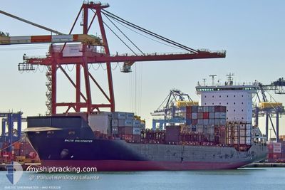
BALTIC SHEARWATER
Container Ship
Current Trip
| Time Travelled | 1 day |
|---|---|
| Remaining Time | 6 h, 3 mins |
| Distance Travelled | 346.66 nm |
| Remaining Distance | 54.01 nm |
| AVG Speed | 12 Noeuds |
| MAX Speed | 14.3 Noeuds |
| AVG Wind | 7.6 knots |
| MAX Wind | 18.8 knots |
| MIN Temp | 14.6°C / 58.28°F |
| MAX Temp | 17.6°C / 63.68°F |
| Tirant d eau | 9.1 m |
| Position reçue | 7 m depuis |
Current Position
| Longitude | -4.36806° |
|---|---|
| Latitude | 36.19021° |
| Etat | Under way using engine |
| Vitesse | 8.8 Noeuds |
| Parcours | 264.3° |
| Zone | Alboran Sea |
| Station | T-AIS |
| Position reçue | 7 m depuis |
Info
Information
The current position of BALTIC SHEARWATER is in Alboran Sea with coordinates 36.19021° / -4.36806° as reported on 2025-02-13 18:07 by AIS to our vessel tracker app. The vessel's current speed is 8.8 Noeuds and is heading at the port of ALGECIRAS. The estimated time of arrival as calculated by MyShipTracking vessel tracking app is 2025-02-14 01:17 LT
The vessel BALTIC SHEARWATER (IMO: 9313228, MMSI: 212906000) is a Container Ship that was built in 2005 ( 20 Age ). It's sailing under the flag of [CY] Cyprus.
In this page you can find informations about the vessels current position, last detected port calls, and current voyage information. If the vessels is not in coverage by AIS you will find the latest position.
The current position of BALTIC SHEARWATER is detected by our AIS receivers and we are not responsible for the reliability of the data. The last position was recorded while the vessel was in Coverage by the Ais receivers of our vessel tracking app.
The current draught of BALTIC SHEARWATER as reported by AIS is 9.1 meters
Weather
| Temperature | 15.4°C / 59.72°F |
|---|---|
| Wind Speed | 4 knots |
| Direction | 245° WSW |
| Pressure | 1020.2 hPa |
| Humidity | 63.2 % |
| Cloud Coverage | 47 % |
Featured Company
Last Port Calls
| Port | Arrival | Departure | Time In Port |
|---|---|---|---|
| 2025-02-11 09:18 | 2025-02-12 15:03 | 1 d | |
| 2025-02-10 05:03 | 2025-02-10 22:27 | 17 h | |
| 2025-02-08 19:19 | 2025-02-09 19:35 | 1 d | |
| 2025-02-07 13:37 | 2025-02-08 08:26 | 18 h | |
| 2025-02-04 05:48 | 2025-02-05 10:48 | 1 d | |
| 2025-02-02 06:15 | 2025-02-02 22:56 | 16 h | |
| 2025-02-01 06:11 | 2025-02-01 20:47 | 14 h | |
| 2025-01-31 00:54 | 2025-01-31 16:44 | 15 h | |
| 2025-01-28 17:39 | 2025-01-29 23:19 | 1 d | |
| 2025-01-27 07:15 | 2025-01-28 06:42 | 23 h |
Last Trips
| Origin | Departure | Destination | Arrival | Distance | |
|---|---|---|---|---|---|
| 2025-02-10 22:27 | 2025-02-11 09:18 | 168.03 nm | |||
| 2025-02-09 19:35 | 2025-02-10 05:03 | 126.35 nm | |||
| 2025-02-08 08:26 | 2025-02-08 19:19 | 157.59 nm | |||
| 2025-02-05 10:48 | 2025-02-07 13:37 | 426.09 nm | |||
| 2025-02-02 22:56 | 2025-02-04 05:48 | 169.65 nm | |||
| 2025-02-01 20:47 | 2025-02-02 06:15 | 128.34 nm | |||
| 2025-01-31 16:44 | 2025-02-01 06:11 | 156.25 nm | |||
| 2025-01-29 23:19 | 2025-01-31 00:54 | 405.95 nm | |||
| 2025-01-28 06:42 | 2025-01-28 17:39 | 165.99 nm | |||
| 2025-01-26 14:35 | 2025-01-27 07:15 | 128.12 nm |
Events
| Heure | Evenement | Détails | Position/ Destination | Info |
|---|---|---|---|---|
| 2025-02-13 18:07 | Etat Changé | Default Under way using engine |
36.19000 / -4.37054
ESALG
|
Vitesse: 8.8 kn Parcours: 264.3° |
| 2025-02-13 11:50 | Etat Changé | Under way using engine Default |
36.29865 / -3.25774
ESALG
|
Vitesse: 10.3 kn Parcours: 263° |
| 2025-02-13 11:40 | Etat Changé | Default Under way using engine |
36.30212 / -3.22240
ESALG
|
Vitesse: 10.3 kn Parcours: 262.4° |
| 2025-02-13 09:20 | Changement d'ETA | 2025/02/14 00:00 2025/02/13 22:00 |
36.36804 / -2.62921
ESALG
|
Vitesse: 12.5 kn Parcours: 257° |
| 2025-02-13 08:54 | Changement de zone | Spanish part of the Alboran Sea Spanish part of the Mediterranean Sea - Western Basin |
36.38396 / -2.51515
Alboran Sea
ESALG
|
Vitesse: 13.2 kn Parcours: 261.8° |
| 2025-02-13 08:54 | Etat Changé | Under way using engine Default |
36.38396 / -2.51515
ESALG
|
Vitesse: 13.2 kn Parcours: 261° |
| 2025-02-13 08:50 | Dans la zone couverte |
36.38396 / -2.51515
Alboran Sea
ESALG
|
Vitesse: 13.2 kn Parcours: 261.8° |
|
| 2025-02-13 05:20 | Etat Changé | Default Under way using engine |
36.77383 / -1.69444
ESALG
|
Vitesse: 12.6 kn Parcours: 233.1° |
| 2025-02-13 05:15 | Etat Changé | Under way using engine Default |
36.78459 / -1.67806
ESALG
|
Vitesse: 12.8 kn Parcours: 232° |
| 2025-02-13 05:15 | Hors de la zone couverte |
36.78459 / -1.67806
Mediterranean Sea - Western Basin
ESALG
|
Vitesse: 12.6 kn Parcours: 233.1° |