
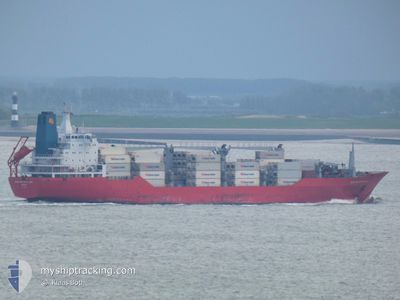
BARRINGTON ISLAND
Reefer
Current Trip
SRPBM
| Time Travelled | 5 days |
|---|---|
| Remaining Time | --- |
| Distance Travelled | 2145.32 nm |
| Remaining Distance | --- |
| AVG Speed | 16.2 Noeuds |
| MAX Speed | 18.7 Noeuds |
| AVG Wind | 13.9 knots |
| MAX Wind | 25.3 knots |
| MIN Temp | 20.7°C / 69.26°F |
| MAX Temp | 29.3°C / 84.74°F |
| Tirant d eau | 7.6 m |
| Position reçue | 3 d depuis |
Current Position
| Longitude | -79.59992° |
|---|---|
| Latitude | 9.00547° |
| Etat | Under way using engine |
| Vitesse | 4.7 Noeuds |
| Parcours | 322° |
| Zone | North Pacific Ocean |
| Station | T-AIS |
| Position reçue | 3 d depuis |
Info
Information
The current position of BARRINGTON ISLAND is in North Pacific Ocean with coordinates 9.00547° / -79.59992° as reported on 2025-02-05 02:25 by AIS to our vessel tracker app. The vessel's current speed is 4.7 Noeuds
The vessel BARRINGTON ISLAND (IMO: 9059614, MMSI: 308701000) is a Reefer that was built in 1993 ( 32 Age ). It's sailing under the flag of [BS] Bahamas.
In this page you can find informations about the vessels current position, last detected port calls, and current voyage information. If the vessels is not in coverage by AIS you will find the latest position.
The current position of BARRINGTON ISLAND is detected by our AIS receivers and we are not responsible for the reliability of the data. The last position was recorded while the vessel was in Coverage by the Ais receivers of our vessel tracking app.
The current draught of BARRINGTON ISLAND as reported by AIS is 7.6 meters
Weather
| Temperature | 24.3°C / 75.74°F |
|---|---|
| Wind Speed | 16 knots |
| Direction | 78° ENE |
| Pressure | 1019.9 hPa |
| Humidity | 76.3 % |
| Cloud Coverage | --- |
Featured Company
Last Port Calls
| Port | Arrival | Departure | Time In Port |
|---|---|---|---|
| 2025-02-02 02:49 | 2025-02-02 12:16 | 9 h | |
| 2025-01-29 00:18 | 2025-01-31 05:54 | 2 d | |
| 2025-01-21 16:10 | 2025-01-22 00:32 | 8 h | |
| 2025-01-19 04:43 | 2025-01-19 12:11 | 7 h | |
| 2025-01-16 20:51 | 2025-01-18 10:03 | 1 d | |
| 2025-01-14 16:19 | 2025-01-14 22:48 | 6 h | |
| 2025-01-14 00:56 | 2025-01-14 07:41 | 6 h | |
| 2025-01-03 13:08 | 2025-01-03 21:46 | 8 h | |
| 2024-12-30 05:48 | 2025-01-02 21:29 | 3 d | |
| 2024-12-29 06:19 | 2024-12-29 16:22 | 10 h |
Most Visited Ports (Last year)
| Port | Arrivals | |
|---|---|---|
| 9 | ||
| 7 | ||
| 7 | ||
| 6 | ||
| 6 | ||
| 6 |
Last Trips
| Origin | Departure | Destination | Arrival | Distance | |
|---|---|---|---|---|---|
| 2025-01-31 00:54 | 2025-02-01 21:49 | 330.81 nm | |||
| 2025-01-21 20:32 | 2025-01-28 19:18 | 2018.86 nm | |||
| 2025-01-19 08:11 | 2025-01-21 12:10 | 689.89 nm | |||
| 2025-01-18 07:03 | 2025-01-19 00:43 | 215.82 nm | |||
| 2025-01-14 18:48 | 2025-01-16 17:51 | 658.41 nm | |||
| 2025-01-14 03:41 | 2025-01-14 12:19 | 111.69 nm | |||
| 2025-01-03 22:46 | 2025-01-13 20:56 | 4005.40 nm | |||
| 2025-01-02 22:29 | 2025-01-03 14:08 | 262.57 nm | |||
| 2024-12-29 16:22 | 2024-12-30 06:48 | 99.45 nm | |||
| 2024-12-15 10:23 | 2024-12-29 06:19 | 5630.12 nm |
Events
| Heure | Evenement | Détails | Position/ Destination | Info |
|---|---|---|---|---|
| 2025-02-05 07:19 | Démarrage | 4.04 nm, South of CRISTOBAL |
9.27976 / -79.92184
SRPBM
|
Vitesse: 3.1 kn Parcours: 13° |
| 2025-02-05 06:07 | Arret | 4.82 nm, South of CRISTOBAL |
9.26680 / -79.92368
SRPBM
|
Vitesse: 0.1 kn Parcours: 9° |
| 2025-02-05 03:15 | Démarrage | 4.73 nm, North West of RODMAN |
9.02151 / -79.61751
SRPBM
|
Vitesse: 4.5 kn Parcours: 302° |
| 2025-02-05 02:55 | Arret | 4.31 nm, North West of RODMAN |
9.01668 / -79.61208
SRPBM
|
Vitesse: 0.1 kn Parcours: 312° |
| 2025-02-05 02:51 | Etat Changé | Default Under way using engine |
9.01633 / -79.61168
SRPBM
|
Vitesse: 4.7 kn Parcours: 322° |
| 2025-02-05 02:25 | Etat Changé | Under way using engine Default |
9.00547 / -79.59992
SRPBM
|
Vitesse: 4.1 kn Parcours: 323° |
| 2025-02-05 02:25 | Hors de la zone couverte |
9.00547 / -79.59992
North Pacific Ocean
|
Vitesse: 4.7 kn Parcours: 322.1° |
|
| 2025-02-05 02:23 | Démarrage | 3.23 nm, North West of RODMAN |
9.00357 / -79.59848
SRPBM
|
Vitesse: 4.1 kn Parcours: 323° |
| 2025-02-05 01:35 | Etat Changé | Default Under way using engine |
8.99764 / -79.59238
SRPBM
|
Vitesse: 0.7 kn Parcours: 317° |
| 2025-02-05 01:35 | Etat Changé | Under way using engine Default |
8.99756 / -79.59230
SRPBM
|
Vitesse: Parcours: 317° |