
BBC ECHO
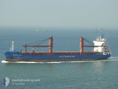
General Cargo
Current Trip
| Time Travelled | 1 day |
|---|---|
| Remaining Time | 1 day |
| Distance Travelled | 275.32 nm |
| Remaining Distance | 476.57 nm |
| AVG Speed | 11.9 Noeuds |
| MAX Speed | 13.6 Noeuds |
| AVG Wind | 12.5 knots |
| MAX Wind | 19 knots |
| MIN Temp | 24°C / 75.2°F |
| MAX Temp | 29.1°C / 84.38°F |
| Tirant d eau | 7.7 m |
| Position reçue | 8 d depuis |
Current Position
| Longitude | -46.30172° |
|---|---|
| Latitude | -23.95957° |
| Etat | Under way using engine |
| Vitesse | 8.6 Noeuds |
| Parcours | 143° |
| Zone | South Atlantic Ocean |
| Station | T-AIS |
| Position reçue | 8 d depuis |
Info
Information
The current position of BBC ECHO is in South Atlantic Ocean with coordinates -23.95957° / -46.30172° as reported on 2025-02-04 05:05 by AIS to our vessel tracker app. The vessel's current speed is 8.6 Noeuds and is heading at the port of SANTOS. The estimated time of arrival as calculated by MyShipTracking vessel tracking app is 2025-02-14 07:29 LT
The vessel BBC ECHO (IMO: 9407603, MMSI: 305536000) is a General Cargo that was built in 2010 ( 15 Age ). It's sailing under the flag of [AG] Antigua Barbuda.
In this page you can find informations about the vessels current position, last detected port calls, and current voyage information. If the vessels is not in coverage by AIS you will find the latest position.
The current position of BBC ECHO is detected by our AIS receivers and we are not responsible for the reliability of the data. The last position was recorded while the vessel was in Coverage by the Ais receivers of our vessel tracking app.
The current draught of BBC ECHO as reported by AIS is 7.7 meters
Weather
| Temperature | 28.4°C / 83.12°F |
|---|---|
| Wind Speed | 12 knots |
| Direction | 69° ENE |
| Pressure | 1012.8 hPa |
| Humidity | 66.3 % |
| Cloud Coverage | 76 % |
Featured Company
Most Visited Ports (Last year)
| Port | Arrivals | |
|---|---|---|
| 5 | ||
| 2 | ||
| 2 | ||
| 2 | ||
| 1 | ||
| 1 |
Last Trips
| Origin | Departure | Destination | Arrival | Distance | |
|---|---|---|---|---|---|
| 2025-02-04 02:40 | 2025-02-05 09:45 | 217.64 nm | |||
| 2024-12-28 18:40 | 2025-02-02 16:27 | 10553.32 nm | |||
| 2024-12-26 06:36 | 2024-12-28 05:16 | 593.79 nm | |||
| 2024-12-12 10:52 | 2024-12-21 17:03 | 531.13 nm | |||
| 2024-11-15 13:45 | 2024-12-06 08:44 | 6691.99 nm |
Events
| Heure | Evenement | Détails | Position/ Destination | Info |
|---|---|---|---|---|
| 2025-02-12 16:43 | Arret | 4.04 nm, East of JARDIM CAMBURI |
-20.30804 / -40.18357
BRSSZ
|
Vitesse: 0.3 kn Parcours: 47° |
| 2025-02-11 17:50 | PORT DE DEPART |
|
-22.89004 / -43.16629
BRSSZ
|
Vitesse: 10.7 kn Parcours: 76° |
| 2025-02-11 17:42 | Démarrage |
-22.89045 / -43.19125
[BR] RIO DE JANEIRO
|
Vitesse: 8.2 kn Parcours: 95° |
|
| 2025-02-05 12:45 | Arret |
-22.89309 / -43.19899
[BR] RIO DE JANEIRO
|
Vitesse: Parcours: 65° |
|
| 2025-02-05 12:45 | Port d'arrivée |
|
-22.89309 / -43.19899
[BR] RIO DE JANEIRO
|
Vitesse: 3.6 kn Parcours: 268° |
| 2025-02-05 12:02 | Démarrage | 2.29 nm, North West of RIO DE JANEIRO |
-22.87829 / -43.19558
BRSSZ
|
Vitesse: 7.8 kn Parcours: 122° |
| 2025-02-04 22:06 | Arret | 2.9 nm, North West of RIO DE JANEIRO |
-22.88172 / -43.21061
BRSSZ
|
Vitesse: Parcours: 222° |
| 2025-02-04 05:40 | PORT DE DEPART |
|
-24.00701 / -46.33746
BRSSZ
|
Vitesse: 8 kn Parcours: 210° |
| 2025-02-04 05:06 | Etat Changé | Default Under way using engine |
-23.96185 / -46.29985
[BR] SANTOS
|
Vitesse: 8.6 kn Parcours: 143° |
| 2025-02-04 05:05 | Hors de la zone couverte |
-23.95957 / -46.30172
South Atlantic Ocean
|
Vitesse: 8.6 kn Parcours: 142.6° |