
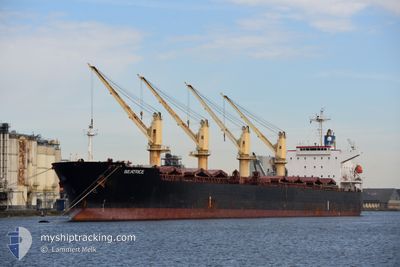
BEATRICE
Bulk Carrier
Current Trip
| Time Travelled | 18 days |
|---|---|
| Remaining Time | 5 days |
| Distance Travelled | 5039.91 nm |
| Remaining Distance | 1428.16 nm |
| AVG Speed | 11.3 Noeuds |
| MAX Speed | 13.1 Noeuds |
| AVG Wind | 10.4 knots |
| MAX Wind | 23.8 knots |
| MIN Temp | 16.9°C / 62.42°F |
| MAX Temp | 27.9°C / 82.22°F |
| Tirant d eau | 12.5 m |
| Position reçue | 4 d depuis |
Current Position
| Longitude | -23.37845° |
|---|---|
| Latitude | 9.84419° |
| Etat | Under way using engine |
| Vitesse | 11.1 Noeuds |
| Parcours | 206.4° |
| Zone | North Atlantic Ocean |
| Station | T-AIS |
| Position reçue | 4 d depuis |
Information
The current position of BEATRICE is in North Atlantic Ocean with coordinates 9.84419° / -23.37845° as reported on 2025-05-28 23:02 by AIS to our vessel tracker app. The vessel's current speed is 11.1 Noeuds and is heading at the port of SANTOS. The estimated time of arrival as calculated by MyShipTracking vessel tracking app is 2025-06-07 11:36 LT
The vessel BEATRICE (IMO: 9430818, MMSI: 538005795) is a Bulk Carrier that was built in 2009 ( 16 Age ). It's sailing under the flag of [MH] Marshall Is.
In this page you can find informations about the vessels current position, last detected port calls, and current voyage information. If the vessels is not in coverage by AIS you will find the latest position.
The current position of BEATRICE is detected by our AIS receivers and we are not responsible for the reliability of the data. The last position was recorded while the vessel was in Coverage by the Ais receivers of our vessel tracking app.
The current draught of BEATRICE as reported by AIS is 12.5 meters
Weather
| Temperature | 27.7°C / 81.86°F |
|---|---|
| Wind Speed | 16 knots |
| Direction | 113° ESE |
| Pressure | 1015.1 hPa |
| Humidity | 66 % |
| Cloud Coverage | 38 % |
Featured Company
Most Visited Ports (Last year)
| Port | Arrivals | |
|---|---|---|
| 2 | ||
| 1 | ||
| 1 | ||
| 1 | ||
| 1 | ||
| 1 |
Last Trips
Events
| Heure | Evenement | Détails | Position/ Destination | Info |
|---|---|---|---|---|
| 2025-05-28 23:07 | Etat Changé | Default Under way using engine |
9.83075 / -23.38477
BR SSZ
|
Vitesse: 11.1 kn Parcours: 206.4° |
| 2025-05-28 23:02 | Hors de la zone couverte |
9.84419 / -23.37845
North Atlantic Ocean
BR SSZ
|
Vitesse: 11.1 kn Parcours: 206.4° |
|
| 2025-05-28 23:02 | Etat Changé | Under way using engine Default |
9.84569 / -23.37776
BR SSZ
|
Vitesse: 10.9 kn Parcours: 208° |
| 2025-05-28 22:47 | Dans la zone couverte |
9.84569 / -23.37776
North Atlantic Ocean
BR SSZ
|
Vitesse: 11.5 kn Parcours: 206.5° |
|
| 2025-05-28 19:47 | Etat Changé | Default Under way using engine |
10.41182 / -23.10706
BR SSZ
|
Vitesse: 11.8 kn Parcours: 207.5° |
| 2025-05-28 19:41 | Hors de la zone couverte |
10.42948 / -23.09880
North Atlantic Ocean
BR SSZ
|
Vitesse: 11.8 kn Parcours: 207.5° |
|
| 2025-05-28 19:01 | Etat Changé | Under way using engine Default |
10.55008 / -23.04327
BR SSZ
|
Vitesse: 11.6 kn Parcours: 206° |
| 2025-05-28 19:00 | Etat Changé | Default Under way using engine |
10.55402 / -23.04129
BR SSZ
|
Vitesse: 11.5 kn Parcours: 204.1° |
| 2025-05-28 18:23 | Etat Changé | Under way using engine Default |
10.66403 / -22.98962
BR SSZ
|
Vitesse: 11.8 kn Parcours: 207° |
| 2025-05-28 18:12 | Etat Changé | Default Under way using engine |
10.69485 / -22.97549
BR SSZ
|
Vitesse: 11.7 kn Parcours: 201.1° |