
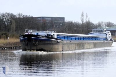
BENEFICIO
Cargo
Current Trip
| Time Travelled | 15 h, 56 mins |
|---|---|
| Remaining Time | 1 h, 3 mins |
| Distance Travelled | 54.84 nm |
| Remaining Distance | 9.44 nm |
| AVG Speed | 6.6 Noeuds |
| MAX Speed | 9.2 Noeuds |
| AVG Wind | 6.5 knots |
| MAX Wind | 9 knots |
| MIN Temp | 1°C / 33.8°F |
| MAX Temp | 5.6°C / 42.08°F |
| Tirant d eau | 0 m |
| Position reçue | 1 m depuis |
Current Position
| Longitude | 5.01269° |
|---|---|
| Latitude | 52.14899° |
| Etat | Under way using engine |
| Vitesse | 7.7 Noeuds |
| Parcours | 133.1° |
| Zone | North Sea |
| Station | T-AIS |
| Position reçue | 1 m depuis |
Info
Information
The current position of BENEFICIO is in North Sea with coordinates 52.14899° / 5.01269° as reported on 2025-02-04 06:44 by AIS to our vessel tracker app. The vessel's current speed is 7.7 Noeuds and is heading at the port of NIEUWEGEIN. The estimated time of arrival as calculated by MyShipTracking vessel tracking app is 2025-02-04 07:48 LT
The vessel BENEFICIO (MMSI: 244670959) is a Cargo It's sailing under the flag of [NL] Netherlands.
In this page you can find informations about the vessels current position, last detected port calls, and current voyage information. If the vessels is not in coverage by AIS you will find the latest position.
The current position of BENEFICIO is detected by our AIS receivers and we are not responsible for the reliability of the data. The last position was recorded while the vessel was in Coverage by the Ais receivers of our vessel tracking app.
Weather
| Temperature | 3.2°C / 37.76°F |
|---|---|
| Wind Speed | 6 knots |
| Direction | 193° SSW |
| Pressure | 1025.2 hPa |
| Humidity | 88.4 % |
| Cloud Coverage | 100 % |
Featured Company
Last Port Calls
| Port | Arrival | Departure | Time In Port |
|---|---|---|---|
| 2025-01-31 09:13 | 2025-02-03 14:49 | 3 d | |
| 2025-01-30 13:14 | 2025-01-30 13:48 | 34 m | |
| 2025-01-29 16:50 | 2025-01-29 17:45 | 54 m | |
| 2025-01-28 21:56 | 2025-01-29 07:27 | 9 h | |
| 2025-01-28 15:27 | 2025-01-28 16:00 | 32 m | |
| 2025-01-27 19:51 | 2025-01-28 10:51 | 14 h | |
| 2025-01-20 15:02 | 2025-01-27 17:46 | 7 d | |
| 2025-01-20 07:57 | 2025-01-20 12:40 | 4 h | |
| 2025-01-13 08:52 | 2025-01-14 02:58 | 18 h | |
| 2025-01-10 13:53 | 2025-01-13 06:29 | 2 d |
Most Visited Ports (Last year)
| Port | Arrivals | |
|---|---|---|
| 19 | ||
| 14 | ||
| 12 | ||
| 9 | ||
| 9 | ||
| 8 |
Last Trips
| Origin | Departure | Destination | Arrival | Distance | |
|---|---|---|---|---|---|
| 2025-01-30 14:48 | 2025-01-31 10:13 | 69.29 nm | |||
| 2025-01-29 18:45 | 2025-01-30 14:14 | 37.47 nm | |||
| 2025-01-29 08:27 | 2025-01-29 17:50 | 64.50 nm | |||
| 2025-01-28 17:00 | 2025-01-28 22:56 | 48.28 nm | |||
| 2025-01-28 11:51 | 2025-01-28 16:27 | 40.56 nm | |||
| 2025-01-27 18:46 | 2025-01-27 20:51 | 19.23 nm | |||
| 2025-01-20 13:40 | 2025-01-20 16:02 | 22.24 nm | |||
| 2025-01-14 03:58 | 2025-01-20 08:57 | 221.54 nm | |||
| 2025-01-13 07:29 | 2025-01-13 09:52 | 25.04 nm | |||
| 2025-01-09 18:19 | 2025-01-10 14:53 | 69.63 nm |
Events
| Heure | Evenement | Détails | Position/ Destination | Info |
|---|---|---|---|---|
| 2025-02-04 04:40 | Démarrage | 0.61 nm, South West of SCHELLINGWOUDE |
52.37237 / 4.95621
AMSTERDAMSEBRUG
|
Vitesse: 4.2 kn Parcours: 179.8° |
| 2025-02-04 04:38 | Etat Changé | Under way using engine Moored |
52.37392 / 4.95622
AMSTERDAMSEBRUG
|
Vitesse: Parcours: 511° |
| 2025-02-04 00:31 | Etat Changé | Moored Default |
52.37427 / 4.95617
AMSTERDAMSEBRUG
|
Vitesse: Parcours: -1° |
| 2025-02-04 00:24 | Etat Changé | Default Moored |
52.37429 / 4.95615
AMSTERDAMSEBRUG
|
Vitesse: Parcours: 511° |
| 2025-02-03 21:15 | Etat Changé | Moored Under way using engine |
52.37429 / 4.95610
AMSTERDAMSEBRUG
|
Vitesse: Parcours: 511° |
| 2025-02-03 20:55 | Arret | 0.51 nm, South West of SCHELLINGWOUDE |
52.37430 / 4.95610
AMSTERDAMSEBRUG
|
Vitesse: Parcours: 511° |
| 2025-02-03 20:45 | Démarrage | 0.27 nm, West of SCHELLINGWOUDE |
52.38065 / 4.95745
AMSTERDAMSEBRUG
|
Vitesse: 3.7 kn Parcours: 286.2° |
| 2025-02-03 20:30 | Arret | 0.18 nm, South West of SCHELLINGWOUDE |
52.37983 / 4.96015
AMSTERDAMSEBRUG
|
Vitesse: 0.3 kn Parcours: 511° |
| 2025-02-03 16:40 | Changement d'ETA | 2025/02/04 05:00 2025/02/04 05:23 |
52.58890 / 5.50788
AMSTERDAMSEBRUG
|
Vitesse: 7.3 kn Parcours: 225.1° |
| 2025-02-03 15:04 | Changement de destination | AMSTERDAMSEBRUG DAMPREMY |
52.58336 / 5.82199
AMSTERDAMSEBRUG
|
Vitesse: 8.4 kn Parcours: 270.6° |