

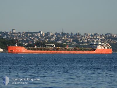
BLUE LAKE STAR
Tanker B

Current Trip
| Time Travelled | 15 h, 56 mins |
|---|---|
| Remaining Time | --- |
| Distance Travelled | 43.94 nm |
| Remaining Distance | --- |
| AVG Speed | 7.1 Noeuds |
| MAX Speed | 8.1 Noeuds |
| AVG Wind | 10.2 knots |
| MAX Wind | 19 knots |
| MIN Temp | 19.4°C / 66.92°F |
| MAX Temp | 25.7°C / 78.26°F |
| Tirant d eau | 4 m |
| Position reçue | 1 m depuis |
Current Position
| Longitude | 28.75478° |
|---|---|
| Latitude | 40.95287° |
| Etat | At anchor |
| Vitesse | 0.1 Noeuds |
| Parcours | 42° |
| Zone | Sea of Marmara |
| Station | T-AIS |
| Position reçue | 1 m depuis |
Information
The current position of BLUE LAKE STAR is in Sea of Marmara with coordinates 40.95287° / 28.75478° as reported on 2025-06-10 15:43 by AIS to our vessel tracker app. The vessel's current speed is 0.1 Noeuds and is heading at the port of HAIFA. The estimated time of arrival as calculated by MyShipTracking vessel tracking app is 2025-06-15 18:00 LT
The vessel BLUE LAKE STAR (IMO: 9729582, MMSI: 352001410) is a Tanker B It's sailing under the flag of [PA] Panama.
In this page you can find informations about the vessels current position, last detected port calls, and current voyage information. If the vessels is not in coverage by AIS you will find the latest position.
The current position of BLUE LAKE STAR is detected by our AIS receivers and we are not responsible for the reliability of the data. The last position was recorded while the vessel was in Coverage by the Ais receivers of our vessel tracking app.
The current draught of BLUE LAKE STAR as reported by AIS is 4 meters
Weather
| Temperature | 23.2°C / 73.76°F |
|---|---|
| Wind Speed | 18 knots |
| Direction | 37° NE |
| Pressure | 1015.7 hPa |
| Humidity | 69.3 % |
| Cloud Coverage | --- |


Featured Company
Last Port Calls
| Port | Arrival | Departure | Time In Port |
|---|---|---|---|
| 2025-06-08 13:07 | 2025-06-10 02:49 | 1 d | |
| 2025-06-03 14:57 | 2025-06-04 15:55 | 1 d | |
| 2025-05-26 09:15 | 2025-05-26 16:14 | 6 h | |
| 2025-05-20 17:28 | 2025-05-21 16:27 | 22 h | |
| 2025-04-24 20:27 | 2025-04-26 15:36 | 1 d | |
| 2025-04-14 07:30 | 2025-04-15 07:58 | 1 d |
Last Trips
| Origin | Departure | Destination | Arrival | Distance | |
|---|---|---|---|---|---|
| 2025-06-04 15:55 | 2025-06-08 13:07 | 645.65 nm | |||
| 2025-05-26 16:14 | 2025-06-03 14:57 | 712.25 nm | |||
| 2025-05-21 16:27 | 2025-05-26 09:15 | 944.56 nm | |||
| 2025-04-26 15:36 | 2025-05-20 17:28 | 1631.15 nm | |||
| 2025-04-15 07:58 | 2025-04-24 20:27 | 1476.28 nm | |||
| 2025-03-29 17:14 | 2025-04-14 07:30 | 662.54 nm |
Events
| Heure | Evenement | Détails | Position/ Destination | Info |
|---|---|---|---|---|
| 2025-06-10 14:11 | Etat Changé | At anchor Default |
40.95295 / 28.75472
TRDIL>ILHFA
|
Vitesse: 0.1 kn Parcours: 39° |
| 2025-06-10 14:02 | Etat Changé | Default At anchor |
40.95277 / 28.75499
TRDIL>ILHFA
|
Vitesse: 0.1 kn Parcours: 35° |
| 2025-06-10 13:21 | Etat Changé | At anchor Default |
40.95262 / 28.75512
TRDIL>ILHFA
|
Vitesse: Parcours: 40° |
| 2025-06-10 13:16 | Etat Changé | Default At anchor |
40.95273 / 28.75504
TRDIL>ILHFA
|
Vitesse: 0.1 kn Parcours: 40° |
| 2025-06-10 11:20 | Etat Changé | At anchor Default |
40.94970 / 28.75410
TRDIL>ILHFA
|
Vitesse: Parcours: 43° |
| 2025-06-10 11:12 | Etat Changé | Default At anchor |
40.94984 / 28.75398
TRDIL>ILHFA
|
Vitesse: Parcours: 43° |
| 2025-06-10 10:56 | Etat Changé | At anchor Default |
40.94964 / 28.75440
TRDIL>ILHFA
|
Vitesse: Parcours: 43° |
| 2025-06-10 10:48 | Etat Changé | Default At anchor |
40.94975 / 28.75406
TRDIL>ILHFA
|
Vitesse: Parcours: 43° |
| 2025-06-10 10:10 | Etat Changé | At anchor Default |
40.94978 / 28.75397
TRDIL>ILHFA
|
Vitesse: 0.2 kn Parcours: 43° |
| 2025-06-10 10:02 | Etat Changé | Default At anchor |
40.94991 / 28.75407
TRDIL>ILHFA
|
Vitesse: 0.2 kn Parcours: 43° |