
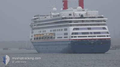
BOLETTE
Passengers Ship
Current Trip
| Time Travelled | 21 h, 28 mins |
|---|---|
| Remaining Time | 2 days |
| Distance Travelled | 316.60 nm |
| Remaining Distance | 1204.14 nm |
| AVG Speed | 15.1 Noeuds |
| MAX Speed | 17.7 Noeuds |
| AVG Wind | 20.6 knots |
| MAX Wind | 34.3 knots |
| MIN Temp | 6.5°C / 43.7°F |
| MAX Temp | 11.6°C / 52.88°F |
| Tirant d eau | 8.1 m |
| Position reçue | 11 h, 8 m depuis |
Current Position
| Longitude | -73.58423° |
|---|---|
| Latitude | -53.03842° |
| Etat | Under way using engine |
| Vitesse | 14.2 Noeuds |
| Parcours | 302.4° |
| Zone | South Pacific Ocean |
| Station | T-AIS |
| Position reçue | 11 h, 8 m depuis |
Info
Information
The current position of BOLETTE is in South Pacific Ocean with coordinates -53.03842° / -73.58423° as reported on 2025-02-01 06:47 by AIS to our vessel tracker app. The vessel's current speed is 14.2 Noeuds and is heading at the port of VALPARAISO. The estimated time of arrival as calculated by MyShipTracking vessel tracking app is 2025-02-04 13:57 LT
The vessel BOLETTE (IMO: 9188037, MMSI: 311000986) is a Passengers Ship that was built in 2000 ( 25 Age ). It's sailing under the flag of [BS] Bahamas.
In this page you can find informations about the vessels current position, last detected port calls, and current voyage information. If the vessels is not in coverage by AIS you will find the latest position.
The current position of BOLETTE is detected by our AIS receivers and we are not responsible for the reliability of the data. The last position was recorded while the vessel was in Coverage by the Ais receivers of our vessel tracking app.
The current draught of BOLETTE as reported by AIS is 8.1 meters
Weather
| Temperature | 10.3°C / 50.54°F |
|---|---|
| Wind Speed | 11 knots |
| Direction | 348° NNW |
| Pressure | 998 hPa |
| Humidity | 80.6 % |
| Cloud Coverage | 100 % |
Featured Company
Last Port Calls
| Port | Arrival | Departure | Time In Port |
|---|---|---|---|
| 2025-01-31 00:21 | 2025-01-31 17:28 | 17 h | |
| 2025-01-26 06:22 | 2025-01-27 00:30 | 18 h | |
| 2025-01-25 07:58 | 2025-01-25 17:45 | 9 h | |
| 2025-01-21 07:50 | 2025-01-21 22:14 | 14 h | |
| 2025-01-11 11:40 | 2025-01-11 20:24 | 8 h | |
| 2025-01-09 07:29 | 2025-01-09 17:15 | 9 h | |
| 2025-01-06 05:23 | 2025-01-06 18:16 | 12 h | |
| 2025-01-04 05:34 | 2025-01-04 16:33 | 10 h | |
| 2024-12-31 11:11 | 2025-01-01 00:48 | 13 h | |
| 2024-12-31 10:44 | 2024-12-31 10:51 | 6 m |
Last Trips
| Origin | Departure | Destination | Arrival | Distance | |
|---|---|---|---|---|---|
| 2025-01-27 00:30 | 2025-01-31 00:21 | 1446.81 nm | |||
| 2025-01-25 17:45 | 2025-01-26 06:22 | 139.76 nm | |||
| 2025-01-21 22:14 | 2025-01-25 07:58 | 1069.71 nm | |||
| 2025-01-11 20:24 | 2025-01-21 07:50 | 3527.07 nm | |||
| 2025-01-09 17:15 | 2025-01-11 11:40 | 721.33 nm | |||
| 2025-01-06 18:16 | 2025-01-09 07:29 | 932.23 nm | |||
| 2025-01-04 16:33 | 2025-01-06 05:23 | 523.06 nm | |||
| 2025-01-01 00:48 | 2025-01-04 05:34 | 1015.99 nm | |||
| 2024-12-31 10:51 | 2024-12-31 11:11 | 0.42 nm | |||
| 2024-12-29 16:42 | 2024-12-31 10:44 | 634.81 nm |
Events
| Heure | Evenement | Détails | Position/ Destination | Info |
|---|---|---|---|---|
| 2025-02-01 06:52 | Etat Changé | Default Under way using engine |
-53.02670 / -73.61305
CL VAP
|
Vitesse: 14.2 kn Parcours: 302.4° |
| 2025-02-01 06:47 | Etat Changé | Under way using engine Default |
-53.03842 / -73.58423
CL VAP
|
Vitesse: 14.9 kn Parcours: 308° |
| 2025-02-01 06:47 | Hors de la zone couverte |
-53.03842 / -73.58423
South Pacific Ocean
CL VAP
|
Vitesse: 14.2 kn Parcours: 302.4° |
|
| 2025-02-01 06:41 | Dans la zone couverte |
-53.03842 / -73.58423
South Pacific Ocean
CL VAP
|
Vitesse: 14.2 kn Parcours: 302.4° |
|
| 2025-02-01 00:22 | Etat Changé | Default Under way using engine |
-53.91043 / -71.37180
CL VAP
|
Vitesse: 15.7 kn Parcours: 289.7° |
| 2025-02-01 00:15 | Etat Changé | Under way using engine Default |
-53.92052 / -71.32692
CL VAP
|
Vitesse: 15.8 kn Parcours: 264° |
| 2025-02-01 00:15 | Hors de la zone couverte |
-53.92052 / -71.32692
South Pacific Ocean
CL VAP
|
Vitesse: 15.7 kn Parcours: 289.7° |
|
| 2025-02-01 00:10 | Etat Changé | Default Under way using engine |
-53.92423 / -71.28733
CL VAP
|
Vitesse: 16 kn Parcours: 254.9° |
| 2025-02-01 00:08 | Etat Changé | Under way using engine Default |
-53.92282 / -71.27398
CL VAP
|
Vitesse: 16.3 kn Parcours: 244° |
| 2025-02-01 00:04 | Etat Changé | Default Under way using engine |
-53.91512 / -71.24416
CL VAP
|
Vitesse: 16.8 kn Parcours: 245.6° |