
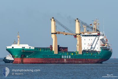
BREB COURAGEOUS
General Cargo
Current Trip
| Trip Time | --- |
|---|---|
| Trip Distance | --- |
| AVG Speed | --- |
| MAX Speed | --- |
| Tirant d eau | --- |
| AVG Wind | --- |
| MAX Wind | --- |
| MIN Temp | --- |
| MAX Temp | --- |
| Position reçue | 9 d depuis |
Current Position
| Longitude | 14.16438° |
|---|---|
| Latitude | 36.75392° |
| Etat | Under way using engine |
| Vitesse | 10.7 Noeuds |
| Parcours | 283.2° |
| Zone | Mediterranean Sea - Eastern Basin |
| Station | T-AIS |
| Position reçue | 9 d depuis |
Info
Information
The current position of BREB COURAGEOUS is in Mediterranean Sea - Eastern Basin with coordinates 36.75392° / 14.16438° as reported on 2025-02-04 16:32 by AIS to our vessel tracker app. The vessel's current speed is 10.7 Noeuds and is currently inside the port of ZARZIS.
The vessel BREB COURAGEOUS (IMO: 9421178, MMSI: 255806042) is a General Cargo that was built in 2009 ( 16 Age ). It's sailing under the flag of [PT] Portugal.
In this page you can find informations about the vessels current position, last detected port calls, and current voyage information. If the vessels is not in coverage by AIS you will find the latest position.
The current position of BREB COURAGEOUS is detected by our AIS receivers and we are not responsible for the reliability of the data. The last position was recorded while the vessel was in Coverage by the Ais receivers of our vessel tracking app.
The current draught of BREB COURAGEOUS as reported by AIS is 7.2 meters
Weather
| Temperature | 17.1°C / 62.78°F |
|---|---|
| Wind Speed | 12 knots |
| Direction | 337° NNW |
| Pressure | 1016.8 hPa |
| Humidity | 61.1 % |
| Cloud Coverage | --- |
Featured Company
Last Port Calls
| Port | Arrival | Departure | Time In Port |
|---|---|---|---|
| 2025-02-06 11:14 | 2025-02-10 23:10 | 4 d | |
| 2025-01-25 16:55 | 2025-02-01 15:28 | 6 d | |
| 2025-01-19 07:30 | 2025-01-21 15:22 | 2 d | |
| 2025-01-07 18:31 | 2025-01-12 14:25 | 4 d | |
| 2025-01-01 07:52 | 2025-01-03 09:03 | 2 d | |
| 2024-12-21 18:34 | 2024-12-27 22:39 | 6 d | |
| 2024-12-09 18:18 | 2024-12-13 18:18 | 3 d | |
| 2024-12-03 06:31 | 2024-12-05 06:29 | 1 d |
Most Visited Ports (Last year)
| Port | Arrivals | |
|---|---|---|
| 10 | ||
| 7 | ||
| 6 | ||
| 3 | ||
| 2 | ||
| 2 |
Last Trips
| Origin | Departure | Destination | Arrival | Distance | |
|---|---|---|---|---|---|
| 2025-02-01 16:28 | 2025-02-06 12:14 | 1211.12 nm | |||
| 2025-01-21 16:22 | 2025-01-25 17:55 | 942.98 nm | |||
| 2025-01-12 15:25 | 2025-01-19 08:30 | 1075.08 nm | |||
| 2025-01-03 10:03 | 2025-01-07 19:31 | 977.36 nm | |||
| 2024-12-27 23:39 | 2025-01-01 08:52 | 555.60 nm | |||
| 2024-12-13 19:18 | 2024-12-21 19:34 | 1232.24 nm | |||
| 2024-12-05 07:29 | 2024-12-09 19:18 | 1013.57 nm | |||
| 2024-11-29 22:56 | 2024-12-03 07:31 | 818.61 nm |
Events
| Heure | Evenement | Détails | Position/ Destination | Info |
|---|---|---|---|---|
| 2025-02-12 21:40 | Arret | 6.74 nm, East of ZARZIS |
33.51147 / 11.25006
DZBJA
|
Vitesse: Parcours: 98° |
| 2025-02-10 23:10 | PORT DE DEPART |
|
36.75661 / 5.12393
DZBJA
|
Vitesse: 3.5 kn Parcours: 119° |
| 2025-02-10 22:43 | Démarrage |
36.74084 / 5.08197
[DZ] BEJAIA
|
Vitesse: 3.9 kn Parcours: 17° |
|
| 2025-02-06 11:29 | Arret |
36.73799 / 5.08013
[DZ] BEJAIA
|
Vitesse: 0.2 kn Parcours: 344° |
|
| 2025-02-06 11:14 | Port d'arrivée |
|
36.74214 / 5.08266
[DZ] BEJAIA
|
Vitesse: 5.6 kn Parcours: 274° |
| 2025-02-04 16:42 | Etat Changé | Default Under way using engine |
36.76156 / 14.12672
DZBJA
|
Vitesse: 10.7 kn Parcours: 283.2° |
| 2025-02-04 16:32 | Hors de la zone couverte |
36.75392 / 14.16438
Mediterranean Sea - Eastern Basin
DZBJA
|
Vitesse: 10.7 kn Parcours: 283.2° |