

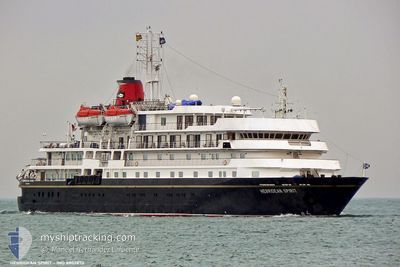
CALEDONIAN SKY
Passengers Ship

Current Trip
HR SIB
| Time Travelled | 1 day |
|---|---|
| Remaining Time | --- |
| Distance Travelled | 143.80 nm |
| Remaining Distance | --- |
| AVG Speed | 7.9 Noeuds |
| MAX Speed | 10.6 Noeuds |
| AVG Wind | 7.9 knots |
| MAX Wind | 11.9 knots |
| MIN Temp | 20.7°C / 69.26°F |
| MAX Temp | 23.7°C / 74.66°F |
| Tirant d eau | 4.3 m |
| Position reçue | 2 h, 52 m depuis |
Current Position
| Longitude | 17.63704° |
|---|---|
| Latitude | 42.56352° |
| Etat | Under way using engine |
| Vitesse | 4.3 Noeuds |
| Parcours | 213° |
| Zone | Adriatic Sea |
| Station | T-AIS |
| Position reçue | 2 h, 52 m depuis |
Information
The current position of CALEDONIAN SKY is in Adriatic Sea with coordinates 42.56352° / 17.63704° as reported on 2025-06-12 00:23 by AIS to our vessel tracker app. The vessel's current speed is 4.3 Noeuds
The vessel CALEDONIAN SKY (IMO: 8802870, MMSI: 311061000) is a Passengers Ship that was built in 1991 ( 34 Age ). It's sailing under the flag of [BS] Bahamas.
In this page you can find informations about the vessels current position, last detected port calls, and current voyage information. If the vessels is not in coverage by AIS you will find the latest position.
The current position of CALEDONIAN SKY is detected by our AIS receivers and we are not responsible for the reliability of the data. The last position was recorded while the vessel was in Coverage by the Ais receivers of our vessel tracking app.
The current draught of CALEDONIAN SKY as reported by AIS is 4.3 meters
Weather
| Temperature | 23.2°C / 73.76°F |
|---|---|
| Wind Speed | 9 knots |
| Direction | 322° NW |
| Pressure | 1013.5 hPa |
| Humidity | 78.9 % |
| Cloud Coverage | 5 % |


Featured Company
Last Port Calls
| Port | Arrival | Departure | Time In Port |
|---|---|---|---|
| 2025-06-10 11:35 | 2025-06-10 21:05 | 9 h | |
| 2025-06-09 07:37 | 2025-06-09 18:04 | 10 h | |
| 2025-06-08 06:18 | 2025-06-08 13:14 | 6 h | |
| 2025-06-02 06:10 | 2025-06-03 03:54 | 21 h | |
| 2025-05-30 07:30 | 2025-05-30 18:12 | 10 h | |
| 2025-05-29 07:21 | 2025-05-29 12:23 | 5 h | |
| 2025-05-28 07:13 | 2025-05-28 18:39 | 11 h | |
| 2025-05-27 06:59 | 2025-05-27 22:24 | 15 h | |
| 2025-05-26 06:57 | 2025-05-26 20:10 | 13 h | |
| 2025-05-25 13:24 | 2025-05-25 14:57 | 1 h |
Most Visited Ports (Last year)
| Port | Arrivals | |
|---|---|---|
| 22 | ||
| 3 | ||
| 2 | ||
| 2 | ||
| 2 | ||
| 2 |
Last Trips
| Origin | Departure | Destination | Arrival | Distance | |
|---|---|---|---|---|---|
| 2025-06-09 18:04 | 2025-06-10 11:35 | 207.96 nm | |||
| 2025-06-08 13:14 | 2025-06-09 07:37 | 204.82 nm | |||
| 2025-06-03 03:54 | 2025-06-08 06:18 | 680.93 nm | |||
| 2025-05-30 18:12 | 2025-06-02 06:10 | 266.98 nm | |||
| 2025-05-29 12:23 | 2025-05-30 07:30 | 172.11 nm | |||
| 2025-05-28 18:39 | 2025-05-29 07:21 | 80.95 nm | |||
| 2025-05-27 22:24 | 2025-05-28 07:13 | 66.39 nm | |||
| 2025-05-26 20:10 | 2025-05-27 06:59 | 85.24 nm | |||
| 2025-05-25 14:57 | 2025-05-26 06:57 | 87.95 nm | |||
| 2025-05-25 12:24 | 2025-05-25 13:24 | 0.50 nm |
Events
| Heure | Evenement | Détails | Position/ Destination | Info |
|---|---|---|---|---|
| 2025-06-12 00:24 | Etat Changé | Default Under way using engine |
42.56251 / 17.63586
HR SIB
|
Vitesse: 4.3 kn Parcours: 213° |
| 2025-06-12 00:23 | Etat Changé | Under way using engine Default |
42.56352 / 17.63704
HR SIB
|
Vitesse: 4.6 kn Parcours: 169° |
| 2025-06-12 00:23 | Dans la zone couverte |
42.56352 / 17.63704
Adriatic Sea
|
Vitesse: 4.3 kn Parcours: 208.5° |
|
| 2025-06-12 00:23 | Hors de la zone couverte |
42.56352 / 17.63704
Adriatic Sea
|
Vitesse: 4.3 kn Parcours: 208.5° |
|
| 2025-06-11 17:14 | Démarrage | 11.68 nm, South East of DOMINCE |
42.80460 / 17.32416
HR SIB
|
Vitesse: 7.6 kn Parcours: 296° |
| 2025-06-11 12:39 | Arret | 12.41 nm, South East of DOMINCE |
42.79626 / 17.33601
HR SIB
|
Vitesse: 0.2 kn Parcours: 267° |
| 2025-06-11 10:35 | Démarrage | 0.53 nm, North West of KORCULA |
42.96940 / 17.12577
HR SIB
|
Vitesse: 6.2 kn Parcours: 84° |
| 2025-06-11 05:08 | Arret | 0.66 nm, West of KORCULA |
42.96776 / 17.12093
HR SIB
|
Vitesse: 0.3 kn Parcours: 298° |
| 2025-06-10 22:09 | Etat Changé | Default Under way using engine |
43.36972 / 15.95813
HR SIB
|
Vitesse: 9.1 kn Parcours: 133° |
| 2025-06-10 22:01 | Hors de la zone couverte |
43.38361 / 15.93738
Adriatic Sea
|
Vitesse: 9.1 kn Parcours: 133° |