
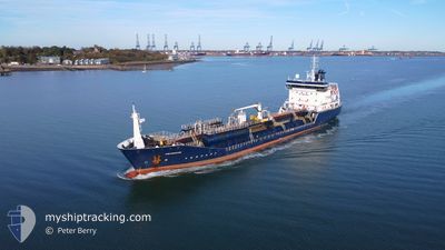
CASTORWATER
Oil/Chemical Tanker
Current Trip
| Time Travelled | 6 h, 33 mins |
|---|---|
| Remaining Time | 15 h, 35 mins |
| Distance Travelled | 64.19 nm |
| Remaining Distance | 206.93 nm |
| AVG Speed | 12.8 Noeuds |
| MAX Speed | 15.9 Noeuds |
| AVG Wind | 17.4 knots |
| MAX Wind | 22 knots |
| MIN Temp | 2.5°C / 36.5°F |
| MAX Temp | 5.4°C / 41.72°F |
| Tirant d eau | 5.2 m |
| Position reçue | 1 h, 28 m depuis |
Current Position
| Longitude | 0.12711° |
|---|---|
| Latitude | 49.99006° |
| Etat | Under way using engine |
| Vitesse | 12.5 Noeuds |
| Parcours | 47.7° |
| Zone | English Channel |
| Station | T-AIS |
| Position reçue | 1 h, 28 m depuis |
Info
Information
The current position of CASTORWATER is in English Channel with coordinates 49.99006° / 0.12711° as reported on 2025-02-07 15:16 by AIS to our vessel tracker app. The vessel's current speed is 12.5 Noeuds and is heading at the port of ROTTERDAM. The estimated time of arrival as calculated by MyShipTracking vessel tracking app is 2025-02-08 08:19 LT
The vessel CASTORWATER (IMO: 9418937, MMSI: 236507000) is a Oil/Chemical Tanker that was built in 2009 ( 16 Age ). It's sailing under the flag of [GI] Gibraltar.
In this page you can find informations about the vessels current position, last detected port calls, and current voyage information. If the vessels is not in coverage by AIS you will find the latest position.
The current position of CASTORWATER is detected by our AIS receivers and we are not responsible for the reliability of the data. The last position was recorded while the vessel was in Coverage by the Ais receivers of our vessel tracking app.
The current draught of CASTORWATER as reported by AIS is 5.2 meters
Weather
| Temperature | 5.5°C / 41.9°F |
|---|---|
| Wind Speed | 23 knots |
| Direction | 97° E |
| Pressure | 1016.7 hPa |
| Humidity | 80.7 % |
| Cloud Coverage | 100 % |
Featured Company
Last Port Calls
| Port | Arrival | Departure | Time In Port |
|---|---|---|---|
| 2025-02-04 16:32 | 2025-02-07 10:11 | 2 d | |
| 2025-01-31 01:04 | 2025-02-01 02:11 | 1 d | |
| 2025-01-30 06:43 | 2025-01-31 00:49 | 18 h | |
| 2025-01-26 20:27 | 2025-01-27 10:25 | 13 h | |
| 2025-01-20 06:32 | 2025-01-21 02:52 | 20 h | |
| 2025-01-17 19:57 | 2025-01-18 18:38 | 22 h | |
| 2025-01-13 19:55 | 2025-01-16 21:36 | 3 d | |
| 2025-01-11 12:43 | 2025-01-12 18:13 | 1 d | |
| 2025-01-09 22:47 | 2025-01-11 12:08 | 1 d | |
| 2025-01-07 13:03 | 2025-01-08 02:08 | 13 h |
Most Visited Ports (Last year)
| Port | Arrivals | |
|---|---|---|
| 20 | ||
| 13 | ||
| 13 | ||
| 10 | ||
| 9 | ||
| 7 |
Last Trips
| Origin | Departure | Destination | Arrival | Distance | |
|---|---|---|---|---|---|
| 2025-02-01 03:11 | 2025-02-04 17:32 | 299.32 nm | |||
| 2025-01-31 01:49 | 2025-01-31 02:04 | 0.90 nm | |||
| 2025-01-27 11:25 | 2025-01-30 07:43 | 332.28 nm | |||
| 2025-01-21 03:52 | 2025-01-26 21:27 | 162.05 nm | |||
| 2025-01-18 19:38 | 2025-01-20 07:32 | 314.58 nm | |||
| 2025-01-16 22:36 | 2025-01-17 20:57 | 275.73 nm | |||
| 2025-01-12 19:13 | 2025-01-13 20:55 | 299.17 nm | |||
| 2025-01-11 13:08 | 2025-01-11 13:43 | 2.03 nm | |||
| 2025-01-08 03:08 | 2025-01-09 23:47 | 279.87 nm | |||
| 2025-01-07 06:44 | 2025-01-07 14:03 | 37.54 nm |
Events
| Heure | Evenement | Détails | Position/ Destination | Info |
|---|---|---|---|---|
| 2025-02-07 15:16 | Hors de la zone couverte |
49.99006 / .12711
English Channel
ROTTERDAM
|
Vitesse: 12.5 kn Parcours: 47.7° |
|
| 2025-02-07 11:26 | Changement d'ETA | 2025/02/08 08:00 2025/02/08 10:00 |
49.43190 / .16849
ROTTERDAM
|
Vitesse: 15.4 kn Parcours: 272.4° |
| 2025-02-07 10:54 | Etat Changé | Under way using engine Moored |
49.44102 / .37006
ROTTERDAM
|
Vitesse: 15.4 kn Parcours: 253.7° |
| 2025-02-07 10:18 | Démarrage | 0.85 nm, South East of PORT JEROME |
49.45985 / .54660
ROTTERDAM
|
Vitesse: 5.6 kn Parcours: 333.6° |
| 2025-02-07 10:14 | Arret | 0.96 nm, South East of PORT JEROME |
49.45807 / .54778
ROTTERDAM
|
Vitesse: 0.3 kn Parcours: 139° |
| 2025-02-07 10:11 | PORT DE DEPART |
|
49.45979 / .54643
ROTTERDAM
|
Vitesse: 2.8 kn Parcours: 147° |
| 2025-02-07 10:06 | Démarrage |
49.46445 / .54327
[FR] PORT JEROME
|
Vitesse: 4.2 kn Parcours: 151° |
|
| 2025-02-07 09:59 | Etat Changé | Moored Default |
49.46626 / .54223
[FR] PORT JEROME
|
Vitesse: Parcours: 142° |
| 2025-02-07 09:56 | Etat Changé | Default Moored |
49.46626 / .54220
[FR] PORT JEROME
|
Vitesse: Parcours: 142° |
| 2025-02-07 09:35 | Etat Changé | Moored Default |
49.46625 / .54221
[FR] PORT JEROME
|
Vitesse: Parcours: 142° |