
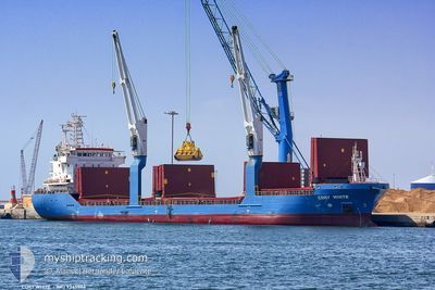
CDRY WHITE
General Cargo
Current Trip
| Time Travelled | 2 days |
|---|---|
| Remaining Time | 11 h, 51 mins |
| Distance Travelled | 721.64 nm |
| Remaining Distance | 174.70 nm |
| AVG Speed | 11.5 Noeuds |
| MAX Speed | 13.4 Noeuds |
| AVG Wind | 7.5 knots |
| MAX Wind | 24.8 knots |
| MIN Temp | 9.9°C / 49.82°F |
| MAX Temp | 15.8°C / 60.44°F |
| Tirant d eau | 4.6 m |
| Position reçue | 2 h, 12 m depuis |
Current Position
| Longitude | 20.11067° |
|---|---|
| Latitude | 38.33333° |
| Etat | Under way using engine |
| Vitesse | 12.3 Noeuds |
| Parcours | 338.3° |
| Zone | Ionian Sea |
| Station | T-AIS |
| Position reçue | 2 h, 12 m depuis |
Info
Information
The current position of CDRY WHITE is in Ionian Sea with coordinates 38.33333° / 20.11067° as reported on 2025-02-16 04:49 by AIS to our vessel tracker app. The vessel's current speed is 12.3 Noeuds and is heading at the port of BRINDISI. The estimated time of arrival as calculated by MyShipTracking vessel tracking app is 2025-02-16 18:53 LT
The vessel CDRY WHITE (IMO: 9365506, MMSI: 247285600) is a General Cargo that was built in 2010 ( 15 Age ). It's sailing under the flag of [IT] Italy.
In this page you can find informations about the vessels current position, last detected port calls, and current voyage information. If the vessels is not in coverage by AIS you will find the latest position.
The current position of CDRY WHITE is detected by our AIS receivers and we are not responsible for the reliability of the data. The last position was recorded while the vessel was in Coverage by the Ais receivers of our vessel tracking app.
The current draught of CDRY WHITE as reported by AIS is 4.6 meters
Weather
| Temperature | 11.5°C / 52.7°F |
|---|---|
| Wind Speed | 6 knots |
| Direction | 205° SSW |
| Pressure | 1009.6 hPa |
| Humidity | 84.4 % |
| Cloud Coverage | 100 % |
Featured Company
Last Port Calls
| Port | Arrival | Departure | Time In Port |
|---|---|---|---|
| 2025-02-12 05:35 | 2025-02-13 14:53 | 1 d | |
| 2025-01-26 20:17 | 2025-02-08 07:26 | 12 d | |
| 2025-01-23 17:45 | 2025-01-25 12:51 | 1 d | |
| 2025-01-20 14:38 | 2025-01-21 12:08 | 21 h | |
| 2025-01-16 05:09 | 2025-01-18 09:28 | 2 d | |
| 2025-01-15 03:22 | 2025-01-15 18:45 | 15 h | |
| 2025-01-10 05:13 | 2025-01-10 12:29 | 7 h | |
| 2025-01-08 14:12 | 2025-01-08 18:28 | 4 h | |
| 2024-12-30 16:28 | 2025-01-03 13:41 | 3 d | |
| 2024-12-21 11:21 | 2024-12-27 22:11 | 6 d |
Last Trips
| Origin | Departure | Destination | Arrival | Distance | |
|---|---|---|---|---|---|
| 2025-02-08 08:26 | 2025-02-12 07:35 | 946.87 nm | |||
| 2025-01-25 13:51 | 2025-01-26 21:17 | 363.83 nm | |||
| 2025-01-21 13:08 | 2025-01-23 18:45 | 375.11 nm | |||
| 2025-01-18 10:28 | 2025-01-20 15:38 | 489.72 nm | |||
| 2025-01-15 19:45 | 2025-01-16 06:09 | 29.77 nm | |||
| 2025-01-10 13:29 | 2025-01-15 04:22 | 657.38 nm | |||
| 2025-01-08 19:28 | 2025-01-10 06:13 | 373.49 nm | |||
| 2025-01-03 14:41 | 2025-01-08 15:12 | 708.02 nm | |||
| 2024-12-27 23:11 | 2024-12-30 17:28 | 278.90 nm | |||
| 2024-12-05 19:38 | 2024-12-21 12:21 | 1199.38 nm |
Events
| Heure | Evenement | Détails | Position/ Destination | Info |
|---|---|---|---|---|
| 2025-02-16 04:49 | Hors de la zone couverte |
38.33333 / 20.11067
Ionian Sea
IT BDS
|
Vitesse: 12.3 kn Parcours: 338.3° |
|
| 2025-02-15 23:54 | Etat Changé | Under way using engine Default |
37.47721 / 20.73138
IT BDS
|
Vitesse: 12.5 kn Parcours: 331° |
| 2025-02-15 23:54 | Dans la zone couverte |
37.47721 / 20.73138
Ionian Sea
IT BDS
|
Vitesse: 12.4 kn Parcours: 330.8° |
|
| 2025-02-15 22:03 | Etat Changé | Default Under way using engine |
37.16163 / 20.98550
IT BDS
|
Vitesse: 12.1 kn Parcours: 311.7° |
| 2025-02-15 21:20 | Hors de la zone couverte |
37.06700 / 21.11637
Ionian Sea
IT BDS
|
Vitesse: 12.1 kn Parcours: 311.7° |
|
| 2025-02-15 21:07 | Detecté en mer | Greek part of the Ionian Sea |
37.03793 / 21.15682
Ionian Sea
IT BDS
|
Vitesse: 12 kn Parcours: 312.6° |
| 2025-02-15 21:07 | Dans la zone couverte |
37.03793 / 21.15682
Ionian Sea
IT BDS
|
Vitesse: 12 kn Parcours: 312.6° |
|
| 2025-02-15 09:17 | Etat Changé | Default Under way using engine |
36.34194 / 23.74561
IT BDS
|
Vitesse: 11.1 kn Parcours: 273.5° |
| 2025-02-15 08:19 | Hors de la zone couverte |
36.33020 / 23.97070
Aegean Sea
IT BDS
|
Vitesse: 11.1 kn Parcours: 273.5° |
|
| 2025-02-14 22:04 | Dans la zone couverte |
36.12017 / 26.42983
Aegean Sea
IT BDS
|
Vitesse: 12.2 kn Parcours: 283.7° |