
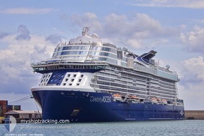
CELEBRITY ASCENT
Passenger
Current Trip
| Time Travelled | 22 h, 3 mins |
|---|---|
| Remaining Time | 1 day |
| Distance Travelled | 400.65 nm |
| Remaining Distance | 913.59 nm |
| AVG Speed | 18.8 Noeuds |
| MAX Speed | 21.1 Noeuds |
| AVG Wind | 19.6 knots |
| MAX Wind | 21.8 knots |
| MIN Temp | 25.1°C / 77.18°F |
| MAX Temp | 26.8°C / 80.24°F |
| Tirant d eau | 8.5 m |
| Position reçue | 16 h, 52 m depuis |
Current Position
| Longitude | -64.27596° |
|---|---|
| Latitude | 19.06748° |
| Etat | Under way using engine |
| Vitesse | 20.1 Noeuds |
| Parcours | 301.8° |
| Zone | North Atlantic Ocean |
| Station | T-AIS |
| Position reçue | 16 h, 52 m depuis |
Info
Information
The current position of CELEBRITY ASCENT is in North Atlantic Ocean with coordinates 19.06748° / -64.27596° as reported on 2025-02-07 03:11 by AIS to our vessel tracker app. The vessel's current speed is 20.1 Noeuds and is heading at the port of PORT EVERGLADES. The estimated time of arrival as calculated by MyShipTracking vessel tracking app is 2025-02-09 05:12 LT
The vessel CELEBRITY ASCENT (IMO: 9838400, MMSI: 256191000) is a Passenger It's sailing under the flag of [MT] Malta.
In this page you can find informations about the vessels current position, last detected port calls, and current voyage information. If the vessels is not in coverage by AIS you will find the latest position.
The current position of CELEBRITY ASCENT is detected by our AIS receivers and we are not responsible for the reliability of the data. The last position was recorded while the vessel was in Coverage by the Ais receivers of our vessel tracking app.
The current draught of CELEBRITY ASCENT as reported by AIS is 8.5 meters
Weather
| Temperature | 25.7°C / 78.26°F |
|---|---|
| Wind Speed | 16 knots |
| Direction | 84° E |
| Pressure | 1017.2 hPa |
| Humidity | 71.8 % |
| Cloud Coverage | 1 % |
Featured Company
Last Port Calls
| Port | Arrival | Departure | Time In Port |
|---|---|---|---|
| 2025-02-06 11:48 | 2025-02-06 22:01 | 10 h | |
| 2025-02-04 10:50 | 2025-02-04 19:09 | 8 h | |
| 2025-02-02 11:40 | 2025-02-02 21:15 | 9 h | |
| 2025-01-29 12:28 | 2025-01-29 22:39 | 10 h | |
| 2025-01-26 11:36 | 2025-01-26 20:53 | 9 h | |
| 2025-01-23 11:48 | 2025-01-23 22:07 | 10 h | |
| 2025-01-21 10:45 | 2025-01-21 19:14 | 8 h | |
| 2025-01-19 11:36 | 2025-01-19 22:24 | 10 h | |
| 2025-01-15 12:26 | 2025-01-16 00:00 | 11 h | |
| 2025-01-13 12:17 | 2025-01-13 21:56 | 9 h |
Most Visited Ports (Last year)
| Port | Arrivals | |
|---|---|---|
| 23 | ||
| 14 | ||
| 13 | ||
| 11 | ||
| 9 | ||
| 9 |
Last Trips
| Origin | Departure | Destination | Arrival | Distance | |
|---|---|---|---|---|---|
| 2025-02-04 15:09 | 2025-02-06 07:48 | 463.29 nm | |||
| 2025-02-02 16:15 | 2025-02-04 06:50 | 697.22 nm | |||
| 2025-01-29 17:39 | 2025-02-02 06:40 | 936.18 nm | |||
| 2025-01-26 15:53 | 2025-01-29 07:28 | 875.85 nm | |||
| 2025-01-23 18:07 | 2025-01-26 06:36 | 1081.39 nm | |||
| 2025-01-21 15:14 | 2025-01-23 07:48 | 468.56 nm | |||
| 2025-01-19 17:24 | 2025-01-21 06:45 | 699.26 nm | |||
| 2025-01-15 19:00 | 2025-01-19 06:36 | 904.54 nm | |||
| 2025-01-13 16:56 | 2025-01-15 07:26 | 688.56 nm | |||
| 2025-01-12 16:06 | 2025-01-13 07:17 | 183.60 nm |
Events
| Heure | Evenement | Détails | Position/ Destination | Info |
|---|---|---|---|---|
| 2025-02-07 03:17 | Etat Changé | Default Under way using engine |
19.08537 / -64.30790
US PEF
|
Vitesse: 20.1 kn Parcours: 301.8° |
| 2025-02-07 03:11 | Hors de la zone couverte |
19.06748 / -64.27596
North Atlantic Ocean
US PEF
|
Vitesse: 20.1 kn Parcours: 301.8° |
|
| 2025-02-07 03:07 | Etat Changé | Under way using engine Default |
19.05570 / -64.25532
US PEF
|
Vitesse: 19.9 kn Parcours: 301° |
| 2025-02-07 03:01 | Etat Changé | Default Under way using engine |
19.04017 / -64.22745
US PEF
|
Vitesse: 19.7 kn Parcours: 300.6° |
| 2025-02-07 02:38 | Changement de zone | British Virgin Islands part of the North Atlantic Ocean British Virgin Islands part of the Caribbean Sea |
18.96437 / -64.11996
North Atlantic Ocean
US PEF
|
Vitesse: 19.5 kn Parcours: 318.2° |
| 2025-02-07 02:07 | Changement de zone | British Virgin Islands part of the Caribbean Sea Anguilla part of the Caribbean Sea |
18.84383 / -64.00452
Caribbean Sea
US PEF
|
Vitesse: 19 kn Parcours: 316.8° |
| 2025-02-07 02:07 | Etat Changé | Under way using engine Default |
18.84383 / -64.00452
US PEF
|
Vitesse: 18.9 kn Parcours: 317° |
| 2025-02-07 02:07 | Dans la zone couverte |
18.84383 / -64.00452
Caribbean Sea
US PEF
|
Vitesse: 19 kn Parcours: 316.8° |
|
| 2025-02-07 00:13 | Etat Changé | Default Under way using engine |
18.39349 / -63.59098
US PEF
|
Vitesse: 18.7 kn Parcours: 317.9° |
| 2025-02-07 00:09 | Hors de la zone couverte |
18.37967 / -63.57834
Caribbean Sea
US PEF
|
Vitesse: 18.7 kn Parcours: 317.9° |