

CELSIUS NEW ORLEANS
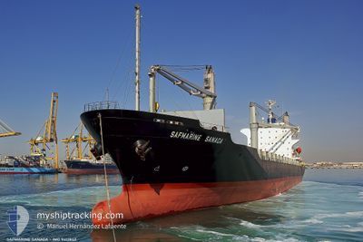
Container Ship

Current Trip
| Trip Time | 11 days |
|---|---|
| Trip Distance | 4021.33 nm |
| AVG Speed | 14.1 Noeuds |
| MAX Speed | 17.2 Noeuds |
| Tirant d eau | 8.3 m |
| AVG Wind | 15.7 knots |
| MAX Wind | 29 knots |
| MIN Temp | 16.1°C / 60.98°F |
| MAX Temp | 33.9°C / 93.02°F |
| Position reçue | 9 d depuis |
Current Position
| Longitude | 55.05452° |
|---|---|
| Latitude | 25.03130° |
| Etat | Moored |
| Vitesse | |
| Parcours | 81° |
| Zone | Persian Gulf |
| Station | T-AIS |
| Position reçue | 9 d depuis |
Information
The current position of CELSIUS NEW ORLEANS is in Persian Gulf with coordinates 25.03130° / 55.05452° as reported on 2025-06-04 15:43 by AIS to our vessel tracker app. The vessel's current speed is 0 Noeuds and is currently inside the port of JEBEL ALI.
The vessel CELSIUS NEW ORLEANS (IMO: 9412842, MMSI: 538009878) is a Container Ship that was built in 2007 ( 18 Age ). It's sailing under the flag of [MH] Marshall Is.
In this page you can find informations about the vessels current position, last detected port calls, and current voyage information. If the vessels is not in coverage by AIS you will find the latest position.
The current position of CELSIUS NEW ORLEANS is detected by our AIS receivers and we are not responsible for the reliability of the data. The last position was recorded while the vessel was in Coverage by the Ais receivers of our vessel tracking app.
The current draught of CELSIUS NEW ORLEANS as reported by AIS is 9.1 meters
Weather
| Temperature | 29.8°C / 85.64°F |
|---|---|
| Wind Speed | 13 knots |
| Direction | 256° WSW |
| Pressure | 1000.6 hPa |
| Humidity | 62.6 % |
| Cloud Coverage | 6 % |


Featured Company
Last Port Calls
| Port | Arrival | Departure | Time In Port |
|---|---|---|---|
| 2025-06-03 04:21 | |||
| 2025-05-21 06:37 | 2025-05-22 03:21 | 20 h | |
| 2025-05-17 06:39 | 2025-05-19 17:28 | 2 d | |
| 2025-05-12 15:37 | 2025-05-13 03:41 | 12 h | |
| 2025-05-08 12:37 | 2025-05-09 21:25 | 1 d | |
| 2025-04-27 06:56 | 2025-04-27 16:28 | 9 h | |
| 2025-04-25 04:28 | 2025-04-25 16:59 | 12 h | |
| 2025-04-20 17:57 | 2025-04-22 11:10 | 1 d | |
| 2025-04-17 12:22 | 2025-04-19 07:18 | 1 d | |
| 2025-04-14 01:48 | 2025-04-15 19:49 | 1 d |
Last Trips
| Origin | Departure | Destination | Arrival | Distance | |
|---|---|---|---|---|---|
| 2025-05-22 03:21 | 2025-06-03 04:21 | 4021.33 nm | |||
| 2025-05-19 17:28 | 2025-05-21 06:37 | 510.06 nm | |||
| 2025-05-13 03:41 | 2025-05-17 06:39 | 1025.11 nm | |||
| 2025-05-09 21:25 | 2025-05-12 15:37 | 251.67 nm | |||
| 2025-04-27 16:28 | 2025-05-08 12:37 | 2880.25 nm | |||
| 2025-04-25 16:59 | 2025-04-27 06:56 | 425.52 nm | |||
| 2025-04-22 11:10 | 2025-04-25 04:28 | 975.39 nm | |||
| 2025-04-19 07:18 | 2025-04-20 17:57 | 512.48 nm | |||
| 2025-04-15 19:49 | 2025-04-17 12:22 | 513.01 nm | |||
| 2025-04-01 11:33 | 2025-04-14 01:48 | 3964.60 nm |
Events
| Heure | Evenement | Détails | Position/ Destination | Info |
|---|---|---|---|---|
| 2025-06-04 15:43 | Hors de la zone couverte |
25.03130 / 55.05452
Persian Gulf
[AE] JEBEL ALI
|
Vitesse: Parcours: 278° |
|
| 2025-06-04 15:01 | Dans la zone couverte |
25.03131 / 55.05452
Persian Gulf
[AE] JEBEL ALI
|
Vitesse: Parcours: 353° |
|
| 2025-06-04 13:28 | Hors de la zone couverte |
25.03132 / 55.05455
Persian Gulf
[AE] JEBEL ALI
|
Vitesse: Parcours: 104° |
|
| 2025-06-04 13:19 | Dans la zone couverte |
25.03132 / 55.05453
Persian Gulf
[AE] JEBEL ALI
|
Vitesse: Parcours: 104° |
|
| 2025-06-04 11:00 | Hors de la zone couverte |
25.03493 / 55.05812
Persian Gulf
[AE] JEBEL ALI
|
Vitesse: 102 kn Parcours: 41° |
|
| 2025-06-04 10:23 | Démarrage |
25.03261 / 55.05628
[AE] JEBEL ALI
|
Vitesse: 44 kn Parcours: 79° |
|
| 2025-06-04 09:14 | Dans la zone couverte |
25.03142 / 55.05458
Persian Gulf
[AE] JEBEL ALI
|
Vitesse: Parcours: 130° |
|
| 2025-06-04 07:44 | Hors de la zone couverte |
25.03133 / 55.05454
Persian Gulf
[AE] JEBEL ALI
|
Vitesse: Parcours: 50° |
|
| 2025-06-04 06:56 | Etat Changé | Moored Default |
25.03127 / 55.05455
[AE] JEBEL ALI
|
Vitesse: Parcours: 80° |
| 2025-06-04 06:14 | Etat Changé | Default Moored |
25.03125 / 55.05454
[AE] JEBEL ALI
|
Vitesse: Parcours: 80° |