

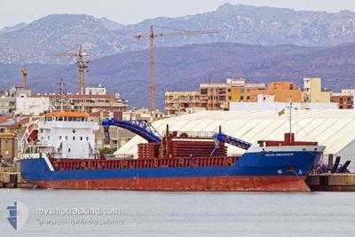
CELTIC AMBASSADOR
General Cargo

Current Trip
| Time Travelled | 1 day |
|---|---|
| Remaining Time | 5 days |
| Distance Travelled | 340.36 nm |
| Remaining Distance | 1413.53 nm |
| AVG Speed | 10.3 Noeuds |
| MAX Speed | 11.8 Noeuds |
| AVG Wind | 12.1 knots |
| MAX Wind | 22.9 knots |
| MIN Temp | 17°C / 62.6°F |
| MAX Temp | 28.6°C / 83.48°F |
| Tirant d eau | 6.5 m |
| Position reçue | 4 h, 14 m depuis |
Current Position
| Longitude | -9.45963° |
|---|---|
| Latitude | 37.40424° |
| Etat | Under way using engine |
| Vitesse | 10.3 Noeuds |
| Parcours | 349.5° |
| Zone | North Atlantic Ocean |
| Station | T-AIS |
| Position reçue | 4 h, 14 m depuis |
Information
The current position of CELTIC AMBASSADOR is in North Atlantic Ocean with coordinates 37.40424° / -9.45963° as reported on 2025-06-12 20:26 by AIS to our vessel tracker app. The vessel's current speed is 10.3 Noeuds and is heading at the port of ROSYTH. The estimated time of arrival as calculated by MyShipTracking vessel tracking app is 2025-06-18 18:07 LT
The vessel CELTIC AMBASSADOR (IMO: 9312705, MMSI: 232033027) is a General Cargo that was built in 2005 ( 20 Age ). It's sailing under the flag of [GB] United Kingdom.
In this page you can find informations about the vessels current position, last detected port calls, and current voyage information. If the vessels is not in coverage by AIS you will find the latest position.
The current position of CELTIC AMBASSADOR is detected by our AIS receivers and we are not responsible for the reliability of the data. The last position was recorded while the vessel was in Coverage by the Ais receivers of our vessel tracking app.
The current draught of CELTIC AMBASSADOR as reported by AIS is 6.5 meters
Weather
| Temperature | 18.4°C / 65.12°F |
|---|---|
| Wind Speed | 11 knots |
| Direction | 331° NNW |
| Pressure | 1017.3 hPa |
| Humidity | 90.4 % |
| Cloud Coverage | 6 % |


Featured Company
Last Port Calls
| Port | Arrival | Departure | Time In Port |
|---|---|---|---|
| 2025-06-10 12:12 | 2025-06-11 17:56 | 1 d | |
| 2025-06-05 22:14 | 2025-06-07 06:18 | 1 d | |
| 2025-05-28 14:32 | 2025-05-30 16:16 | 2 d | |
| 2025-05-24 08:12 | 2025-05-26 22:33 | 2 d | |
| 2025-05-16 21:21 | 2025-05-23 02:25 | 6 d | |
| 2025-05-06 04:55 | 2025-05-06 05:40 | 45 m | |
| 2025-05-01 05:16 | 2025-05-06 00:06 | 4 d | |
| 2025-05-01 00:20 | 2025-05-01 00:45 | 24 m | |
| 2025-04-24 07:29 | 2025-04-25 21:11 | 1 d | |
| 2025-04-19 12:12 | 2025-04-23 19:18 | 4 d |
Most Visited Ports (Last year)
| Port | Arrivals | |
|---|---|---|
| 9 | ||
| 9 | ||
| 4 | ||
| 4 | ||
| 4 | ||
| 3 |
Last Trips
| Origin | Departure | Destination | Arrival | Distance | |
|---|---|---|---|---|---|
| 2025-06-07 06:18 | 2025-06-10 12:12 | 377.15 nm | |||
| 2025-05-30 16:16 | 2025-06-05 22:14 | 1610.84 nm | |||
| 2025-05-26 22:33 | 2025-05-28 14:32 | 417.01 nm | |||
| 2025-05-23 02:25 | 2025-05-24 08:12 | 244.56 nm | |||
| 2025-05-06 05:40 | 2025-05-16 21:21 | 1861.16 nm | |||
| 2025-05-06 00:06 | 2025-05-06 04:55 | 49.29 nm | |||
| 2025-05-01 00:45 | 2025-05-01 05:16 | 49.02 nm | |||
| 2025-04-25 21:11 | 2025-05-01 00:20 | 1388.57 nm | |||
| 2025-04-23 19:18 | 2025-04-24 07:29 | 32.25 nm | |||
| 2025-04-10 23:20 | 2025-04-19 12:12 | 1670.60 nm |
Events
| Heure | Evenement | Détails | Position/ Destination | Info |
|---|---|---|---|---|
| 2025-06-12 20:33 | Etat Changé | Default Under way using engine |
37.42427 / -9.46433
ROSYTH
|
Vitesse: 10.3 kn Parcours: 349.5° |
| 2025-06-12 20:26 | Hors de la zone couverte |
37.40424 / -9.45963
North Atlantic Ocean
ROSYTH
|
Vitesse: 10.3 kn Parcours: 349.5° |
|
| 2025-06-12 20:16 | Changement de zone | Portuguese part of the North Atlantic Ocean Spanish part of the Strait of Gibraltar |
37.37812 / -9.45363
North Atlantic Ocean
ROSYTH
|
Vitesse: 10.2 kn Parcours: 348.7° |
| 2025-06-12 20:15 | Etat Changé | Under way using engine Default |
37.37346 / -9.45251
ROSYTH
|
Vitesse: 10.4 kn Parcours: 350° |
| 2025-06-12 19:57 | Dans la zone couverte |
37.37812 / -9.45363
North Atlantic Ocean
ROSYTH
|
Vitesse: 10.2 kn Parcours: 348.7° |
|
| 2025-06-12 00:53 | Etat Changé | Default Under way using engine |
35.96269 / -5.90241
ROSYTH
|
Vitesse: 11 kn Parcours: 268.9° |
| 2025-06-12 00:46 | Hors de la zone couverte |
35.96305 / -5.87664
Strait of Gibraltar
ROSYTH
|
Vitesse: 11 kn Parcours: 268.9° |
|
| 2025-06-12 00:34 | Etat Changé | Under way using engine Default |
35.96381 / -5.83073
ROSYTH
|
Vitesse: 11.2 kn Parcours: 268° |
| 2025-06-12 00:29 | Etat Changé | Default Under way using engine |
35.96447 / -5.81093
ROSYTH
|
Vitesse: 11 kn Parcours: 267.9° |
| 2025-06-12 00:20 | Etat Changé | Under way using engine Default |
35.96462 / -5.77918
ROSYTH
|
Vitesse: 11.4 kn Parcours: 270° |