
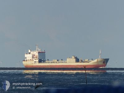
CEMENT TRADER
Cement Carrier
Current Trip
| Time Travelled | 6 days |
|---|---|
| Remaining Time | --- |
| Distance Travelled | 697.77 nm |
| Remaining Distance | --- |
| AVG Speed | 9.8 Noeuds |
| MAX Speed | 12 Noeuds |
| AVG Wind | 15.7 knots |
| MAX Wind | 27 knots |
| MIN Temp | 11.2°C / 52.16°F |
| MAX Temp | 17°C / 62.6°F |
| Tirant d eau | 7.2 m |
| Position reçue | 2 d depuis |
Current Position
| Longitude | -8.89012° |
|---|---|
| Latitude | 42.16199° |
| Etat | Under way using engine |
| Vitesse | 10.2 Noeuds |
| Parcours | 78.1° |
| Zone | North Atlantic Ocean |
| Station | T-AIS |
| Position reçue | 2 d depuis |
Info
Information
The current position of CEMENT TRADER is in North Atlantic Ocean with coordinates 42.16199° / -8.89012° as reported on 2025-12-11 21:47 by AIS to our vessel tracker app. The vessel's current speed is 10.2 Noeuds
The vessel CEMENT TRADER (IMO: 7716763, MMSI: 304048000) is a Cement Carrier that was built in 1980 ( 45 Age ). It's sailing under the flag of [AG] Antigua Barbuda.
In this page you can find informations about the vessels current position, last detected port calls, and current voyage information. If the vessels is not in coverage by AIS you will find the latest position.
The current position of CEMENT TRADER is detected by our AIS receivers and we are not responsible for the reliability of the data. The last position was recorded while the vessel was in Coverage by the Ais receivers of our vessel tracking app.
The current draught of CEMENT TRADER as reported by AIS is 7.2 meters
Weather
| Temperature | 13.5°C / 56.3°F |
|---|---|
| Wind Speed | 12 knots |
| Direction | 193° SSW |
| Pressure | 1018.2 hPa |
| Humidity | 84.8 % |
| Cloud Coverage | 100 % |
Featured Company
Last Port Calls
| Port | Arrival | Departure | Time In Port |
|---|---|---|---|
| 2025-12-06 02:03 | 2025-12-08 03:14 | 2 d | |
| 2025-11-11 19:17 | 2025-11-15 06:09 | 3 d | |
| 2025-11-11 18:02 | 2025-11-11 19:00 | 58 m | |
| 2025-10-30 16:23 | 2025-11-02 01:36 | 2 d | |
| 2025-10-07 06:13 | 2025-10-10 00:10 | 2 d | |
| 2025-10-02 14:12 | 2025-10-04 13:47 | 1 d |
Last Trips
| Origin | Departure | Destination | Arrival | Distance | |
|---|---|---|---|---|---|
| 2025-11-15 06:09 | 2025-12-06 02:03 | 2428.82 nm | |||
| 2025-11-11 19:00 | 2025-11-11 19:17 | 1.14 nm | |||
| 2025-11-02 01:36 | 2025-11-11 18:02 | 1335.58 nm | |||
| 2025-10-10 00:10 | 2025-10-30 16:23 | 2615.46 nm | |||
| 2025-10-04 13:47 | 2025-10-07 06:13 | 414.53 nm | |||
| 2025-09-18 09:02 | 2025-10-02 14:12 | 2414.20 nm |
Events
| Heure | Evenement | Détails | Position/ Destination | Info |
|---|---|---|---|---|
| 2025-12-13 14:14 | Démarrage | 4.99 nm, South West of CANGAS |
42.21571 / -8.87994
ES VGO
|
Vitesse: 7.1 kn Parcours: 64° |
| 2025-12-12 06:33 | Arret | 5.26 nm, South West of CANGAS |
42.21423 / -8.88568
ES VGO
|
Vitesse: 0.1 kn Parcours: 353° |
| 2025-12-11 22:39 | Arret | 5.19 nm, South West of CANGAS |
42.21800 / -8.88660
ES VGO
|
Vitesse: Parcours: 158° |
| 2025-12-11 21:54 | Etat Changé | Default Under way using engine |
42.17328 / -8.86739
ES VGO
|
Vitesse: 10.2 kn Parcours: 78.1° |
| 2025-12-11 21:47 | Changement de zone | Spanish part of the North Atlantic Ocean Portuguese part of the North Atlantic Ocean |
42.16199 / -8.89012
North Atlantic Ocean
ES VGO
|
Vitesse: 10.2 kn Parcours: 78.1° |
| 2025-12-11 21:47 | Etat Changé | Under way using engine Default |
42.16199 / -8.89012
ES VGO
|
Vitesse: 10 kn Parcours: 66° |
| 2025-12-11 21:47 | Hors de la zone couverte |
42.16199 / -8.89012
North Atlantic Ocean
ES VGO
|
Vitesse: 10.2 kn Parcours: 78.1° |
|
| 2025-12-11 21:39 | Dans la zone couverte |
42.16199 / -8.89012
North Atlantic Ocean
ES VGO
|
Vitesse: 10.2 kn Parcours: 78.1° |
|
| 2025-12-11 04:49 | Etat Changé | Default Under way using engine |
39.30372 / -9.74277
ES VGO
|
Vitesse: 9.9 kn Parcours: 358.8° |
| 2025-12-11 04:43 | Hors de la zone couverte |
39.28853 / -9.74140
North Atlantic Ocean
ES VGO
|
Vitesse: 9.9 kn Parcours: 358.8° |