

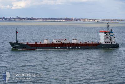
CEMLUNA
Cement Carrier

Current Trip
| Time Travelled | 2 days |
|---|---|
| Remaining Time | 3 h, 5 mins |
| Distance Travelled | 515.27 nm |
| Remaining Distance | 28.97 nm |
| AVG Speed | 9.7 Noeuds |
| MAX Speed | 12.1 Noeuds |
| AVG Wind | 9.6 knots |
| MAX Wind | 17 knots |
| MIN Temp | 10.7°C / 51.26°F |
| MAX Temp | 14.9°C / 58.82°F |
| Tirant d eau | 3.4 m |
| Position reçue | Maintenant |
Current Position
| Longitude | 10.60549° |
|---|---|
| Latitude | 57.07839° |
| Etat | Under way using engine |
| Vitesse | 8.7 Noeuds |
| Parcours | 203.2° |
| Zone | Kattegat |
| Station | T-AIS |
| Position reçue | Maintenant |
Information
The current position of CEMLUNA is in Kattegat with coordinates 57.07839° / 10.60549° as reported on 2025-06-01 06:03 by AIS to our vessel tracker app. The vessel's current speed is 8.7 Noeuds and is heading at the port of AALBORG. The estimated time of arrival as calculated by MyShipTracking vessel tracking app is 2025-06-01 09:09 LT
The vessel CEMLUNA (IMO: 9007063, MMSI: 209671000) is a Cement Carrier that was built in 1991 ( 34 Age ). It's sailing under the flag of [CY] Cyprus.
In this page you can find informations about the vessels current position, last detected port calls, and current voyage information. If the vessels is not in coverage by AIS you will find the latest position.
The current position of CEMLUNA is detected by our AIS receivers and we are not responsible for the reliability of the data. The last position was recorded while the vessel was in Coverage by the Ais receivers of our vessel tracking app.
The current draught of CEMLUNA as reported by AIS is 3.4 meters
Weather
| Temperature | 13.6°C / 56.48°F |
|---|---|
| Wind Speed | 14 knots |
| Direction | 156° SSE |
| Pressure | 1010.3 hPa |
| Humidity | 90.9 % |
| Cloud Coverage | 75 % |


Featured Company
Last Port Calls
| Port | Arrival | Departure | Time In Port |
|---|---|---|---|
| 2025-05-28 21:08 | 2025-05-30 02:26 | 1 d | |
| 2025-05-28 10:49 | 2025-05-28 18:34 | 7 h | |
| 2025-05-28 09:49 | 2025-05-28 10:29 | 39 m | |
| 2025-05-24 07:39 | 2025-05-24 19:37 | 11 h | |
| 2025-05-19 18:38 | 2025-05-20 22:47 | 1 d | |
| 2025-05-15 20:20 | 2025-05-16 09:39 | 13 h | |
| 2025-05-11 19:47 | 2025-05-13 05:35 | 1 d | |
| 2025-05-07 18:36 | 2025-05-08 06:10 | 11 h | |
| 2025-05-02 13:40 | 2025-05-03 19:20 | 1 d | |
| 2025-04-26 08:45 | 2025-04-28 11:38 | 2 d |
Last Trips
| Origin | Departure | Destination | Arrival | Distance | |
|---|---|---|---|---|---|
| 2025-05-28 20:34 | 2025-05-28 23:08 | 19.21 nm | |||
| 2025-05-28 12:29 | 2025-05-28 12:49 | 1.12 nm | |||
| 2025-05-24 21:37 | 2025-05-28 11:49 | 543.79 nm | |||
| 2025-05-21 00:47 | 2025-05-24 09:39 | 573.77 nm | |||
| 2025-05-16 11:39 | 2025-05-19 20:38 | 587.95 nm | |||
| 2025-05-13 06:35 | 2025-05-15 22:20 | 561.82 nm | |||
| 2025-05-08 08:10 | 2025-05-11 20:47 | 573.14 nm | |||
| 2025-05-03 20:20 | 2025-05-07 20:36 | 829.29 nm | |||
| 2025-04-28 13:38 | 2025-05-02 14:40 | 829.98 nm | |||
| 2025-04-24 16:14 | 2025-04-26 10:45 | 400.22 nm |
Events
| Heure | Evenement | Détails | Position/ Destination | Info |
|---|---|---|---|---|
| 2025-06-01 01:19 | Changement de zone | Danish part of the Kattegat Danish part of the Skaggerak |
57.75867 / 10.76427
Kattegat
DKAAL
|
Vitesse: 9.3 kn Parcours: 182.9° |
| 2025-05-31 21:25 | Changement d'ETA | 2025/06/01 08:30 2025/06/01 07:00 |
57.58784 / 9.72659
DKAAL
|
Vitesse: 10 kn Parcours: 56.2° |
| 2025-05-31 21:19 | Démarrage | 8.4 nm, West of HIRTSHALS |
57.57979 / 9.70424
DKAAL
|
Vitesse: 6.2 kn Parcours: 54.5° |
| 2025-05-31 21:14 | Etat Changé | Under way using engine Not under command |
57.57912 / 9.70068
DKAAL
|
Vitesse: 0.3 kn Parcours: 187° |
| 2025-05-31 21:13 | Arret | 8.51 nm, West of HIRTSHALS |
57.57908 / 9.70078
DKAAL
|
Vitesse: 0.3 kn Parcours: 192° |
| 2025-05-31 21:01 | Etat Changé | Not under command Under way using engine |
57.57670 / 9.70492
DKAAL
|
Vitesse: 2 kn Parcours: 326° |
| 2025-05-31 16:41 | Changement de zone | Danish part of the Skaggerak Danish part of the North Sea |
57.16074 / 8.55341
Skaggerak
DKAAL
|
Vitesse: 11 kn Parcours: 54.1° |
| 2025-05-31 05:56 | Etat Changé | Under way using engine Default |
55.59067 / 6.68966
DKAAL
|
Vitesse: 10 kn Parcours: 32° |
| 2025-05-31 05:50 | Etat Changé | Default Under way using engine |
55.57439 / 6.67227
DKAAL
|
Vitesse: 10 kn Parcours: 32.1° |
| 2025-05-31 05:10 | Detecté en mer | Danish part of the North Sea |
55.48025 / 6.56794
North Sea
DKAAL
|
Vitesse: 10.1 kn Parcours: 30.2° |