

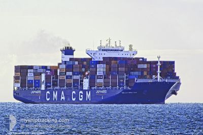
CMA CGM AMBITION
Cargo D

Current Trip
| Time Travelled | 1 day |
|---|---|
| Remaining Time | 5 days |
| Distance Travelled | 544.56 nm |
| Remaining Distance | 2715.95 nm |
| AVG Speed | 16.3 Noeuds |
| MAX Speed | 19 Noeuds |
| AVG Wind | 8.8 knots |
| MAX Wind | 14.4 knots |
| MIN Temp | 18.1°C / 64.58°F |
| MAX Temp | 20.1°C / 68.18°F |
| Tirant d eau | 14.8 m |
| Position reçue | 7 h, 58 m depuis |
Current Position
| Longitude | -13.79986° |
|---|---|
| Latitude | 37.29291° |
| Etat | Under way using engine |
| Vitesse | 18.2 Noeuds |
| Parcours | 289.2° |
| Zone | North Atlantic Ocean |
| Station | T-AIS |
| Position reçue | 7 h, 58 m depuis |
Information
The current position of CMA CGM AMBITION is in North Atlantic Ocean with coordinates 37.29291° / -13.79986° as reported on 2025-06-12 04:37 by AIS to our vessel tracker app. The vessel's current speed is 18.2 Noeuds and is heading at the port of NEW YORK. The estimated time of arrival as calculated by MyShipTracking vessel tracking app is 2025-06-18 07:28 LT
The vessel CMA CGM AMBITION (IMO: 9951551, MMSI: 256787000) is a Cargo D It's sailing under the flag of [MT] Malta.
In this page you can find informations about the vessels current position, last detected port calls, and current voyage information. If the vessels is not in coverage by AIS you will find the latest position.
The current position of CMA CGM AMBITION is detected by our AIS receivers and we are not responsible for the reliability of the data. The last position was recorded while the vessel was in Coverage by the Ais receivers of our vessel tracking app.
The current draught of CMA CGM AMBITION as reported by AIS is 14.8 meters
Weather
| Temperature | 19.3°C / 66.74°F |
|---|---|
| Wind Speed | 12 knots |
| Direction | 224° SW |
| Pressure | 1017.2 hPa |
| Humidity | 79.8 % |
| Cloud Coverage | 88 % |


Featured Company
Last Port Calls
| Port | Arrival | Departure | Time In Port |
|---|---|---|---|
| 2025-06-10 13:18 | 2025-06-11 07:00 | 17 h | |
| 2025-06-01 13:02 | 2025-06-03 02:35 | 1 d | |
| 2025-05-29 00:56 | 2025-05-30 06:53 | 1 d | |
| 2025-05-24 09:52 | 2025-05-26 12:25 | 2 d | |
| 2025-05-21 18:50 | 2025-05-22 21:16 | 1 d | |
| 2025-05-18 08:58 | 2025-05-19 07:36 | 22 h | |
| 2025-05-01 15:39 | 2025-05-02 22:58 | 1 d | |
| 2025-04-28 20:13 | 2025-04-30 08:34 | 1 d | |
| 2025-04-24 14:15 | 2025-04-25 12:12 | 21 h | |
| 2025-04-21 01:18 | 2025-04-21 02:36 | 1 h |
Last Trips
| Origin | Departure | Destination | Arrival | Distance | |
|---|---|---|---|---|---|
| 2025-06-03 02:35 | 2025-06-10 13:18 | 625.43 nm | |||
| 2025-05-30 06:53 | 2025-06-01 13:02 | 568.57 nm | |||
| 2025-05-26 12:25 | 2025-05-29 00:56 | 79.94 nm | |||
| 2025-05-22 21:16 | 2025-05-24 09:52 | 397.81 nm | |||
| 2025-05-19 07:36 | 2025-05-21 18:50 | 1012.18 nm | |||
| 2025-05-02 22:58 | 2025-05-18 08:58 | 4048.58 nm | |||
| 2025-04-30 08:34 | 2025-05-01 15:39 | 424.70 nm | |||
| 2025-04-25 12:12 | 2025-04-28 20:13 | 555.68 nm | |||
| 2025-04-21 02:36 | 2025-04-24 14:15 | 316.39 nm | |||
| 2025-04-09 12:43 | 2025-04-21 01:18 | 3814.49 nm |
Events
| Heure | Evenement | Détails | Position/ Destination | Info |
|---|---|---|---|---|
| 2025-06-12 04:48 | Etat Changé | Default Under way using engine |
37.31059 / -13.86225
USNYC
|
Vitesse: 18.2 kn Parcours: 289.2° |
| 2025-06-12 04:37 | Hors de la zone couverte |
37.29291 / -13.79986
North Atlantic Ocean
USNYC
|
Vitesse: 18.2 kn Parcours: 289.2° |
|
| 2025-06-12 04:32 | Changement de zone | High seas of the North Atlantic Ocean Spanish part of the Strait of Gibraltar |
37.28348 / -13.76653
North Atlantic Ocean
USNYC
|
Vitesse: 18.2 kn Parcours: 289.8° |
| 2025-06-12 04:32 | Etat Changé | Under way using engine Default |
37.28348 / -13.76653
USNYC
|
Vitesse: 18.2 kn Parcours: 290° |
| 2025-06-12 04:32 | Dans la zone couverte |
37.28348 / -13.76653
North Atlantic Ocean
USNYC
|
Vitesse: 18.2 kn Parcours: 289.8° |
|
| 2025-06-11 07:01 | Etat Changé | Default Under way using engine |
35.96824 / -5.83495
USNYC
|
Vitesse: 17.2 kn Parcours: 270.6° |
| 2025-06-11 06:56 | Etat Changé | Under way using engine Default |
35.96787 / -5.80502
USNYC
|
Vitesse: 17 kn Parcours: 271° |
| 2025-06-11 06:56 | Hors de la zone couverte |
35.96787 / -5.80502
Strait of Gibraltar
USNYC
|
Vitesse: 17.2 kn Parcours: 270.6° |
|
| 2025-06-11 06:53 | Etat Changé | Default Under way using engine |
35.96766 / -5.78872
USNYC
|
Vitesse: 16.1 kn Parcours: 269.5° |
| 2025-06-11 05:00 | PORT DE DEPART |
|
36.11231 / -5.41341
USNYC
|
Vitesse: 6.8 kn Parcours: 121° |