

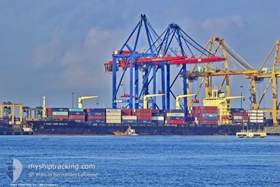
CMA CGM MALTA
Container Ship
Current Trip
| Time Travelled | 1 day |
|---|---|
| Remaining Time | --- |
| Distance Travelled | 408.31 nm |
| Remaining Distance | --- |
| AVG Speed | 13.4 Noeuds |
| MAX Speed | 15.7 Noeuds |
| AVG Wind | 7.8 knots |
| MAX Wind | 13 knots |
| MIN Temp | 25.8°C / 78.44°F |
| MAX Temp | 32.3°C / 90.14°F |
| Tirant d eau | 11.4 m |
| Position reçue | 17 d depuis |
Current Position
| Longitude | -14.07050° |
|---|---|
| Latitude | 27.61749° |
| Etat | Under way using engine |
| Vitesse | 14.2 Noeuds |
| Parcours | 222.9° |
| Zone | North Atlantic Ocean |
| Station | T-AIS |
| Position reçue | 17 d depuis |
Information
The current position of CMA CGM MALTA is in North Atlantic Ocean with coordinates 27.61749° / -14.07050° as reported on 2025-04-09 00:56 by AIS to our vessel tracker app. The vessel's current speed is 14.2 Noeuds and is heading at the port of NASSIT.
The vessel CMA CGM MALTA (IMO: 9301433, MMSI: 229340000) is a Container Ship that was built in 2004 ( 21 Age ). It's sailing under the flag of [MT] Malta.
In this page you can find informations about the vessels current position, last detected port calls, and current voyage information. If the vessels is not in coverage by AIS you will find the latest position.
The current position of CMA CGM MALTA is detected by our AIS receivers and we are not responsible for the reliability of the data. The last position was recorded while the vessel was in Coverage by the Ais receivers of our vessel tracking app.
The current draught of CMA CGM MALTA as reported by AIS is 11.4 meters
Weather
| Temperature | 28.6°C / 83.48°F |
|---|---|
| Wind Speed | 6 knots |
| Direction | 170° S |
| Pressure | 1009.4 hPa |
| Humidity | 74.7 % |
| Cloud Coverage | 100 % |
Featured Company
Last Port Calls
| Port | Arrival | Departure | Time In Port |
|---|---|---|---|
| 2025-04-24 17:36 | 2025-04-25 13:52 | 20 h | |
| 2025-04-19 17:56 | 2025-04-23 18:17 | 4 d | |
| 2025-04-16 17:58 | 2025-04-17 16:46 | 22 h | |
| 2025-04-05 09:54 | 2025-04-07 02:44 | 1 d | |
| 2025-03-31 22:58 | 2025-04-01 08:01 | 9 h | |
| 2025-03-22 17:03 | 2025-03-23 14:19 | 21 h | |
| 2025-03-22 03:39 | 2025-03-22 12:43 | 9 h | |
| 2025-03-20 17:51 |
Last Trips
| Origin | Departure | Destination | Arrival | Distance | |
|---|---|---|---|---|---|
| 2025-04-23 18:17 | 2025-04-24 17:36 | 322.41 nm | |||
| 2025-04-17 16:46 | 2025-04-19 17:56 | 321.52 nm | |||
| 2025-04-07 02:44 | 2025-04-16 17:58 | 2100.39 nm | |||
| 2025-04-01 08:01 | 2025-04-05 09:54 | 250.74 nm | |||
| 2025-03-23 14:19 | 2025-03-31 22:58 | 1963.22 nm | |||
| 2025-03-22 12:43 | 2025-03-22 17:03 | 48.06 nm | |||
| 2025-03-20 17:51 | 2025-03-22 03:39 | 80.04 nm |
Events
| Heure | Evenement | Détails | Position/ Destination | Info |
|---|---|---|---|---|
| 2025-04-25 13:52 | PORT DE DEPART |
|
4.73641 / -6.61022
SLFNA
|
Vitesse: 3.3 kn Parcours: 115° |
| 2025-04-25 13:48 | Démarrage |
4.73909 / -6.61543
[CI] SAN PEDRO
|
Vitesse: 3.3 kn Parcours: 115° |
|
| 2025-04-24 18:00 | Arret |
4.73861 / -6.61846
[CI] SAN PEDRO
|
Vitesse: Parcours: 170° |
|
| 2025-04-24 17:36 | Port d'arrivée |
|
4.73794 / -6.61280
[CI] SAN PEDRO
|
Vitesse: 5.2 kn Parcours: 283° |
| 2025-04-23 18:17 | PORT DE DEPART |
|
6.35282 / -10.81697
SLFNA
|
Vitesse: 5.8 kn Parcours: 299° |
| 2025-04-23 18:10 | Démarrage |
6.34610 / -10.80575
[LR] MONROVIA
|
Vitesse: 4.2 kn Parcours: 300° |
|
| 2025-04-19 18:19 | Arret |
6.34323 / -10.79639
[LR] MONROVIA
|
Vitesse: 0.2 kn Parcours: 201° |
|
| 2025-04-19 17:56 | Port d'arrivée |
|
6.34849 / -10.80973
[LR] MONROVIA
|
Vitesse: 6.1 kn Parcours: 125° |
| 2025-04-19 17:38 | Démarrage | 2.07 nm, West of MONROVIA |
6.35847 / -10.83640
SLFNA
|
Vitesse: 4.4 kn Parcours: 91° |
| 2025-04-19 17:30 | Arret | 2.45 nm, West of MONROVIA |
6.36001 / -10.84256
SLFNA
|
Vitesse: 0.2 kn Parcours: 107° |