
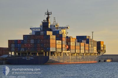
CMA CGM MONTREAL
Container Ship
Current Trip
| Time Travelled | 17 h, 53 mins |
|---|---|
| Remaining Time | --- |
| Distance Travelled | 117.34 nm |
| Remaining Distance | --- |
| AVG Speed | 9.6 Noeuds |
| MAX Speed | 11.1 Noeuds |
| AVG Wind | 3.7 knots |
| MAX Wind | 7.8 knots |
| MIN Temp | 8.3°C / 46.94°F |
| MAX Temp | 10.9°C / 51.62°F |
| Tirant d eau | 8.4 m |
| Position reçue | 1 m depuis |
Current Position
| Longitude | 14.06108° |
|---|---|
| Latitude | 44.33760° |
| Etat | Under way using engine |
| Vitesse | 0.3 Noeuds |
| Parcours | 38° |
| Zone | Adriatic Sea |
| Station | T-AIS |
| Position reçue | 1 m depuis |
Info
Information
The current position of CMA CGM MONTREAL is in Adriatic Sea with coordinates 44.33760° / 14.06108° as reported on 2025-02-10 15:05 by AIS to our vessel tracker app. The vessel's current speed is 0.3 Noeuds
The vessel CMA CGM MONTREAL (IMO: 9363417, MMSI: 229846000) is a Container Ship that was built in 2007 ( 18 Age ). It's sailing under the flag of [MT] Malta.
In this page you can find informations about the vessels current position, last detected port calls, and current voyage information. If the vessels is not in coverage by AIS you will find the latest position.
The current position of CMA CGM MONTREAL is detected by our AIS receivers and we are not responsible for the reliability of the data. The last position was recorded while the vessel was in Coverage by the Ais receivers of our vessel tracking app.
The current draught of CMA CGM MONTREAL as reported by AIS is 8.4 meters
Weather
| Temperature | 10.7°C / 51.26°F |
|---|---|
| Wind Speed | 2 knots |
| Direction | 286° WNW |
| Pressure | 1025 hPa |
| Humidity | 77.5 % |
| Cloud Coverage | 100 % |
Featured Company
Last Port Calls
| Port | Arrival | Departure | Time In Port |
|---|---|---|---|
| 2025-02-09 11:15 | 2025-02-09 22:14 | 10 h | |
| 2025-02-07 12:45 | 2025-02-09 03:05 | 1 d | |
| 2025-02-06 11:49 | 2025-02-06 18:49 | 7 h | |
| 2025-02-05 06:26 | 2025-02-05 16:25 | 9 h | |
| 2025-02-01 12:49 | 2025-02-02 22:31 | 1 d | |
| 2025-01-26 04:33 | 2025-01-26 09:32 | 4 h | |
| 2025-01-25 16:07 | 2025-01-25 22:48 | 6 h | |
| 2025-01-25 02:56 | 2025-01-25 09:59 | 7 h | |
| 2025-01-23 20:05 | 2025-01-24 04:33 | 8 h | |
| 2025-01-23 06:00 | 2025-01-23 15:15 | 9 h |
Last Trips
| Origin | Departure | Destination | Arrival | Distance | |
|---|---|---|---|---|---|
| 2025-02-09 03:05 | 2025-02-09 11:15 | 74.15 nm | |||
| 2025-02-06 18:49 | 2025-02-07 12:45 | 104.45 nm | |||
| 2025-02-05 16:25 | 2025-02-06 11:49 | 116.49 nm | |||
| 2025-02-02 22:31 | 2025-02-05 06:26 | 676.22 nm | |||
| 2025-01-26 09:32 | 2025-02-01 12:49 | 956.15 nm | |||
| 2025-01-25 22:48 | 2025-01-26 04:33 | 62.62 nm | |||
| 2025-01-25 09:59 | 2025-01-25 16:07 | 51.25 nm | |||
| 2025-01-24 04:33 | 2025-01-25 02:56 | 261.60 nm | |||
| 2025-01-23 15:15 | 2025-01-23 20:05 | 40.08 nm | |||
| 2025-01-21 18:13 | 2025-01-23 06:00 | 455.44 nm |
Events
| Heure | Evenement | Détails | Position/ Destination | Info |
|---|---|---|---|---|
| 2025-02-10 08:31 | Arret | 15.34 nm, South West of SUSAK |
44.38606 / 14.00205
HRRJK
|
Vitesse: 0.3 kn Parcours: 326° |
| 2025-02-10 01:23 | Changement de zone | Croatian part of the Adriatic Sea Italian part of the Adriatic Sea |
45.26626 / 13.05978
Adriatic Sea
HRRJK
|
Vitesse: 10.3 kn Parcours: 171.2° |
| 2025-02-10 01:19 | Tirant d'eau modifié | 8.4 8 |
45.27759 / 13.05726
HRRJK
|
Vitesse: 10.3 kn Parcours: 171.3° |
| 2025-02-10 01:19 | Changement d'ETA | 2025/02/11 06:00 |
45.27759 / 13.05726
HRRJK
|
Vitesse: 10.3 kn Parcours: 171.3° |
| 2025-02-10 01:13 | Tirant d'eau modifié | 8 8.4 |
45.29465 / 13.05348
HRRJK
|
Vitesse: 10.3 kn Parcours: 171.1° |
| 2025-02-10 00:25 | Tirant d'eau modifié | 8.4 8 |
45.42254 / 13.09772
HRRJK
|
Vitesse: 10.2 kn Parcours: 214.6° |
| 2025-02-10 00:25 | Changement d'ETA | 2025/02/11 06:00 |
45.42254 / 13.09772
HRRJK
|
Vitesse: 10.2 kn Parcours: 214.6° |
| 2025-02-10 00:13 | Tirant d'eau modifié | 8 8.4 |
45.44729 / 13.13033
HRRJK
|
Vitesse: 10.2 kn Parcours: 228.1° |
| 2025-02-09 23:31 | Tirant d'eau modifié | 8.4 8 |
45.52697 / 13.25908
HRRJK
|
Vitesse: 10.3 kn Parcours: 229° |
| 2025-02-09 23:31 | Changement d'ETA | 2025/02/11 06:00 |
45.52697 / 13.25908
HRRJK
|
Vitesse: 10.3 kn Parcours: 229° |