
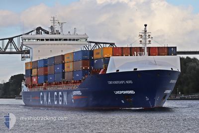
CONTAINERSHIPS NORD
Cargo A
Current Trip
| Time Travelled | 18 h, 21 mins |
|---|---|
| Remaining Time | 1 day |
| Distance Travelled | 259.00 nm |
| Remaining Distance | 475.46 nm |
| AVG Speed | 12.5 Noeuds |
| MAX Speed | 17.5 Noeuds |
| AVG Wind | 14.3 knots |
| MAX Wind | 23 knots |
| MIN Temp | -0.3°C / 31.46°F |
| MAX Temp | 3.9°C / 39.02°F |
| Tirant d eau | 7.1 m |
| Position reçue | 1 m depuis |
Current Position
| Longitude | 8.71969° |
|---|---|
| Latitude | 53.87264° |
| Etat | Under way using engine |
| Vitesse | 10 Noeuds |
| Parcours | 135.6° |
| Zone | North Sea |
| Station | T-AIS |
| Position reçue | 1 m depuis |
Info
Information
The current position of CONTAINERSHIPS NORD is in North Sea with coordinates 53.87264° / 8.71969° as reported on 2025-02-12 04:28 by AIS to our vessel tracker app. The vessel's current speed is 10 Noeuds and is heading at the port of KLAIPEDA. The estimated time of arrival as calculated by MyShipTracking vessel tracking app is 2025-02-14 01:42 LT
The vessel CONTAINERSHIPS NORD (IMO: 9813993, MMSI: 232046824) is a Cargo A It's sailing under the flag of [GB] United Kingdom.
In this page you can find informations about the vessels current position, last detected port calls, and current voyage information. If the vessels is not in coverage by AIS you will find the latest position.
The current position of CONTAINERSHIPS NORD is detected by our AIS receivers and we are not responsible for the reliability of the data. The last position was recorded while the vessel was in Coverage by the Ais receivers of our vessel tracking app.
The current draught of CONTAINERSHIPS NORD as reported by AIS is 7.1 meters
Weather
| Temperature | -1.3°C / 29.66°F |
|---|---|
| Wind Speed | 14 knots |
| Direction | 96° E |
| Pressure | 1021.4 hPa |
| Humidity | 78.3 % |
| Cloud Coverage | 100 % |
Featured Company
Last Port Calls
| Port | Arrival | Departure | Time In Port |
|---|---|---|---|
| 2025-02-10 16:41 | 2025-02-11 10:09 | 17 h | |
| 2025-02-08 16:36 | 2025-02-09 21:02 | 1 d | |
| 2025-02-05 02:57 | 2025-02-05 21:30 | 18 h | |
| 2025-02-03 20:18 | 2025-02-04 19:08 | 22 h | |
| 2025-01-30 11:57 | 2025-01-31 23:51 | 1 d | |
| 2025-01-30 11:33 | 2025-01-30 11:44 | 11 m | |
| 2025-01-28 20:22 | 2025-01-29 13:53 | 17 h | |
| 2025-01-27 08:41 | 2025-01-27 09:22 | 41 m | |
| 2025-01-25 06:29 | 2025-01-26 09:26 | 1 d | |
| 2025-01-24 04:22 | 2025-01-24 22:34 | 18 h |
Last Trips
| Origin | Departure | Destination | Arrival | Distance | |
|---|---|---|---|---|---|
| 2025-02-09 21:02 | 2025-02-10 17:41 | 281.39 nm | |||
| 2025-02-05 22:30 | 2025-02-08 16:36 | 1010.05 nm | |||
| 2025-02-04 21:08 | 2025-02-05 03:57 | 118.48 nm | |||
| 2025-01-31 23:51 | 2025-02-03 22:18 | 844.46 nm | |||
| 2025-01-30 11:44 | 2025-01-30 11:57 | 0.33 nm | |||
| 2025-01-29 13:53 | 2025-01-30 11:33 | 286.19 nm | |||
| 2025-01-27 10:22 | 2025-01-28 20:22 | 428.55 nm | |||
| 2025-01-26 10:26 | 2025-01-27 09:41 | 363.79 nm | |||
| 2025-01-25 00:34 | 2025-01-25 07:29 | 117.86 nm | |||
| 2025-01-21 17:44 | 2025-01-24 06:22 | 737.67 nm |
Events
| Heure | Evenement | Détails | Position/ Destination | Info |
|---|---|---|---|---|
| 2025-02-12 03:30 | Etat Changé | Under way using engine Default |
53.97202 / 8.49480
LTKLJ
|
Vitesse: 12 kn Parcours: 103° |
| 2025-02-12 03:29 | Etat Changé | Default Under way using engine |
53.97257 / 8.49028
LTKLJ
|
Vitesse: 11.8 kn Parcours: 103° |
| 2025-02-12 03:23 | Etat Changé | Under way using engine Default |
53.97655 / 8.45772
LTKLJ
|
Vitesse: 11.8 kn Parcours: 102° |
| 2025-02-12 02:49 | Etat Changé | Default Under way using engine |
53.99276 / 8.26423
LTKLJ
|
Vitesse: 9.5 kn Parcours: 94.7° |
| 2025-02-12 02:35 | Etat Changé | Under way using engine Default |
53.99037 / 8.19249
LTKLJ
|
Vitesse: 10 kn Parcours: 100° |
| 2025-02-12 01:48 | Etat Changé | Default Under way using engine |
53.96619 / 7.92391
LTKLJ
|
Vitesse: 13.1 kn Parcours: 76.2° |
| 2025-02-12 01:41 | Etat Changé | Under way using engine Default |
53.96128 / 7.88574
LTKLJ
|
Vitesse: 13.5 kn Parcours: 77° |
| 2025-02-12 01:41 | Dans la zone couverte |
53.96128 / 7.88574
North Sea
LTKLJ
|
Vitesse: 13 kn Parcours: 76.2° |
|
| 2025-02-12 00:47 | Etat Changé | Default Under way using engine |
53.91540 / 7.55089
LTKLJ
|
Vitesse: 13.6 kn Parcours: 77° |
| 2025-02-12 00:37 | Hors de la zone couverte |
53.90724 / 7.48886
North Sea
LTKLJ
|
Vitesse: 13.6 kn Parcours: 77° |