
CORAL MONACTIS
Lpg Tanker
Current Trip
| Time Travelled | 1 day |
|---|---|
| Remaining Time | 11 h, 59 mins |
| Distance Travelled | 412.13 nm |
| Remaining Distance | 135.06 nm |
| AVG Speed | 11.2 Noeuds |
| MAX Speed | 13.4 Noeuds |
| AVG Wind | 18.8 knots |
| MAX Wind | 24 knots |
| MIN Temp | 0.2°C / 32.36°F |
| MAX Temp | 3.4°C / 38.12°F |
| Tirant d eau | 6.5 m |
| Position reçue | 2 h, 25 m depuis |
Current Position
| Longitude | 4.29498° |
|---|---|
| Latitude | 53.12365° |
| Etat | Under way using engine |
| Vitesse | 10.9 Noeuds |
| Parcours | 226.8° |
| Zone | North Sea |
| Station | T-AIS |
| Position reçue | 2 h, 25 m depuis |
Info
Information
The current position of CORAL MONACTIS is in North Sea with coordinates 53.12365° / 4.29498° as reported on 2025-02-13 08:35 by AIS to our vessel tracker app. The vessel's current speed is 10.9 Noeuds and is heading at the port of ANTWERP. The estimated time of arrival as calculated by MyShipTracking vessel tracking app is 2025-02-13 22:59 LT
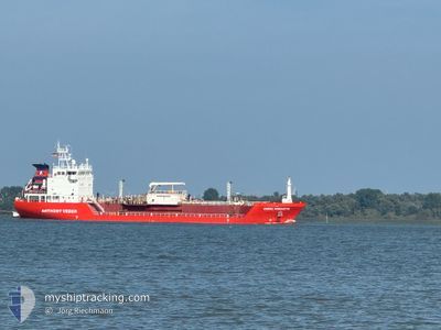
The vessel CORAL MONACTIS (IMO: 9373735, MMSI: 244870428) is a Lpg Tanker that was built in 2009 ( 16 Age ). It's sailing under the flag of [NL] Netherlands.
In this page you can find informations about the vessels current position, last detected port calls, and current voyage information. If the vessels is not in coverage by AIS you will find the latest position.
The current position of CORAL MONACTIS is detected by our AIS receivers and we are not responsible for the reliability of the data. The last position was recorded while the vessel was in Coverage by the Ais receivers of our vessel tracking app.
The current draught of CORAL MONACTIS as reported by AIS is 6.5 meters
Weather
| Temperature | 3.3°C / 37.94°F |
|---|---|
| Wind Speed | 16 knots |
| Direction | 36° NE |
| Pressure | 1023 hPa |
| Humidity | 74.2 % |
| Cloud Coverage | 97 % |
Featured Company
Last Port Calls
| Port | Arrival | Departure | Time In Port |
|---|---|---|---|
| 2025-02-10 23:22 | 2025-02-11 18:20 | 18 h | |
| 2025-02-06 22:10 | 2025-02-08 01:13 | 1 d | |
| 2025-02-03 09:06 | 2025-02-04 10:07 | 1 d | |
| 2025-01-29 18:17 | 2025-02-01 06:31 | 2 d | |
| 2025-01-26 03:22 | 2025-01-27 01:19 | 21 h | |
| 2025-01-22 00:43 | 2025-01-23 09:39 | 1 d | |
| 2025-01-06 23:33 | 2025-01-08 08:34 | 1 d | |
| 2025-01-01 03:58 | 2025-01-01 22:26 | 18 h | |
| 2024-12-26 19:28 | 2024-12-27 22:31 | 1 d | |
| 2024-12-22 23:07 | 2024-12-23 17:12 | 18 h |
Last Trips
| Origin | Departure | Destination | Arrival | Distance | |
|---|---|---|---|---|---|
| 2025-02-08 02:13 | 2025-02-11 00:22 | 563.07 nm | |||
| 2025-02-04 11:07 | 2025-02-06 23:10 | 565.62 nm | |||
| 2025-02-01 07:31 | 2025-02-03 10:06 | 564.10 nm | |||
| 2025-01-27 02:19 | 2025-01-29 19:17 | 568.22 nm | |||
| 2025-01-23 09:39 | 2025-01-26 04:22 | 569.68 nm | |||
| 2025-01-08 09:34 | 2025-01-22 00:43 | 2281.18 nm | |||
| 2025-01-01 23:26 | 2025-01-07 00:33 | 587.34 nm | |||
| 2024-12-27 23:31 | 2025-01-01 04:58 | 568.87 nm | |||
| 2024-12-23 18:12 | 2024-12-26 20:28 | 566.40 nm | |||
| 2024-12-18 14:34 | 2024-12-23 00:07 | 686.06 nm |
Events
| Heure | Evenement | Détails | Position/ Destination | Info |
|---|---|---|---|---|
| 2025-02-13 08:39 | Etat Changé | Default Under way using engine |
53.11519 / 4.27970
BE,ANR
|
Vitesse: 10.9 kn Parcours: 226.8° |
| 2025-02-13 08:35 | Etat Changé | Under way using engine Default |
53.12365 / 4.29498
BE,ANR
|
Vitesse: 10.8 kn Parcours: 227° |
| 2025-02-13 08:35 | Hors de la zone couverte |
53.12365 / 4.29498
North Sea
BE,ANR
|
Vitesse: 10.9 kn Parcours: 226.8° |
|
| 2025-02-13 08:24 | Etat Changé | Default Under way using engine |
53.14615 / 4.33523
BE,ANR
|
Vitesse: 10.7 kn Parcours: 226.6° |
| 2025-02-13 08:15 | Changement de zone | Dutch part of the North Sea German part of the North Sea |
53.16334 / 4.36576
North Sea
BE,ANR
|
Vitesse: 10.7 kn Parcours: 226.6° |
| 2025-02-13 08:15 | Etat Changé | Under way using engine Default |
53.16334 / 4.36576
BE,ANR
|
Vitesse: 10.7 kn Parcours: 221° |
| 2025-02-13 08:09 | Dans la zone couverte |
53.16334 / 4.36576
North Sea
BE,ANR
|
Vitesse: 10.7 kn Parcours: 226.6° |
|
| 2025-02-12 19:17 | Etat Changé | Default Under way using engine |
55.20685 / 5.76494
BE,ANR
|
Vitesse: 10 kn Parcours: 201.5° |
| 2025-02-12 19:15 | Hors de la zone couverte |
55.21294 / 5.76912
North Sea
BE,ANR
|
Vitesse: 10 kn Parcours: 201.5° |
|
| 2025-02-12 17:56 | Detecté en mer | German part of the North Sea |
55.41674 / 5.90887
North Sea
BE,ANR
|
Vitesse: 10.1 kn Parcours: 201.7° |