

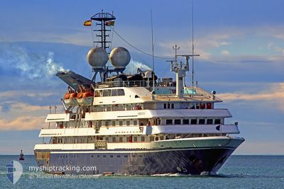
CORINTHIAN
Passengers Ship
Current Trip
| Time Travelled | 3 days |
|---|---|
| Remaining Time | --- |
| Distance Travelled | 958.50 nm |
| Remaining Distance | 127.00 nm |
| AVG Speed | 13 Noeuds |
| MAX Speed | 15.2 Noeuds |
| AVG Wind | 14.4 knots |
| MAX Wind | 22.9 knots |
| MIN Temp | 11.9°C / 53.42°F |
| MAX Temp | 17.6°C / 63.68°F |
| Tirant d eau | 4.2 m |
| Position reçue | 19 h, 56 m depuis |
Current Position
| Longitude | -7.88912° |
|---|---|
| Latitude | 47.34672° |
| Etat | Under way using engine |
| Vitesse | 14.2 Noeuds |
| Parcours | 19.3° |
| Zone | North Atlantic Ocean |
| Station | T-AIS |
| Position reçue | 19 h, 56 m depuis |
Information
The current position of CORINTHIAN is in North Atlantic Ocean with coordinates 47.34672° / -7.88912° as reported on 2025-06-05 11:17 by AIS to our vessel tracker app. The vessel's current speed is 14.2 Noeuds and is heading at the port of AVONMOUTH. The estimated time of arrival as calculated by MyShipTracking vessel tracking app is 2025-06-06 14:00 LT
The vessel CORINTHIAN (IMO: 8708672, MMSI: 249556000) is a Passengers Ship that was built in 1990 ( 35 Age ). It's sailing under the flag of [MT] Malta.
In this page you can find informations about the vessels current position, last detected port calls, and current voyage information. If the vessels is not in coverage by AIS you will find the latest position.
The current position of CORINTHIAN is detected by our AIS receivers and we are not responsible for the reliability of the data. The last position was recorded while the vessel was in Coverage by the Ais receivers of our vessel tracking app.
The current draught of CORINTHIAN as reported by AIS is 4.2 meters
Weather
| Temperature | 11.9°C / 53.42°F |
|---|---|
| Wind Speed | 16 knots |
| Direction | 285° WNW |
| Pressure | 1007.2 hPa |
| Humidity | 71.2 % |
| Cloud Coverage | 7 % |
Featured Company
Last Port Calls
| Port | Arrival | Departure | Time In Port |
|---|---|---|---|
| 2025-06-02 07:25 | 2025-06-03 08:04 | 1 d | |
| 2025-05-30 04:55 | 2025-06-01 18:19 | 2 d | |
| 2025-05-28 21:46 | 2025-05-29 16:09 | 18 h | |
| 2025-05-28 06:50 | 2025-05-28 18:26 | 11 h | |
| 2025-05-27 07:13 | 2025-05-27 22:20 | 15 h | |
| 2025-05-26 07:07 | 2025-05-26 14:19 | 7 h | |
| 2025-05-25 07:14 | 2025-05-25 17:25 | 10 h | |
| 2025-05-22 07:01 | 2025-05-24 18:19 | 2 d | |
| 2025-05-21 07:05 | 2025-05-21 17:08 | 10 h | |
| 2025-05-19 07:00 | 2025-05-19 21:58 | 14 h |
Last Trips
| Origin | Departure | Destination | Arrival | Distance | |
|---|---|---|---|---|---|
| 2025-06-01 18:19 | 2025-06-02 07:25 | 151.95 nm | |||
| 2025-05-29 16:09 | 2025-05-30 04:55 | 126.43 nm | |||
| 2025-05-28 18:26 | 2025-05-28 21:46 | 36.97 nm | |||
| 2025-05-27 22:20 | 2025-05-28 06:50 | 66.65 nm | |||
| 2025-05-26 14:19 | 2025-05-27 07:13 | 200.71 nm | |||
| 2025-05-25 17:25 | 2025-05-26 07:07 | 159.78 nm | |||
| 2025-05-24 18:19 | 2025-05-25 07:14 | 167.93 nm | |||
| 2025-05-21 17:08 | 2025-05-22 07:01 | 169.08 nm | |||
| 2025-05-19 21:58 | 2025-05-21 07:05 | 358.68 nm | |||
| 2025-05-18 21:06 | 2025-05-19 07:00 | 68.83 nm |
Events
| Heure | Evenement | Détails | Position/ Destination | Info |
|---|---|---|---|---|
| 2025-06-05 11:18 | Etat Changé | Default Under way using engine |
47.35220 / -7.88643
BRISTOL
|
Vitesse: 14.2 kn Parcours: 19.3° |
| 2025-06-05 11:17 | Hors de la zone couverte |
47.34672 / -7.88912
North Atlantic Ocean
BRISTOL
|
Vitesse: 14.2 kn Parcours: 19.3° |
|
| 2025-06-05 11:03 | Etat Changé | Under way using engine Default |
47.29760 / -7.91191
BRISTOL
|
Vitesse: 14.2 kn Parcours: 17° |
| 2025-06-05 10:48 | Dans la zone couverte |
47.29760 / -7.91191
North Atlantic Ocean
BRISTOL
|
Vitesse: 14.3 kn Parcours: 17.5° |
|
| 2025-06-05 09:30 | Etat Changé | Default Under way using engine |
46.95090 / -8.07200
BRISTOL
|
Vitesse: 13.9 kn Parcours: 15.2° |
| 2025-06-05 09:21 | Hors de la zone couverte |
46.91637 / -8.08647
North Atlantic Ocean
BRISTOL
|
Vitesse: 13.9 kn Parcours: 15.2° |
|
| 2025-06-05 09:01 | Detecté en mer | French part of the North Atlantic Ocean |
46.84195 / -8.11805
North Atlantic Ocean
BRISTOL
|
Vitesse: 14.2 kn Parcours: 15.2° |
| 2025-06-05 09:01 | Dans la zone couverte |
46.84195 / -8.11805
North Atlantic Ocean
BRISTOL
|
Vitesse: 14.2 kn Parcours: 15.2° |
|
| 2025-06-04 09:22 | Etat Changé | Default Under way using engine |
41.40712 / -9.84539
BRISTOL
|
Vitesse: 13.7 kn Parcours: 359.9° |
| 2025-06-04 08:51 | Hors de la zone couverte |
41.28745 / -9.84685
North Atlantic Ocean
BRISTOL
|
Vitesse: 13.7 kn Parcours: 359.9° |