

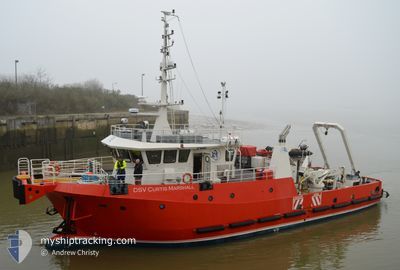
DSV CURTIS MARSHALL
Spare - Local Vessel

Current Trip
| Time Travelled | 1 day |
|---|---|
| Remaining Time | 10 h, 57 mins |
| Distance Travelled | 383.41 nm |
| Remaining Distance | 146.59 nm |
| AVG Speed | 11.2 Noeuds |
| MAX Speed | 14.5 Noeuds |
| AVG Wind | 9.1 knots |
| MAX Wind | 19.8 knots |
| MIN Temp | 13.9°C / 57.02°F |
| MAX Temp | 20.2°C / 68.36°F |
| Tirant d eau | 2.6 m |
| Position reçue | 15 m depuis |
Current Position
| Longitude | -1.38310° |
|---|---|
| Latitude | 50.29917° |
| Etat | Under way using engine |
| Vitesse | 11.9 Noeuds |
| Parcours | 254° |
| Zone | English Channel |
| Station | T-AIS |
| Position reçue | 15 m depuis |
Information
The current position of DSV CURTIS MARSHALL is in English Channel with coordinates 50.29917° / -1.38310° as reported on 2025-06-14 18:39 by AIS to our vessel tracker app. The vessel's current speed is 11.9 Noeuds and is heading at the port of FALMOUTH. The estimated time of arrival as calculated by MyShipTracking vessel tracking app is 2025-06-15 06:51 LT
The vessel DSV CURTIS MARSHALL (IMO: 9775012, MMSI: 235107219) is a Spare - Local Vessel It's sailing under the flag of [GB] United Kingdom.
In this page you can find informations about the vessels current position, last detected port calls, and current voyage information. If the vessels is not in coverage by AIS you will find the latest position.
The current position of DSV CURTIS MARSHALL is detected by our AIS receivers and we are not responsible for the reliability of the data. The last position was recorded while the vessel was in Coverage by the Ais receivers of our vessel tracking app.
The current draught of DSV CURTIS MARSHALL as reported by AIS is 2.6 meters
Weather
| Temperature | 14.4°C / 57.92°F |
|---|---|
| Wind Speed | 12 knots |
| Direction | 244° WSW |
| Pressure | 1019.1 hPa |
| Humidity | 89.5 % |
| Cloud Coverage | 17 % |


Featured Company
Last Port Calls
| Port | Arrival | Departure | Time In Port |
|---|---|---|---|
| 2025-06-09 17:33 | 2025-06-13 06:16 | 3 d | |
| 2025-06-09 17:16 | |||
| 2025-06-09 16:50 | |||
| 2025-06-09 16:50 | |||
| 2025-06-09 07:47 | |||
| 2025-06-09 07:00 | 2025-06-09 07:36 | 36 m | |
| 2025-05-28 16:06 | 2025-06-08 13:45 | 10 d | |
| 2025-05-14 16:42 | 2025-05-28 06:48 | 13 d | |
| 2025-05-02 09:15 | 2025-05-14 06:19 | 11 d |
Most Visited Ports (Last year)
| Port | Arrivals | |
|---|---|---|
| 11 | ||
| 10 | ||
| 5 | ||
| 3 | ||
| 1 | ||
| 1 |
Last Trips
| Origin | Departure | Destination | Arrival | Distance | |
|---|---|---|---|---|---|
| 2025-06-09 17:16 | 2025-06-09 17:33 | 3.26 nm | |||
| 2025-06-09 16:50 | 2025-06-09 16:50 | --- | |||
| 2025-06-09 07:36 | 2025-06-09 07:47 | 0.71 nm | |||
| 2025-06-08 13:45 | 2025-06-09 07:00 | 5.08 nm | |||
| 2025-05-28 06:48 | 2025-05-28 16:06 | 9.59 nm | |||
| 2025-05-14 06:19 | 2025-05-14 16:42 | 9.28 nm | |||
| 2025-03-26 14:25 | 2025-05-02 09:15 | 611.40 nm |
Events
| Heure | Evenement | Détails | Position/ Destination | Info |
|---|---|---|---|---|
| 2025-06-14 13:47 | Dans la zone couverte |
50.56993 / .15701
English Channel
FALMOUTH
|
Vitesse: 9.8 kn Parcours: 257.1° |
|
| 2025-06-14 08:57 | Hors de la zone couverte |
51.00105 / 1.30040
English Channel
FALMOUTH
|
Vitesse: 13.6 kn Parcours: 234.5° |
|
| 2025-06-14 08:23 | Changement de zone | United Kingdom part of the English Channel United Kingdom part of the North Sea |
51.07646 / 1.46620
English Channel
FALMOUTH
|
Vitesse: 13.2 kn Parcours: 229° |
| 2025-06-14 06:17 | Changement d'ETA | 2025/06/16 12:00 2025/06/16 18:00 |
51.46505 / 1.73209
FALMOUTH
|
Vitesse: 10.7 kn Parcours: 192.7° |
| 2025-06-14 01:46 | Dans la zone couverte |
52.19435 / 1.80202
North Sea
FALMOUTH
|
Vitesse: 10.7 kn Parcours: 184.6° |
|
| 2025-06-14 00:43 | Hors de la zone couverte |
52.38703 / 1.84282
North Sea
FALMOUTH
|
Vitesse: 11.2 kn Parcours: 186° |
|
| 2025-06-13 17:57 | Dans la zone couverte |
53.63137 / .80269
North Sea
FALMOUTH
|
Vitesse: 13 kn Parcours: 135.2° |
|
| 2025-06-13 16:24 | Hors de la zone couverte |
53.86717 / .42152
North Sea
FALMOUTH
|
Vitesse: 12.6 kn Parcours: 134° |
|
| 2025-06-13 14:13 | Dans la zone couverte |
54.18249 / -.06659
North Sea
FALMOUTH
|
Vitesse: 10.9 kn Parcours: 129.6° |
|
| 2025-06-13 11:43 | Hors de la zone couverte |
54.48519 / -.55038
North Sea
FALMOUTH
|
Vitesse: 9.4 kn Parcours: 136.3° |