
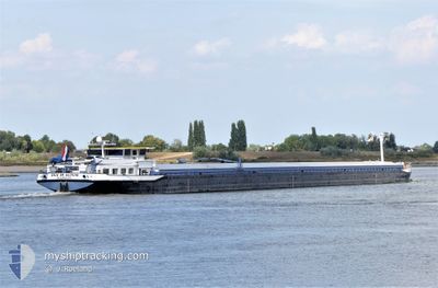
DUC IN ALTUM
Cargo
Current Trip
| Time Travelled | 2 days |
|---|---|
| Remaining Time | --- |
| Distance Travelled | 157.14 nm |
| Remaining Distance | --- |
| AVG Speed | 5.4 Noeuds |
| MAX Speed | 8.4 Noeuds |
| AVG Wind | 6.3 knots |
| MAX Wind | 12 knots |
| MIN Temp | -6.6°C / 20.12°F |
| MAX Temp | 0.2°C / 32.36°F |
| Tirant d eau | 0 m |
| Position reçue | 20 h, 40 m depuis |
Current Position
| Longitude | 7.29458° |
|---|---|
| Latitude | 50.52410° |
| Etat | Under way using engine |
| Vitesse | 4.2 Noeuds |
| Parcours | 163.4° |
| Zone | North Sea |
| Station | T-AIS |
| Position reçue | 20 h, 40 m depuis |
Info
Information
The current position of DUC IN ALTUM is in North Sea with coordinates 50.52410° / 7.29458° as reported on 2026-01-07 13:37 by AIS to our vessel tracker app. The vessel's current speed is 4.2 Noeuds and is heading at the port of FRANKFURT AM MAIN. The estimated time of arrival as calculated by MyShipTracking vessel tracking app is 2026-01-08 19:50 LT
The vessel DUC IN ALTUM (MMSI: 244630150) is a Cargo It's sailing under the flag of [NL] Netherlands.
In this page you can find informations about the vessels current position, last detected port calls, and current voyage information. If the vessels is not in coverage by AIS you will find the latest position.
The current position of DUC IN ALTUM is detected by our AIS receivers and we are not responsible for the reliability of the data. The last position was recorded while the vessel was in Coverage by the Ais receivers of our vessel tracking app.
Weather
| Temperature | -1.9°C / 28.58°F |
|---|---|
| Wind Speed | 12 knots |
| Direction | 182° S |
| Pressure | 1010.1 hPa |
| Humidity | 73.8 % |
| Cloud Coverage | 100 % |
Featured Company
Last Port Calls
| Port | Arrival | Departure | Time In Port |
|---|---|---|---|
| 2026-01-05 15:55 | 2026-01-05 16:20 | 25 m | |
| 2026-01-04 16:22 | 2026-01-05 11:58 | 19 h | |
| 2026-01-04 14:30 | 2026-01-04 15:59 | 1 h | |
| 2026-01-04 09:39 | 2026-01-04 10:03 | 24 m | |
| 2026-01-03 17:37 | 2026-01-04 07:06 | 13 h | |
| 2025-12-16 16:41 | 2025-12-18 14:29 | 1 d | |
| 2025-12-13 19:42 | 2025-12-14 06:41 | 10 h | |
| 2025-12-05 15:57 | 2025-12-05 16:23 | 25 m | |
| 2025-12-05 15:18 | 2025-12-05 15:53 | 34 m | |
| 2025-12-04 21:32 | 2025-12-05 11:36 | 14 h |
Most Visited Ports (Last year)
| Port | Arrivals | |
|---|---|---|
| 13 | ||
| 12 | ||
| 11 | ||
| 8 | ||
| 8 | ||
| 7 |
Last Trips
| Origin | Departure | Destination | Arrival | Distance | |
|---|---|---|---|---|---|
| 2026-01-05 11:58 | 2026-01-05 15:55 | 31.17 nm | |||
| 2026-01-04 15:59 | 2026-01-04 16:22 | 2.47 nm | |||
| 2026-01-04 10:03 | 2026-01-04 14:30 | 31.70 nm | |||
| 2026-01-04 07:06 | 2026-01-04 09:39 | 21.46 nm | |||
| 2025-12-18 14:29 | 2026-01-03 17:37 | 131.31 nm | |||
| 2025-12-14 06:41 | 2025-12-16 16:41 | 156.56 nm | |||
| 2025-12-05 16:23 | 2025-12-13 19:42 | 195.12 nm | |||
| 2025-12-05 15:53 | 2025-12-05 15:57 | 0.20 nm | |||
| 2025-12-05 11:36 | 2025-12-05 15:18 | 18.83 nm | |||
| 2025-12-04 10:59 | 2025-12-04 21:32 | 56.44 nm |
Events
| Heure | Evenement | Détails | Position/ Destination | Info |
|---|---|---|---|---|
| 2026-01-07 13:37 | Hors de la zone couverte |
50.52410 / 7.29458
North Sea
LENGFURT
|
Vitesse: 4.2 kn Parcours: 163.4° |
|
| 2026-01-07 12:36 | Dans la zone couverte |
50.58884 / 7.21393
North Sea
LENGFURT
|
Vitesse: 6.3 kn Parcours: 146.4° |
|
| 2026-01-07 11:31 | Hors de la zone couverte |
50.68317 / 7.18030
North Sea
LENGFURT
|
Vitesse: 5 kn Parcours: 143.2° |
|
| 2026-01-07 06:35 | Etat Changé | Under way using engine Default |
50.96874 / 6.99958
LENGFURT
|
Vitesse: 5.1 kn Parcours: 156° |
| 2026-01-07 06:29 | Etat Changé | Default Under way using engine |
50.97702 / 6.99805
LENGFURT
|
Vitesse: 5 kn Parcours: 142.7° |
| 2026-01-07 04:13 | Démarrage | 1.59 nm, North East of DORMAGEN |
51.09916 / 6.88157
LENGFURT
|
Vitesse: 3.1 kn Parcours: 203.6° |
| 2026-01-07 04:09 | Dans la zone couverte |
51.10045 / 6.88216
North Sea
LENGFURT
|
Vitesse: 2.7 kn Parcours: 216° |
|
| 2026-01-07 03:04 | Hors de la zone couverte |
51.10301 / 6.88450
North Sea
LENGFURT
|
Vitesse: Parcours: 0° |
|
| 2026-01-07 03:04 | Dans la zone couverte |
51.10301 / 6.88450
North Sea
LENGFURT
|
Vitesse: Parcours: 0° |
|
| 2026-01-07 01:58 | Hors de la zone couverte |
51.10301 / 6.88450
North Sea
LENGFURT
|
Vitesse: Parcours: 0° |