

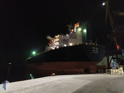
DYLAN
Oil Products Tanker

Current Trip
| Time Travelled | 15 days |
|---|---|
| Remaining Time | --- |
| Distance Travelled | 4285.69 nm |
| Remaining Distance | --- |
| AVG Speed | 11.1 Noeuds |
| MAX Speed | 17.1 Noeuds |
| AVG Wind | 12.8 knots |
| MAX Wind | 35 knots |
| MIN Temp | 1.8°C / 35.24°F |
| MAX Temp | 22.9°C / 73.22°F |
| Tirant d eau | 12.2 m |
| Position reçue | 2 d depuis |
Current Position
| Longitude | -19.69860° |
|---|---|
| Latitude | 21.17282° |
| Etat | Under way using engine |
| Vitesse | 12.5 Noeuds |
| Parcours | 210.5° |
| Zone | North Atlantic Ocean |
| Station | T-AIS |
| Position reçue | 2 d depuis |
Information
The current position of DYLAN is in North Atlantic Ocean with coordinates 21.17282° / -19.69860° as reported on 2025-04-07 19:33 by AIS to our vessel tracker app. The vessel's current speed is 12.5 Noeuds and is heading at the port of PARANAGUA. The estimated time of arrival as calculated by MyShipTracking vessel tracking app is 2025-04-18 20:00 LT
The vessel DYLAN (IMO: 9282510, MMSI: 538005182) is a Oil Products Tanker that was built in 2004 ( 21 Age ). It's sailing under the flag of [MH] Marshall Is.
In this page you can find informations about the vessels current position, last detected port calls, and current voyage information. If the vessels is not in coverage by AIS you will find the latest position.
The current position of DYLAN is detected by our AIS receivers and we are not responsible for the reliability of the data. The last position was recorded while the vessel was in Coverage by the Ais receivers of our vessel tracking app.
The current draught of DYLAN as reported by AIS is 12.2 meters
Weather
| Temperature | 22.8°C / 73.04°F |
|---|---|
| Wind Speed | 13 knots |
| Direction | 29° NNE |
| Pressure | 1015.9 hPa |
| Humidity | 88.4 % |
| Cloud Coverage | 27 % |


Featured Company
Last Port Calls
| Port | Arrival | Departure | Time In Port |
|---|---|---|---|
| 2025-03-24 10:19 | 2025-03-25 14:51 | 1 d | |
| 2025-02-11 08:49 | 2025-02-13 23:10 | 2 d |
Last Trips
| Origin | Departure | Destination | Arrival | Distance | |
|---|---|---|---|---|---|
| 2025-02-13 23:10 | 2025-03-24 10:19 | 2939.78 nm | |||
| 2025-01-17 14:46 | 2025-02-11 08:49 | 3110.75 nm |
Events
| Heure | Evenement | Détails | Position/ Destination | Info |
|---|---|---|---|---|
| 2025-04-07 19:37 | Etat Changé | Default Under way using engine |
21.16187 / -19.70543
BRPNG
|
Vitesse: 12.5 kn Parcours: 210.5° |
| 2025-04-07 19:33 | Hors de la zone couverte |
21.17282 / -19.69860
North Atlantic Ocean
BRPNG
|
Vitesse: 12.5 kn Parcours: 210.5° |
|
| 2025-04-07 19:29 | Etat Changé | Under way using engine Default |
21.18564 / -19.69074
BRPNG
|
Vitesse: 12.6 kn Parcours: 211° |
| 2025-04-07 19:19 | Dans la zone couverte |
21.17795 / -19.69545
North Atlantic Ocean
BRPNG
|
Vitesse: 12.5 kn Parcours: 209.7° |
|
| 2025-04-07 18:18 | Etat Changé | Default Under way using engine |
21.39728 / -19.55282
BRPNG
|
Vitesse: 12.5 kn Parcours: 213.2° |
| 2025-04-07 18:12 | Hors de la zone couverte |
21.41800 / -19.53877
North Atlantic Ocean
BRPNG
|
Vitesse: 12.5 kn Parcours: 213.2° |
|
| 2025-04-07 17:29 | Etat Changé | Under way using engine Default |
21.54392 / -19.45249
BRPNG
|
Vitesse: 12.5 kn Parcours: 212° |
| 2025-04-07 17:23 | Etat Changé | Default Under way using engine |
21.56015 / -19.44142
BRPNG
|
Vitesse: 12.4 kn Parcours: 212.3° |
| 2025-04-07 17:16 | Etat Changé | Under way using engine Default |
21.57985 / -19.42820
BRPNG
|
Vitesse: 12.5 kn Parcours: 212° |
| 2025-04-07 17:06 | Dans la zone couverte |
21.57985 / -19.42820
North Atlantic Ocean
BRPNG
|
Vitesse: 12.4 kn Parcours: 212.3° |