

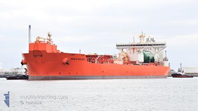
EAGLE BALDER
Tanker

Current Trip
| Time Travelled | 11 days |
|---|---|
| Remaining Time | 4 h, 5 mins |
| Distance Travelled | 1795.26 nm |
| Remaining Distance | 50.11 nm |
| AVG Speed | 10.7 Noeuds |
| MAX Speed | 14.3 Noeuds |
| AVG Wind | 16.8 knots |
| MAX Wind | 38.7 knots |
| MIN Temp | 8.7°C / 47.66°F |
| MAX Temp | 15.9°C / 60.62°F |
| Tirant d eau | 13.8 m |
| Position reçue | Maintenant |
Current Position
| Longitude | 10.70555° |
|---|---|
| Latitude | 57.99612° |
| Etat | Under way using engine |
| Vitesse | 11.6 Noeuds |
| Parcours | 92.7° |
| Zone | Skaggerak |
| Station | T-AIS |
| Position reçue | Maintenant |
Information
The current position of EAGLE BALDER is in Skaggerak with coordinates 57.99612° / 10.70555° as reported on 2025-06-08 09:09 by AIS to our vessel tracker app. The vessel's current speed is 11.6 Noeuds and is heading at the port of GOTEBORG. The estimated time of arrival as calculated by MyShipTracking vessel tracking app is 2025-06-08 15:15 LT
The vessel EAGLE BALDER (IMO: 9833113, MMSI: 257089150) is a Tanker It's sailing under the flag of [NO] Norway.
In this page you can find informations about the vessels current position, last detected port calls, and current voyage information. If the vessels is not in coverage by AIS you will find the latest position.
The current position of EAGLE BALDER is detected by our AIS receivers and we are not responsible for the reliability of the data. The last position was recorded while the vessel was in Coverage by the Ais receivers of our vessel tracking app.
The current draught of EAGLE BALDER as reported by AIS is 13.8 meters
Weather
| Temperature | 11.8°C / 53.24°F |
|---|---|
| Wind Speed | 7 knots |
| Direction | 197° SSW |
| Pressure | 1003.2 hPa |
| Humidity | 76.3 % |
| Cloud Coverage | 43 % |


Featured Company
Last Port Calls
| Port | Arrival | Departure | Time In Port |
|---|---|---|---|
| 2025-05-26 00:06 | 2025-05-27 19:30 | 1 d | |
| 2025-04-10 10:32 | 2025-04-12 19:00 | 2 d | |
| 2025-04-06 05:38 |
Last Trips
| Origin | Departure | Destination | Arrival | Distance | |
|---|---|---|---|---|---|
| 2025-04-12 19:00 | 2025-05-26 00:06 | 4733.60 nm | |||
| 2025-04-06 05:38 | 2025-04-10 10:32 | 1172.87 nm |
Events
| Heure | Evenement | Détails | Position/ Destination | Info |
|---|---|---|---|---|
| 2025-06-08 08:28 | Etat Changé | Under way using engine Default |
58.00523 / 10.45568
GOTHENBURG
|
Vitesse: 11.8 kn Parcours: 94° |
| 2025-06-08 08:27 | Etat Changé | Default Under way using engine |
58.00557 / 10.44660
GOTHENBURG
|
Vitesse: 11.8 kn Parcours: 93.5° |
| 2025-06-08 07:05 | Changement d'ETA | 2025/06/08 12:30 2025/06/08 13:00 |
58.01680 / 9.95019
GOTHENBURG
|
Vitesse: 11.6 kn Parcours: 88.3° |
| 2025-06-08 05:47 | Detecté en mer | Danish part of the Skaggerak |
58.02280 / 9.48244
Skaggerak
GOTHENBURG
|
Vitesse: 11.6 kn Parcours: 93.4° |
| 2025-06-07 23:53 | Detecté en mer | Norwegian part of the Skaggerak |
57.69458 / 7.55984
Skaggerak
GOTHENBURG
|
Vitesse: 11.3 kn Parcours: 91.7° |
| 2025-06-07 12:48 | Démarrage | 16.82 nm, South West of SKUDENESHAVN |
58.94736 / 4.87642
GOTHENBURG
|
Vitesse: 3.2 kn Parcours: 96° |
| 2025-06-07 12:29 | Arret | 16.93 nm, South West of SKUDENESHAVN |
58.94809 / 4.87022
GOTHENBURG
|
Vitesse: 0.3 kn Parcours: 120° |
| 2025-06-07 01:28 | Tirant d'eau modifié | 13.8 9.4 |
60.74826 / 2.21601
GOTHENBURG
|
Vitesse: 12.9 kn Parcours: 151.9° |
| 2025-06-07 01:28 | Changement de destination | GOTHENBURG STATFJORD |
60.74826 / 2.21601
GOTHENBURG
|
Vitesse: 12.9 kn Parcours: 151.9° |
| 2025-06-07 01:28 | Changement d'ETA | 2025/06/08 13:00 2025/06/04 04:00 |
60.74826 / 2.21601
GOTHENBURG
|
Vitesse: 12.9 kn Parcours: 151.9° |