
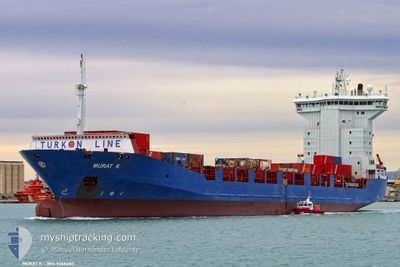
EGY SKY
Container Ship
Current Trip
| Time Travelled | 14 h, 11 mins |
|---|---|
| Remaining Time | --- |
| Distance Travelled | 158.68 nm |
| Remaining Distance | --- |
| AVG Speed | 11.6 Noeuds |
| MAX Speed | 12.9 Noeuds |
| AVG Wind | 10.8 knots |
| MAX Wind | 13.7 knots |
| MIN Temp | 14.6°C / 58.28°F |
| MAX Temp | 16.8°C / 62.24°F |
| Tirant d eau | 5.6 m |
| Position reçue | 2 d depuis |
Current Position
| Longitude | 32.29598° |
|---|---|
| Latitude | 31.49077° |
| Etat | Under way using engine |
| Vitesse | 12.5 Noeuds |
| Parcours | 280.6° |
| Zone | Mediterranean Sea - Eastern Basin |
| Station | T-AIS |
| Position reçue | 2 d depuis |
Info
Information
The current position of EGY SKY is in Mediterranean Sea - Eastern Basin with coordinates 31.49077° / 32.29598° as reported on 2025-02-26 14:31 by AIS to our vessel tracker app. The vessel's current speed is 12.5 Noeuds
The vessel EGY SKY (IMO: 9366483, MMSI: 622113177) is a Container Ship that was built in 2007 ( 18 Age ). It's sailing under the flag of [EG] Egypt.
In this page you can find informations about the vessels current position, last detected port calls, and current voyage information. If the vessels is not in coverage by AIS you will find the latest position.
The current position of EGY SKY is detected by our AIS receivers and we are not responsible for the reliability of the data. The last position was recorded while the vessel was in Coverage by the Ais receivers of our vessel tracking app.
The current draught of EGY SKY as reported by AIS is 5.6 meters
Weather
| Temperature | 16.1°C / 60.98°F |
|---|---|
| Wind Speed | 10 knots |
| Direction | 261° W |
| Pressure | 1019.1 hPa |
| Humidity | 61.8 % |
| Cloud Coverage | 7 % |
Featured Company
Last Port Calls
| Port | Arrival | Departure | Time In Port |
|---|---|---|---|
| 2025-02-27 08:33 | 2025-02-28 08:25 | 23 h | |
| 2025-02-25 11:47 | 2025-02-26 12:45 | 1 d | |
| 2025-02-23 10:41 | 2025-02-23 23:45 | 13 h | |
| 2025-02-22 02:05 | 2025-02-23 09:05 | 1 d | |
| 2025-02-19 01:26 | 2025-02-19 21:19 | 19 h | |
| 2025-02-18 03:40 | 2025-02-18 03:55 | 15 m | |
| 2025-02-14 20:45 | 2025-02-16 03:16 | 1 d | |
| 2025-02-05 01:34 | 2025-02-06 13:18 | 1 d | |
| 2025-02-02 13:50 | 2025-02-03 01:30 | 11 h | |
| 2025-02-02 07:55 | 2025-02-02 08:47 | 51 m |
Last Trips
| Origin | Departure | Destination | Arrival | Distance | |
|---|---|---|---|---|---|
| 2025-02-24 01:45 | 2025-02-27 10:33 | 208.01 nm | |||
| 2025-02-24 01:45 | 2025-02-25 13:47 | 25.44 nm | |||
| 2025-02-20 00:19 | 2025-02-23 12:41 | 663.54 nm | |||
| 2025-02-20 00:19 | 2025-02-22 04:05 | 648.75 nm | |||
| 2025-02-18 06:55 | 2025-02-19 04:26 | 267.86 nm | |||
| 2025-02-16 07:16 | 2025-02-18 06:40 | 605.57 nm | |||
| 2025-02-06 15:18 | 2025-02-15 00:45 | 1005.07 nm | |||
| 2025-02-03 04:30 | 2025-02-05 03:34 | 422.79 nm | |||
| 2025-02-02 11:47 | 2025-02-02 16:50 | 52.05 nm | |||
| 2025-01-30 18:01 | 2025-02-02 10:55 | 612.40 nm |
Events
| Heure | Evenement | Détails | Position/ Destination | Info |
|---|---|---|---|---|
| 2025-02-28 21:41 | Arret | 12.89 nm, North East of PORT SAID |
31.43395 / 32.44098
EGPSE
|
Vitesse: 0.1 kn Parcours: 234° |
| 2025-02-28 08:25 | PORT DE DEPART |
|
31.16108 / 29.83491
EGPSE
|
Vitesse: 9.8 kn Parcours: 218° |
| 2025-02-28 08:18 | Démarrage |
31.17168 / 29.85372
[EG] ALEXANDRIA
|
Vitesse: 6.8 kn Parcours: 220° |
|
| 2025-02-27 09:05 | Arret |
31.17058 / 29.86110
[EG] ALEXANDRIA
|
Vitesse: 0.1 kn Parcours: 38° |
|
| 2025-02-27 08:33 | Port d'arrivée |
|
31.16331 / 29.84708
[EG] ALEXANDRIA
|
Vitesse: 4.2 kn Parcours: 75° |
| 2025-02-27 07:23 | Démarrage | 3.44 nm, North West of EL DEKHEILA |
31.17660 / 29.74917
EGPSE
|
Vitesse: 9.6 kn Parcours: 86° |
| 2025-02-27 03:45 | Arret | 4.65 nm, North West of EL DEKHEILA |
31.17747 / 29.72332
EGPSE
|
Vitesse: 0.1 kn Parcours: 102° |
| 2025-02-26 14:38 | Etat Changé | Default Under way using engine |
31.49721 / 32.26808
EGPSE
|
Vitesse: 12.5 kn Parcours: 280.6° |
| 2025-02-26 14:31 | Etat Changé | Under way using engine Default |
31.49077 / 32.29598
EGPSE
|
Vitesse: 12.4 kn Parcours: 279° |
| 2025-02-26 14:31 | Hors de la zone couverte |
31.49077 / 32.29598
Mediterranean Sea - Eastern Basin
|
Vitesse: 12.5 kn Parcours: 280.6° |