
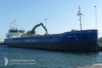
EIDSVAAG SIRIUS
General Cargo
Current Trip
| Time Travelled | 17 h, 14 mins |
|---|---|
| Remaining Time | 10 h, 52 mins |
| Distance Travelled | 183.67 nm |
| Remaining Distance | 128.53 nm |
| AVG Speed | 10.9 Noeuds |
| MAX Speed | 11.8 Noeuds |
| AVG Wind | 19.5 knots |
| MAX Wind | 22 knots |
| MIN Temp | -0.7°C / 30.74°F |
| MAX Temp | 1.3°C / 34.34°F |
| Tirant d eau | 3.2 m |
| Position reçue | 1 m depuis |
Current Position
| Longitude | 11.07558° |
|---|---|
| Latitude | 54.60617° |
| Etat | Under way using engine |
| Vitesse | 11.5 Noeuds |
| Parcours | 265.2° |
| Zone | Baltic Sea |
| Station | T-AIS |
| Position reçue | 1 m depuis |
Info
Information
The current position of EIDSVAAG SIRIUS is in Baltic Sea with coordinates 54.60617° / 11.07558° as reported on 2025-02-12 09:45 by AIS to our vessel tracker app. The vessel's current speed is 11.5 Noeuds and is heading at the port of HAMBURG. The estimated time of arrival as calculated by MyShipTracking vessel tracking app is 2025-02-12 21:38 LT
The vessel EIDSVAAG SIRIUS (IMO: 9279044, MMSI: 257414000) is a General Cargo that was built in 2006 ( 19 Age ). It's sailing under the flag of [NO] Norway.
In this page you can find informations about the vessels current position, last detected port calls, and current voyage information. If the vessels is not in coverage by AIS you will find the latest position.
The current position of EIDSVAAG SIRIUS is detected by our AIS receivers and we are not responsible for the reliability of the data. The last position was recorded while the vessel was in Coverage by the Ais receivers of our vessel tracking app.
The current draught of EIDSVAAG SIRIUS as reported by AIS is 3.2 meters
Weather
| Temperature | 0.5°C / 32.9°F |
|---|---|
| Wind Speed | 21 knots |
| Direction | 105° ESE |
| Pressure | 1023.7 hPa |
| Humidity | 66 % |
| Cloud Coverage | --- |
Featured Company
Last Port Calls
| Port | Arrival | Departure | Time In Port |
|---|---|---|---|
| 2025-02-08 15:21 | 2025-02-11 17:32 | 3 d | |
| 2025-02-04 05:55 | 2025-02-04 18:59 | 13 h | |
| 2025-02-02 20:43 | 2025-02-03 12:24 | 15 h | |
| 2025-01-31 18:39 | 2025-02-01 13:27 | 18 h | |
| 2025-01-29 09:45 | 2025-01-29 13:20 | 3 h | |
| 2025-01-23 13:12 | 2025-01-26 14:56 | 3 d | |
| 2025-01-21 17:35 | 2025-01-23 08:26 | 1 d | |
| 2025-01-14 01:01 | 2025-01-16 18:23 | 2 d | |
| 2025-01-10 17:04 | 2025-01-13 23:11 | 3 d | |
| 2025-01-07 23:18 | 2025-01-08 01:08 | 1 h |
Most Visited Ports (Last year)
| Port | Arrivals | |
|---|---|---|
| 14 | ||
| 12 | ||
| 10 | ||
| 10 | ||
| 8 | ||
| 6 |
Last Trips
| Origin | Departure | Destination | Arrival | Distance | |
|---|---|---|---|---|---|
| 2025-02-04 18:59 | 2025-02-08 15:21 | 598.40 nm | |||
| 2025-02-03 12:24 | 2025-02-04 05:55 | 188.24 nm | |||
| 2025-02-01 13:27 | 2025-02-02 20:43 | 164.39 nm | |||
| 2025-01-29 13:20 | 2025-01-31 18:39 | 378.55 nm | |||
| 2025-01-26 14:56 | 2025-01-29 09:45 | 418.84 nm | |||
| 2025-01-23 08:26 | 2025-01-23 13:12 | 45.03 nm | |||
| 2025-01-16 18:23 | 2025-01-21 17:35 | 1197.29 nm | |||
| 2025-01-13 23:11 | 2025-01-14 01:01 | 23.21 nm | |||
| 2025-01-08 01:08 | 2025-01-10 17:04 | 539.51 nm | |||
| 2025-01-07 01:20 | 2025-01-07 23:18 | 210.52 nm |
Events
| Heure | Evenement | Détails | Position/ Destination | Info |
|---|---|---|---|---|
| 2025-02-12 09:17 | Changement de zone | German part of the Baltic Sea Danish part of the Baltic Sea |
54.59932 / 11.22852
Baltic Sea
DEHAM
|
Vitesse: 11.9 kn Parcours: 290.2° |
| 2025-02-12 07:26 | Tirant d'eau modifié | 3.2 3.8 |
54.44761 / 11.76913
DEHAM
|
Vitesse: 11 kn Parcours: 291.4° |
| 2025-02-12 07:26 | Changement d'ETA | 2025/02/13 04:00 2025/02/12 23:00 |
54.44761 / 11.76913
DEHAM
|
Vitesse: 11 kn Parcours: 291.4° |
| 2025-02-12 03:07 | Changement de zone | Danish part of the Baltic Sea German part of the Baltic Sea |
54.79427 / 12.82004
Baltic Sea
DEHAM
|
Vitesse: 11.1 kn Parcours: 269.3° |
| 2025-02-11 23:13 | Etat Changé | Under way using engine Default |
54.51614 / 13.82829
DEHAM
|
Vitesse: 10.8 kn Parcours: 329° |
| 2025-02-11 23:05 | Etat Changé | Default Under way using engine |
54.49574 / 13.84891
DEHAM
|
Vitesse: 10.9 kn Parcours: 330.7° |
| 2025-02-11 22:21 | Etat Changé | Under way using engine Default |
54.37803 / 13.95968
DEHAM
|
Vitesse: 10.8 kn Parcours: 332° |
| 2025-02-11 22:09 | Etat Changé | Default Under way using engine |
54.34666 / 13.98826
DEHAM
|
Vitesse: 10.9 kn Parcours: 334.3° |
| 2025-02-11 21:41 | Etat Changé | Under way using engine Default |
54.26948 / 14.05685
DEHAM
|
Vitesse: 10.9 kn Parcours: 333° |
| 2025-02-11 21:37 | Etat Changé | Default Under way using engine |
54.25918 / 14.06584
DEHAM
|
Vitesse: 10.8 kn Parcours: 334.5° |