
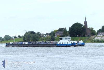
EILTANK 68
Tanker
Current Trip
| Time Travelled | 20 h, 33 mins |
|---|---|
| Remaining Time | 10 h, 28 mins |
| Distance Travelled | 67.26 nm |
| Remaining Distance | 81.31 nm |
| AVG Speed | 7.3 Noeuds |
| MAX Speed | 8.8 Noeuds |
| AVG Wind | 16.1 knots |
| MAX Wind | 19.3 knots |
| MIN Temp | 0.7°C / 33.26°F |
| MAX Temp | 3.5°C / 38.3°F |
| Tirant d eau | 2.5 m |
| Position reçue | 1 m depuis |
Current Position
| Longitude | 5.24142° |
|---|---|
| Latitude | 52.45487° |
| Etat | Under way using engine |
| Vitesse | 8 Noeuds |
| Parcours | 238.9° |
| Zone | North Sea |
| Station | T-AIS |
| Position reçue | 1 m depuis |
Info
Information
The current position of EILTANK 68 is in North Sea with coordinates 52.45487° / 5.24142° as reported on 2025-02-10 11:41 by AIS to our vessel tracker app. The vessel's current speed is 8 Noeuds and is heading at the port of ROTTERDAM. The estimated time of arrival as calculated by MyShipTracking vessel tracking app is 2025-02-10 23:11 LT
The vessel EILTANK 68 (MMSI: 211512080) is a Tanker It's sailing under the flag of [DE] Germany.
In this page you can find informations about the vessels current position, last detected port calls, and current voyage information. If the vessels is not in coverage by AIS you will find the latest position.
The current position of EILTANK 68 is detected by our AIS receivers and we are not responsible for the reliability of the data. The last position was recorded while the vessel was in Coverage by the Ais receivers of our vessel tracking app.
The current draught of EILTANK 68 as reported by AIS is 2.5 meters
Weather
| Temperature | 2.5°C / 36.5°F |
|---|---|
| Wind Speed | 19 knots |
| Direction | 76° ENE |
| Pressure | 1026.9 hPa |
| Humidity | 78.4 % |
| Cloud Coverage | 47 % |
Featured Company
Last Port Calls
| Port | Arrival | Departure | Time In Port |
|---|---|---|---|
| 2025-02-09 15:30 | 2025-02-09 16:10 | 39 m | |
| 2025-02-09 12:44 | 2025-02-09 13:27 | 43 m | |
| 2025-02-05 08:10 | 2025-02-05 11:27 | 3 h | |
| 2025-02-04 12:41 | 2025-02-04 16:23 | 3 h | |
| 2025-02-03 09:28 | 2025-02-03 10:18 | 49 m | |
| 2025-01-29 09:29 | 2025-02-03 06:26 | 4 d | |
| 2025-01-28 19:18 | 2025-01-29 05:55 | 10 h | |
| 2025-01-27 16:06 | |||
| 2025-01-27 16:04 | |||
| 2025-01-27 13:19 | 2025-01-27 13:58 | 39 m |
Last Trips
| Origin | Departure | Destination | Arrival | Distance | |
|---|---|---|---|---|---|
| 2025-02-09 13:27 | 2025-02-09 15:30 | 11.74 nm | |||
| 2025-02-05 11:27 | 2025-02-09 12:44 | 69.22 nm | |||
| 2025-02-04 16:23 | 2025-02-05 08:10 | 11.79 nm | |||
| 2025-02-03 10:18 | 2025-02-04 12:41 | 112.98 nm | |||
| 2025-02-03 06:26 | 2025-02-03 09:28 | 32.09 nm | |||
| 2025-01-29 05:55 | 2025-01-29 09:29 | 32.64 nm | |||
| 2025-01-27 16:04 | 2025-01-28 19:18 | 116.10 nm | |||
| 2025-01-27 13:58 | 2025-01-27 16:06 | 11.23 nm | |||
| 2025-01-24 09:41 | 2025-01-27 13:19 | 102.49 nm | |||
| 2025-01-24 01:02 | 2025-01-24 09:19 | 2.16 nm |
Events
| Heure | Evenement | Détails | Position/ Destination | Info |
|---|---|---|---|---|
| 2025-02-10 10:35 | Démarrage | 0.15 nm, West of LELYSTAD |
52.52625 / 5.43458
ROTTERDAM 2E PETROHA
|
Vitesse: 3.4 kn Parcours: 183.6° |
| 2025-02-10 10:29 | Arret | 0.18 nm, North West of LELYSTAD |
52.52815 / 5.43483
ROTTERDAM 2E PETROHA
|
Vitesse: 0.3 kn Parcours: 511° |
| 2025-02-10 07:44 | Démarrage | 0.93 nm, West of LEMMER |
52.84900 / 5.67501
ROTTERDAM 2E PETROHA
|
Vitesse: 4.7 kn Parcours: 198.8° |
| 2025-02-10 07:37 | Arret | 0.89 nm, West of LEMMER |
52.85159 / 5.67656
ROTTERDAM 2E PETROHA
|
Vitesse: 0.2 kn Parcours: 511° |
| 2025-02-10 07:17 | Dans la zone couverte |
52.86371 / 5.68343
North Sea
ROTTERDAM 2E PETROHA
|
Vitesse: 6.8 kn Parcours: 198.3° |
|
| 2025-02-10 05:55 | Hors de la zone couverte |
52.99461 / 5.69820
North Sea
ROTTERDAM 2E PETROHA
|
Vitesse: 2.1 kn Parcours: 221.7° |
|
| 2025-02-10 05:55 | Dans la zone couverte |
52.99461 / 5.69820
North Sea
ROTTERDAM 2E PETROHA
|
Vitesse: 2.1 kn Parcours: 221.7° |
|
| 2025-02-09 21:48 | Hors de la zone couverte |
53.00348 / 5.71396
North Sea
ROTTERDAM 2E PETROHA
|
Vitesse: 4.9 kn Parcours: 229° |
|
| 2025-02-09 21:47 | Dans la zone couverte |
53.00427 / 5.71548
North Sea
ROTTERDAM 2E PETROHA
|
Vitesse: 5.3 kn Parcours: 227.8° |
|
| 2025-02-09 17:50 | Hors de la zone couverte |
53.22771 / 6.17190
North Sea
ROTTERDAM 2E PETROHA
|
Vitesse: 5.7 kn Parcours: 241.9° |