

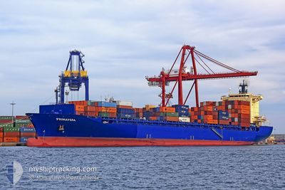
ELBSPIRIT
Container Ship

Current Trip
EGZZ1
| Time Travelled | 4 days |
|---|---|
| Remaining Time | --- |
| Distance Travelled | 1923.35 nm |
| Remaining Distance | --- |
| AVG Speed | 17.5 Noeuds |
| MAX Speed | 20.3 Noeuds |
| AVG Wind | 16.1 knots |
| MAX Wind | 24.2 knots |
| MIN Temp | 12.2°C / 53.96°F |
| MAX Temp | 17.8°C / 64.04°F |
| Tirant d eau | 11.4 m |
| Position reçue | 2 d depuis |
Current Position
| Longitude | 14.79669° |
|---|---|
| Latitude | 36.26136° |
| Etat | Under way using engine |
| Vitesse | 17.4 Noeuds |
| Parcours | 108.9° |
| Zone | Mediterranean Sea - Eastern Basin |
| Station | T-AIS |
| Position reçue | 2 d depuis |
Information
The current position of ELBSPIRIT is in Mediterranean Sea - Eastern Basin with coordinates 36.26136° / 14.79669° as reported on 2025-03-26 11:36 by AIS to our vessel tracker app. The vessel's current speed is 17.4 Noeuds
The vessel ELBSPIRIT (IMO: 9372860, MMSI: 636091619) is a Container Ship that was built in 2008 ( 17 Age ). It's sailing under the flag of [LR] Liberia.
In this page you can find informations about the vessels current position, last detected port calls, and current voyage information. If the vessels is not in coverage by AIS you will find the latest position.
The current position of ELBSPIRIT is detected by our AIS receivers and we are not responsible for the reliability of the data. The last position was recorded while the vessel was in Coverage by the Ais receivers of our vessel tracking app.
The current draught of ELBSPIRIT as reported by AIS is 11.4 meters
Weather
| Temperature | 17.1°C / 62.78°F |
|---|---|
| Wind Speed | 14 knots |
| Direction | 296° WNW |
| Pressure | 1012.1 hPa |
| Humidity | 72.2 % |
| Cloud Coverage | --- |


Featured Company
Last Port Calls
| Port | Arrival | Departure | Time In Port |
|---|---|---|---|
| 2025-03-23 01:31 | 2025-03-24 05:24 | 1 d | |
| 2025-03-20 16:13 | 2025-03-22 07:16 | 1 d | |
| 2025-03-14 00:10 | 2025-03-14 14:21 | 14 h | |
| 2025-03-06 21:13 | 2025-03-09 19:38 | 2 d | |
| 2025-03-02 19:41 | 2025-03-03 04:57 | 9 h | |
| 2025-02-28 08:03 | 2025-02-28 16:45 | 8 h | |
| 2025-02-24 10:17 | 2025-02-25 15:21 | 1 d | |
| 2025-02-21 15:01 | 2025-02-22 02:13 | 11 h | |
| 2025-02-20 06:09 | 2025-02-20 15:19 | 9 h | |
| 2025-02-15 14:35 | 2025-02-17 07:27 | 1 d |
Most Visited Ports (Last year)
| Port | Arrivals | |
|---|---|---|
| 18 | ||
| 17 | ||
| 12 | ||
| 10 | ||
| 10 | ||
| 7 |
Last Trips
| Origin | Departure | Destination | Arrival | Distance | |
|---|---|---|---|---|---|
| 2025-03-22 07:16 | 2025-03-23 01:31 | 83.61 nm | |||
| 2025-03-14 14:21 | 2025-03-20 16:13 | 620.07 nm | |||
| 2025-03-09 19:38 | 2025-03-14 00:10 | 764.43 nm | |||
| 2025-03-03 04:57 | 2025-03-06 21:13 | 1092.33 nm | |||
| 2025-02-25 15:21 | 2025-03-02 19:41 | 1117.99 nm | |||
| 2025-02-25 15:21 | 2025-02-28 08:03 | 630.43 nm | |||
| 2025-02-22 02:13 | 2025-02-24 10:17 | 568.85 nm | |||
| 2025-02-17 07:27 | 2025-02-21 15:01 | 1339.09 nm | |||
| 2025-02-17 07:27 | 2025-02-20 06:09 | 948.24 nm | |||
| 2025-02-11 06:48 | 2025-02-15 14:35 | 1041.12 nm |
Events
| Heure | Evenement | Détails | Position/ Destination | Info |
|---|---|---|---|---|
| 2025-03-28 18:24 | Arret | 7.75 nm, North of PORT SAID |
31.37914 / 32.33416
EGZZ1
|
Vitesse: 0.3 kn Parcours: 298° |
| 2025-03-26 11:42 | Etat Changé | Default Under way using engine |
36.25288 / 14.82738
EGZZ1
|
Vitesse: 17.4 kn Parcours: 108.9° |
| 2025-03-26 11:36 | Hors de la zone couverte |
36.26136 / 14.79669
Mediterranean Sea - Eastern Basin
EGZZ1
|
Vitesse: 17.4 kn Parcours: 108.9° |
|
| 2025-03-26 11:22 | Etat Changé | Under way using engine Default |
36.28400 / 14.71621
EGZZ1
|
Vitesse: 17.3 kn Parcours: 109° |
| 2025-03-26 11:18 | Etat Changé | Default Under way using engine |
36.29104 / 14.69141
EGZZ1
|
Vitesse: 17.3 kn Parcours: 109.2° |
| 2025-03-26 09:05 | Changement de zone | Maltese part of the Mediterranean Sea - Eastern Basin Spanish part of the Alboran Sea |
36.48819 / 13.94341
Mediterranean Sea - Eastern Basin
EGZZ1
|
Vitesse: 17.4 kn Parcours: 108.7° |
| 2025-03-26 09:05 | Etat Changé | Under way using engine Default |
36.48819 / 13.94341
EGZZ1
|
Vitesse: 17.6 kn Parcours: 111° |
| 2025-03-26 09:05 | Dans la zone couverte |
36.48819 / 13.94341
Mediterranean Sea - Eastern Basin
EGZZ1
|
Vitesse: 17.4 kn Parcours: 108.7° |
|
| 2025-03-24 07:31 | Etat Changé | Default Under way using engine |
36.13883 / -4.25766
EGZZ1
|
Vitesse: 19.1 kn Parcours: 81.5° |
| 2025-03-24 07:26 | Hors de la zone couverte |
36.13502 / -4.28870
Alboran Sea
EGZZ1
|
Vitesse: 19.1 kn Parcours: 81.5° |