
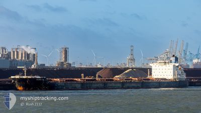
ELENA VE
Bulk Carrier
Current Trip
0RDER
| Time Travelled | 1 day |
|---|---|
| Remaining Time | --- |
| Distance Travelled | 519.05 nm |
| Remaining Distance | --- |
| AVG Speed | 13.6 Noeuds |
| MAX Speed | 17 Noeuds |
| AVG Wind | 4.3 knots |
| MAX Wind | 10 knots |
| MIN Temp | 22.1°C / 71.78°F |
| MAX Temp | 31°C / 87.8°F |
| Tirant d eau | 9.1 m |
| Position reçue | 18 d depuis |
Current Position
| Longitude | -7.68677° |
|---|---|
| Latitude | 46.88668° |
| Etat | Under way using engine |
| Vitesse | 11 Noeuds |
| Parcours | 212° |
| Zone | North Atlantic Ocean |
| Station | T-AIS |
| Position reçue | 18 d depuis |
Info
Information
The current position of ELENA VE is in North Atlantic Ocean with coordinates 46.88668° / -7.68677° as reported on 2025-02-18 04:55 by AIS to our vessel tracker app. The vessel's current speed is 11 Noeuds
The vessel ELENA VE (IMO: 9453066, MMSI: 636014709) is a Bulk Carrier that was built in 2010 ( 15 Age ). It's sailing under the flag of [LR] Liberia.
In this page you can find informations about the vessels current position, last detected port calls, and current voyage information. If the vessels is not in coverage by AIS you will find the latest position.
The current position of ELENA VE is detected by our AIS receivers and we are not responsible for the reliability of the data. The last position was recorded while the vessel was in Coverage by the Ais receivers of our vessel tracking app.
The current draught of ELENA VE as reported by AIS is 9.1 meters
Weather
| Temperature | 24.7°C / 76.46°F |
|---|---|
| Wind Speed | 7 knots |
| Direction | 19° NNE |
| Pressure | 1012.1 hPa |
| Humidity | 90.3 % |
| Cloud Coverage | 78 % |
Featured Company
Last Port Calls
| Port | Arrival | Departure | Time In Port |
|---|---|---|---|
| 2025-03-05 08:30 | 2025-03-07 10:28 | 2 d | |
| 2025-02-09 12:10 | 2025-02-14 22:14 | 5 d | |
| 2025-01-19 23:27 | 2025-01-22 00:35 | 2 d | |
| 2025-01-05 08:17 | 2025-01-06 20:47 | 1 d |
Most Visited Ports (Last year)
| Port | Arrivals | |
|---|---|---|
| 2 | ||
| 2 | ||
| 1 | ||
| 1 | ||
| 1 | ||
| 1 |
Last Trips
| Origin | Departure | Destination | Arrival | Distance | |
|---|---|---|---|---|---|
| 2025-02-14 23:14 | 2025-03-05 05:30 | 5021.66 nm | |||
| 2025-01-22 00:35 | 2025-02-09 13:10 | 3340.06 nm | |||
| 2025-01-06 21:47 | 2025-01-19 23:27 | 3378.32 nm | |||
| 2024-12-23 03:57 | 2025-01-05 09:17 | 3284.69 nm |
Events
| Heure | Evenement | Détails | Position/ Destination | Info |
|---|---|---|---|---|
| 2025-03-07 11:12 | Arret | 1.65 nm, West of PORTO TROMBETAS |
-1.45169 / -56.40305
0RDER
|
Vitesse: 0.1 kn Parcours: 324° |
| 2025-03-07 10:28 | PORT DE DEPART |
|
-1.45722 / -56.39354
0RDER
|
Vitesse: 3.4 kn Parcours: 277° |
| 2025-03-07 10:19 | Démarrage |
-1.45887 / -56.38487
[BR] PORTO TROMBETAS
|
Vitesse: 3.4 kn Parcours: 277° |
|
| 2025-03-05 08:30 | Arret |
-1.45945 / -56.36976
[BR] PORTO TROMBETAS
|
Vitesse: 0.1 kn Parcours: 272° |
|
| 2025-03-05 08:30 | Port d'arrivée |
|
-1.45945 / -56.36976
[BR] PORTO TROMBETAS
|
Vitesse: 1.9 kn Parcours: 263° |
| 2025-03-03 11:43 | Démarrage | 6.13 nm, North East of MACAPA |
.08918 / -50.97062
0RDER
|
Vitesse: 3.2 kn Parcours: 259° |
| 2025-03-03 07:37 | Arret | 5.8 nm, North East of MACAPA |
.08345 / -50.97300
0RDER
|
Vitesse: 0.1 kn Parcours: 21° |